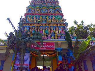
Jagathala is a panchayat town in The Nilgiris district in the Indian state of Tamil Nadu.
Jawad is a Tehsil and a Nagar Panchayat in Neemuch district in the Indian state of Madhya Pradesh.
Kadathur is a panchayat town in Dharmapuri district in the Indian state of Tamil Nadu. Kadathur is situated 20 kilometres (12 mi) southeast of Dharmapuri. It is in the southern region of the district.
Kaliakkavilai is a town panchayat in Kanyakumari district in the Indian state of Tamil Nadu, close to the Tamil Nadu-Kerala border. It lies on the Kochi-Thiruvananthapuram-Kanyakumari National highway 47.
Kannamangalam, previously referred as Mangalam is a panchayat town in Tiruvanamalai district in the Indian state of Tamil Nadu. It is located around 21 km from Vellore. Places with the suffix "mangalam" were believed to have been given as charity by the Kings of a particular reign, "Kannamangalam" was thus named by the same criteria. The Naganathi River, which passes through locality serve the water needs of the town during seasonal periods. Mudaliars and Muslims form the majority of the population in Kannamangalam town. Where as, Vanniyars are abundant in neighbouring villages.
Kannampalayam is a suburb of Coimbatore, in the Indian state of Tamil Nadu. Kannampalayam is a Town Panchayat.
Kuchanur is a panchayat town in Theni district in the Indian state of Tamil Nadu.
Maharajganj is a town and a nagar panchayat in Azamgarh district in the Indian state of Uttar Pradesh. It is connected to National Highway 233B (India), linking Azamgarh to Rajesultanpur.

Meerpet–Jillelguda is a satellite city of Hyderabad and a municipal corporation in Rangareddy district of the Indian state of Telangana. The municipal corporation was formed after merging municipality of Meerpet and Jillelguda.
Nallur (Nalloor) is a panchayat town in Kanniyakumari district in the Indian state of Tamil Nadu.
Nandivaram-Guduvancheri is a municipality located in Chennai Metro City in Chengalpattu district in the Indian state of Tamil Nadu. It is lies in the southern part of Chennai metropolitan area.
Neyyoor is a panchayat town in Kanniyakumari district in the Indian state of Tamil Nadu.
Odugathur is a panchayat town in the Vellore district in the Indian state of Tamil Nadu.

Olavanna is a panchayat in Kozhikode district in the Indian state of Kerala. Olavanna is the most populous panchayat in kerala. It is located 10 km from Kozhikode City. Olavanna panchayath shares the border with Kozhikode corporation and Perumanna panchayath. At first it was a large agricultural area. Today there are many small and large scale industries.Pantheerankavu is the major town in the panchayat. There are also small marketplaces such as the Olavanna Chungam, Kodinattumukku, Mathara, Palazhi, Kunnathupalam, Iringallor. The railway station is around 10 kilometres away and the nearest airport is Calicut international Airport. HiLite Mall is located in Palazhi junction.
Sarai Mir is a town and a nagar panchayat in Azamgarh district in the Indian state of Uttar Pradesh.

Channarayapatna is a town and Taluk headquarters in Hassan district of Karnataka, India. It lies on the Bangalore-Mangalore National Highway-75 in Karnataka, India. Jain pilgrimage Shravanabelagola is a famous site in the taluk. Channarayapatna has major railway connection from Bangalore to Mangalore, Karwar, and Mysore.
Thenkarai is a panchayat grama in Theni district in the Indian state of Tamil Nadu.
Elampillai is a Panchayat Town in Salem district in the Indian state of Tamil Nadu. It is known for textiles like silk sarees and other allied works like Jacquard punching and saree designing.
Narayangarh is a nagar panchayat city in district of Mandsaur, Madhya Pradesh. The city is divided into 15 wards for which elections are held every 5 years. The Narayangarh Nagar Panchayat has population of 10,191 of which 5,168 are males while 5,023 are females as per report released by Census India 2011.
Kerur is a town in Bagalkot district in Karnataka, which located on NH 218. It has an average elevation of 617 meters (2024 feet). It's the birthplace of Jagadish Shettar, a former Chief Minister of Karnataka. Kerur is a Town Panchayat city in the district of Bagalkot, Karnataka. The Kerur city is divided into 16 wards for which elections are held every five years. The Kerur Town Panchayat has a population of 19,731 of which 9,929 are males while 9,802 are females as per report released by Census India 2011.


