This article possibly contains original research .(June 2018) |
Thirthahalli | |
|---|---|
Taluk | |
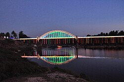 Tunga Bridge with Lightings during Theppotsava | |
 Thirthahalli Location in Karnataka, India | |
| Coordinates: 13°41′24″N75°14′42″E / 13.690°N 75.245°E | |
| Country | |
| State | Karnataka |
| District | Shimoga district |
| Region | Malenadu |
| Government | |
| • MLA | Araga Jnanendra |
| Area | |
• Total | 5.91 km2 (2.28 sq mi) |
| Elevation 566 | 591 m (1,939 ft) |
| Population (2011 [1] ) | |
• Total | 14,357 |
| • Density | 2,430/km2 (6,290/sq mi) |
| Time zone | UTC+5:30 (IST) |
| PIN | 577 432 |
| Telephone code | 08181 |
| Vehicle registration | KA-14 |
| Website | www |
Thirthahalli is a panchayat town located in the Shimoga district of the state of Karnataka, India. It lies on the bank of the river Tunga and is also the headquarters of the Thirthahalli Taluk of Shimoga district.
