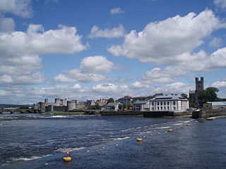
Thomond Bridge is an historic bridge over the River Shannon, not far from its mouth in Limerick, County Limerick, Ireland.

Thomond Bridge is an historic bridge over the River Shannon, not far from its mouth in Limerick, County Limerick, Ireland.
The earliest construction of Thomond Bridge was built near a fording point. [1] The old medieval Thomond Bridge, of fourteen arches, sat on the same site as the current bridge, [2] [3] near the 13th-century King John's Castle. [4] The Treaty Stone was placed near to there, symbolising the end of the 1691 Siege of Limerick, during which the bridge was the site of a failed defence of Limerick City.

The current bridge, of seven arches, was built in 1836, [5] replacing the earlier structure while incorporating its pier foundations. [6] The bridge now forms part of the R445 (formerly the N7), carrying traffic on the Northern Relief Road. [7]


Caherdavin is a northern suburban district of Limerick city in the mid-west of Ireland. As of 2022, the population of Caherdavin is 7,364.

Bunratty Castle is a large 15th-century tower house in County Clare, Ireland. It is located in the centre of Bunratty village, by the N18 road between Limerick and Ennis, near Shannon Town and its airport. The castle and the adjoining folk park are run by Shannon Heritage as tourist attractions.

Cratloe is a village in County Clare, Ireland, situated between Limerick and Shannon in the mid-west of Ireland. It is possible that the name derives from Croit-shliabh meaning "hump-backed hill", referring to Woodcock Hill. The present-day parish of Cratloe consists of the former parish of Kilfintinan and a portion of the contemporary parish of Killeely. This was agreed upon by priests in the 18th century, who claimed there were not enough members of the clergy to operate fully in both parishes.

King John's Castle also known as Limerick Castle is a 13th-century castle located on King's Island in Limerick, Ireland, next to the River Shannon. Although the site dates back to 922 when the Vikings lived on the Island, the castle itself was built on the orders of King John of England in 1200. Some of the external walls, towers and fortifications remain, and the site is open for visitors. The remains of a Viking settlement were uncovered during archaeological excavations at the site in 1900.

King's Island is an area of central Limerick, Ireland. The area is often referred to colloquially as The Island and consists of two distinct areas, Englishtown and St Mary's Park. The historical city of Limerick known as Englishtown is located on the southern end and St Mary's Park; a local authority housing estate is located on the northern end.

O'Brien's Bridge or O'Briensbridge is a village in east County Clare, Ireland, on the west bank of the River Shannon, in a civil parish of the same name. It is named for the bridge across the Shannon at that point, built by Turlough O'Brien in 1506.

As with other cities in Ireland, Limerick has a history of great architecture. A 1574 document, prepared for the Spanish ambassador, describes some of the wealth and architecture in the city:

Thomond, also known as the Kingdom of Limerick, was a kingdom of Gaelic Ireland, associated geographically with present-day County Clare and County Limerick, as well as parts of County Tipperary around Nenagh and its hinterland. The kingdom represented the core homeland of the Dál gCais people, although there were other Gaels in the area such as the Éile and Eóganachta, and even the Norse of Limerick. It existed from the collapse of the Kingdom of Munster in the 12th century as competition between the Ó Briain and the Mac Cárthaigh led to the schism between Thomond and Desmond. It continued to exist outside of the Anglo-Norman-controlled Lordship of Ireland until the 16th century.

Murroe, officially spelled Moroe, is a village in County Limerick, Ireland.

Ballingarry is a village in County Limerick, Ireland. It is located near the village of Granagh and between the towns of Rathkeale and Kilmallock on the R518 road. Ballingarry lies in a civil parish of the same name, and within the ecclesiastical parish of Ballingarry-Granagh in the Roman Catholic Diocese of Limerick. The village had a population of 570 as of the 2022 census, up from 521 at the 2016 census.

Sixmilebridge is a large village in County Clare, Ireland. Located midway between Ennis and Limerick city, the village is a short distance away from the main N18 road. Locally, it is commonly called 'the Bridge'.

Glin is a village in the northwest of County Limerick, Ireland. It is on the south shore of the River Shannon's estuary, on the N69 road between Foynes and Tarbert. The population of the village at the 2022 census was 644.

Croom or Crom Castle, also called the Castle of Crom, is a historic castle in the town of Croom, County Limerick, that is notable for its occupation as one of the principal residences of the Kildare branch of the FitzGerald dynasty. Their ancient war cry and motto "Crom a Boo", or in Irish "Crom Abú" or "Crom forever", comes from the strategic fortress. Before the FitzGeralds it was the site of an earlier fortress of the O'Donovans.

Newtown Pery is an area of central Limerick, Ireland, and forms the main city centre of the city. The district is known for its Georgian architectural heritage and is the core area of Limerick's Georgian Quarter. It is one of the three towns that make up modern-day Limerick City Centre, the other two being the older Englishtown and Irishtown, which date from the medieval period. Newtown Pery houses the largest collection of Georgian townhouses in Ireland outside of Dublin. In 1837, Samuel Lewis in his Topographical Dictionary of Ireland described Newtown Pery as "one of the handsomest towns in Ireland".

Killaloe is a civil parish in County Clare, Ireland. The main settlement is the town of Killaloe.

Killone is a civil parish of County Clare, Ireland, to the southwest of Ennis. It is known for the ruins of Killone Abbey on the grounds of Newhall House and Estate.

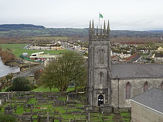
St. Munchin's Parish is an Irish civil parish that lies partly in County Clare and partly in County Limerick, including the city centre of Limerick. It takes its name from Saint Munchin, the first Bishop of Limerick. According to tradition its church was the first cathedral of the diocese of Limerick, built in 561 AD.
Killeely is a civil parish that lies partly in County Clare and partly in County Limerick in Ireland.

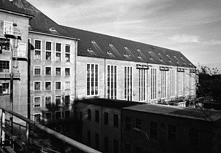
St. Patrick's, or Kilquane, is a civil parish situated on both banks of the River Shannon near the city of Limerick in Ireland. It is unusual in that it is distributed over three baronies: Bunratty Lower, Clanwilliam and the barony of the City of Limerick. Besides the suburbs of the city, it also contains the villages of Ardnacrusha and Parteen. It is known for the Ardnacrusha power plant, a major hydroelectric plant.
Killeenagarriff is a civil parish in the historical barony of Clanwilliam in County Limerick, Ireland. Settlements in Killeenagarriff include the town of Annacotty, and population centres at Ahane and Barringtonsbridge.