Thorland

Last updated
Thorland
Greenland edcp location map.svg
Red pog.svg
Thorland
Geography
LocationSoutheast Greenland
Coordinates 63°34′N41°30′W / 63.567°N 41.500°W / 63.567; -41.500 Coordinates: 63°34′N41°30′W / 63.567°N 41.500°W / 63.567; -41.500
Adjacent to Bernstorff Fjord
Length47 km (29.2 mi)
Width29 km (18 mi)
Highest elevation1,915.9 m (6285.8 ft)
Highest point Ansbjerg
Administration
Greenland (Denmark)
Municipality Sermersooq
Demographics
Population0

Thorland (Danish : Thors Land) is a peninsula in the King Frederick VI Coast, southeastern Greenland. It is a part of the Sermersooq municipality.

Contents

History

One of the coastal islands, Igdluluarssuk (Sattiaatteq) at the entrance of the fjord on its southern side, had had the northernmost Inuit settlement of the southern group on the east coast in the recent past. [1]

Arctic explorer Wilhelm August Graah of the Danish Navy explored this area in 1828–30, during an expedition in search of the legendary Eastern Norse Settlement and named this peninsula after Thor. [2]

In 1931 Norway sent two expeditions to establish hunting, meteorological and radio stations in Southeast Greenland. Founded by Finn Devold, on Ship Heimen from Tromsø, a Norwegian station was built in southern Thorland and named Finnsbu. [3] The other expedition, led by Ole Mortensen, went to Storfjord (Kangerlussuaq Fjord) on ship Signalhorn and built a hut there. Since hunting there was poor, Mortensen moved with his men south to Lindenow Fjord, where a station named Moreton was built which was later moved to neighboring Nanuuseq Fjord and renamed Torgilsbu. [4] Finnsbu was abandoned following the 1933 resolution of the Permanent Court of International Justice rejecting Norway's claims in Greenland. [5]

Geography

Thorland
Map of Thorland

Thorland is surrounded to the northeast by the Bernstorff Fjord —across which lies the Odinland Peninsula, to the east by the Irminger Sea and to the southwest by the Northern Skjoldungen Fjord, with Skjoldungen on the facing shore.

To the west and the northwest the peninsula is attached to the mainland. Cape Moltke is the easternmost point. The southern part has a deeply indented coast dividing into three narrow arms jutting southeastwards with deep fjords between them, including the Graah Fjord, Jaette Fjord and Kangerdlikajik. [6] Several glaciers pour into the Bernstorff Fjord from the northern side of the peninsula, the most important of which are Storebjørn Glacier, Tjalfe Glacier and Røskva Glacier, while the Jomfruen in the west has its terminus in the Norrevig, an offshoot of the Northern Skjoldungen Fjord. [7]

There are several islands at the mouth of the fjords at the eastern end of the peninsula the largest of which are Tupikajik, Akorninarmiut, Imaarsivik, Kiasigssaq, Qiputalik, Nappat, Qeertartivaq and Igdluluarssuk (Sattiaatteq) where there are Paleo-Eskimo archaeological sites. [7]

Mountains

This desolate peninsula is a destination for mountain climbing owing to some of its sturdy granite walls and jagged peaks. [8] Its highest point is 1,916 m high Ansbjerg, a nunatak rising above the Norrevig in the SW at 63°34′35″N41°40′5″W / 63.57639°N 41.66806°W / 63.57639; -41.66806 . Other notable summits are Kokkefars Hat, a conspicuous 996 m high peak at 63°27′5″N41°33′25″W / 63.45139°N 41.55694°W / 63.45139; -41.55694 in the southernmost arm of the peninsula, [9] Hvidbræmmen, a 1,304 m high peak in the northern side of Thorland, Hvide Telt, Hakkefjeld, Hanekammen and Rypefjeldet. [10]

In Thorland there are several nunataks besides Ansbjerg, such as Akuliaruseq, Diabastoppen, Skønheden and Strudsen. Svartalfbjerg is a mountain on the west side of the Storebjørn Glacier. [7]

1944 map of the area around Skjoldungen with the Thorland Peninsula just north of the island. Skjoldungen v2-ed.jpg
1944 map of the area around Skjoldungen with the Thorland Peninsula just north of the island.

See also

Related Research Articles

<span class="mw-page-title-main">Wilhelm August Graah</span> Danish naval officer and Arctic explorer

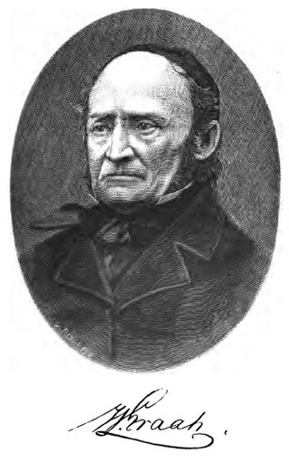
Wilhelm August Graah (1793–1863) was a Danish naval officer and Arctic explorer. Graah had mapped areas of West Greenland when he, in 1828–30, was sent by King Frederick VI of Denmark on an expedition to the unmapped eastern coast with the purpose to search for the lost Eastern Norse Settlement.

<span class="mw-page-title-main">Skjoldungen</span>

Skjoldungen is a large uninhabited island in the King Frederick VI Coast, southeastern Greenland. Administratively it is part of the Sermersooq municipality. The weather of the island is characterized by tundra climate.

Ensomheden, meaning 'Loneliness' in the Danish language, is an uninhabited island in southeastern Greenland. Administratively it is part of the Sermersooq municipality. The weather of the island is characterized by tundra climate.

<span class="mw-page-title-main">Bernstorff Fjord</span> Body of water

Bernstorff Fjord is a fjord in King Frederick VI Coast, eastern Greenland.

Lindenow Fjord or Kangerlussuatsiaq, is a fjord in the King Frederick VI Coast, Kujalleq municipality, southern Greenland.

<span class="mw-page-title-main">King Frederick VI Coast</span> Region in Greenland

King Frederick VI Coast is a major geographic division of Greenland. It comprises the coastal area of Southeastern Greenland in Sermersooq and Kujalleq municipalities fronting the Irminger Sea of the North Atlantic Ocean. It is bordered by King Christian IX Land on the north and the Greenland Ice Sheet to the west.

Iluileq is a fjord in the King Frederick VI Coast, Kujalleq municipality, southern Greenland.

Avaqqat Kangerluat, also known as Avarqqat Kangerluat, Avaqqat Kangerlua and Puiagtoq Fjord, is a fjord in the King Frederick VI Coast, Kujalleq municipality, southern Greenland.

<span class="mw-page-title-main">Sehested Fjord</span> Body of water

Sehested Fjord ) is a fjord of the King Frederick VI Coast in the Sermersooq municipality, southeastern Greenland.

<span class="mw-page-title-main">Odinland</span> Peninsula in southeastern Greenland

Odinland, also Odinsland in the Defense Mapping Agency Greenland Navigation charts, is a peninsula in the King Frederick VI Coast, southeastern Greenland. It is a part of the Sermersooq municipality.

The Graah Mountains are a mountain range in southeastern Greenland. Administratively this range is part of the Kujalleq municipality.

Cape Møsting is a headland in the North Atlantic Ocean, southeast Greenland, Kujalleq municipality.

<span class="mw-page-title-main">Cape Moltke</span>

Cape Moltke is a headland in the North Atlantic Ocean, southeast Greenland, Kujalleq municipality.

<span class="mw-page-title-main">Torgilsbu</span> Place in Greenland, Denmark

Torgilsbu was a Norwegian hunting, meteorological and radio station located on the King Frederick VI Coast, Southeastern Greenland.

<span class="mw-page-title-main">Finnsbu</span> Place in Greenland, Denmark

Finnsbu was a Norwegian hunting, meteorological and radio station located on the King Frederick VI Coast, Southeastern Greenland.

<span class="mw-page-title-main">Storfjord Station</span> Place in Greenland, Denmark

Storfjord was a Norwegian hunting, meteorological and radio station ("Storfjord/LMR") located in King Christian IX Land, Eastern Greenland.

Graah Fjord, also known as Devold Fjord and Langenæs Fjord, is a fjord in King Frederick VI Coast, eastern Greenland.

<span class="mw-page-title-main">Storebjørn Glacier</span>

Storebjørn Glacier, is a glacier in the King Frederick VI Coast, Sermersooq, southeastern Greenland.

References

  1. Encyclopedia Arctica 15: Biographies - Gustav Frederick Holm
  2. Graah, W. A. (1832). Undersøgelses-Reise til Østkysten af Grønland, efter kongelig Befaling udført i Aarene 1828-31[Exploration of the East Coast of Greenland, by royal order executed in the years 1828-31] (in Danish). Copenhagen.
  3. Recent Norwegian Expeditions to Southeast-Greenland, Gunnar Horn
  4. Norwegian Expedition to South-East Greenland, 1932
  5. Spencer Apollonio, Lands That Hold One Spellbound: A Story of East Greenland, 2008, pp. 188-189
  6. Prostar Sailing Directions 2005 Greenland and Iceland Enroute, p. 102
  7. 1 2 3 "Thors Land". Mapcarta. Retrieved 5 May 2016.
  8. North America, East Greenland, Thor's Land, Queen Lilliana, First Ascent
  9. View of the Northern Skjoldungen Fjord with the Kokkefars Hat in the distance
  10. GoogleEarth