Three States is an extinct town in Mississippi County, in the U.S. state of Missouri. The GNIS classifies it as a populated place. [1]
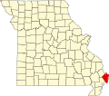
Mississippi County is a county located in the Bootheel of the U.S. state of Missouri, with its eastern border formed by the Mississippi River. As of the 2010 census, the population was 14,358. The largest city and county seat is Charleston. The county was officially organized on February 14, 1845, and was named after the Mississippi River.
In the United States, a state is a constituent political entity, of which there are currently 50. Bound together in a political union, each state holds governmental jurisdiction over a separate and defined geographic territory and shares its sovereignty with the federal government. Due to this shared sovereignty, Americans are citizens both of the federal republic and of the state in which they reside. State citizenship and residency are flexible, and no government approval is required to move between states, except for persons restricted by certain types of court orders.
Missouri is a state in the Midwestern United States. With over six million residents, it is the 18th-most populous state of the Union. The largest urban areas are St. Louis, Kansas City, Springfield and Columbia; the capital is Jefferson City. The state is the 21st-most extensive in area. Missouri is bordered by eight states : Iowa to the north, Illinois, Kentucky and Tennessee to the east, Arkansas to the south and Oklahoma, Kansas and Nebraska to the west. In the South are the Ozarks, a forested highland, providing timber, minerals and recreation. The Missouri River, after which the state is named, flows through the center of the state into the Mississippi River, which makes up Missouri's eastern border.
A post office called Three States was established in 1893, and remained in operation until 1899. [2] The community took its name from the Three States Lumber Company. [3] A variant name was "St. James". [3]
The Three States Lumber Company Mill Powerhouse, also known as the Burdette Plantation Company Store, is a historic industrial site on Old Mill Road in Burdette, Arkansas. The only surviving element of what was once a much larger sawmill, the powerhouse is a two-part structure built in 1909 to provide electrical power to the Three States Lumber Company. The northern part of the building is a two-story brick structure with a gable roof, while the southern part is a single-story shed-roof concrete structure, which includes the remnants of a smokestack. The Three States company ran a large sawmill on this site between 1906 and 1922, removing most of the structures when its operations shut down. The property was converted into a plantation when the company moved out, and this building became the company store.
Dorena is an unincorporated community in southeastern Mississippi County, Missouri, United States. Route 77 and Route 102 intersect here, approximately thirteen miles southeast of East Prairie. Dorena lends its name to the nearby Dorena-Hickman Ferry, which connects Route 77 with the Kentucky side of the Mississippi River.
Alfalfa Center is an unincorporated community in Mississippi County, in the U.S. state of Missouri.
Belmont is an extinct town in Mississippi County, on the eastern border of the U.S. state of Missouri at the Mississippi River. The GNIS classifies it as a populated place under the name "Belmont Landing".
Buckeye is an unincorporated community in Mississippi County, in the U.S. state of Missouri.
Catalpa is an unincorporated community in Mississippi County, in the U.S. state of Missouri.
Crosno is an extinct town in Mississippi County, in the U.S. state of Missouri. The GNIS classifies it as a populated place.
Dogwood is an unincorporated community in Mississippi County, in the U.S. state of Missouri.
Fuget is an extinct town in Mississippi County, in the U.S. state of Missouri. The GNIS classifies it as a populated place.
Greenfield is an extinct town in Mississippi County, in the U.S. state of Missouri. The GNIS classifies it as a populated place.
Henson is an unincorporated community in Mississippi County, in the U.S. state of Missouri.
Norfolk is an extinct town in Mississippi County, in the U.S. state of Missouri.
Rushs Ridge is an extinct town in Mississippi County, in the U.S. state of Missouri. The GNIS classifies it as a populated place.
Samos is an unincorporated community in Mississippi County, in the U.S. state of Missouri.
Texas Bend is an unincorporated community in Mississippi County, in the U.S. state of Missouri.
Whiting is an unincorporated community in Mississippi County, in the U.S. state of Missouri.
Long Prairie Township is an inactive township in Mississippi County, in the U.S. state of Missouri.
Mississippi Township is an inactive township in Mississippi County, in the U.S. state of Missouri.
Ohio Township is an inactive township in Mississippi County, in the U.S. state of Missouri.
St. James Township is an inactive township in Mississippi County, in the U.S. state of Missouri.
Wolf Island Township is an inactive township in Mississippi County, in the U.S. state of Missouri.
Coordinates: 36°37′04″N89°16′33″W / 36.61778°N 89.27583°W
A geographic coordinate system is a coordinate system that enables every location on Earth to be specified by a set of numbers, letters or symbols. The coordinates are often chosen such that one of the numbers represents a vertical position and two or three of the numbers represent a horizontal position; alternatively, a geographic position may be expressed in a combined three-dimensional Cartesian vector. A common choice of coordinates is latitude, longitude and elevation. To specify a location on a plane requires a map projection.
This Mississippi County, Missouri state location article is a stub. You can help Wikipedia by expanding it. |