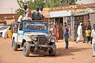
Niamey is the capital and largest city of Niger. Niamey lies on the Niger River, primarily situated on the east bank. Niamey's population was counted as 1,026,848 as of the 2012 census. As of 2017, population projections show the capital district growing at a slower rate than the country as a whole, which has the world's highest fertility rate. The city is located in a pearl millet growing region, while manufacturing industries include bricks, ceramic goods, cement, and weaving.

Dosso is a city in the south-west corner of Niger. It lies 130–140 kilometres (81–87 mi) south-east of the capital Niamey at the junction of the main routes to Zinder and Benin. The eighth-most populous town in Niger and the largest in Dosso Region, it had an official population during the 2001 census of 43,561. The population grew to 58,671 in the 2012 census. It is the capital of its region - which covers five departments in the southwestern corner of the nation - as well as of its own department, Dosso Department. The city itself lies at the centre of its own Urban Commune.

Tillabéri is a town in the extreme west of Niger. It is situated 113 kilometres or 70 miles northwest of the capital Niamey on the River Niger. It is an important market town and administrative center, being the capital of department of Tillabéri and Tillabéri Region. The town had a population of 47,678 at the 2012 census.
Tillabéri is one of the seven Regions of Niger; the capital of the Region is Tillabéri. Tillabéri Region was created in 1992, when Niamey Region was split, with Niamey and its immediate hinterland becoming a new capital district enclaved within Tillabéri Region.
Mainé-Soroa is a town in southeastern Niger, the capital of the Mainé-Soroa Department, and is in turn part of Diffa Region. The town's population was 78,735 at the 2012 census.

Niger is divided into seven regions, each of which is named after its capital. Additionally, the national capital, Niamey, comprises a capital district.

AS Douanes is a Nigerien football club based in Niamey and sponsored by the government taxation police. Prior to the 2005–6 season they played in the city of Tillabéry, and have competed in the top national league since the 2004 season, when they were promoted from the regional division 2. AS Douanes has won Nigerien league once but have never won cup championship.
Republic Day, a national holiday in the Republic of Niger is commemorated on 18 December 1958.
Diffa Airport is an airport serving Diffa, a town in the extreme southeast of Niger, near the border with Nigeria.

Dirkou Airport is an airport serving the isolated Saharan outpost of Dirkou, Niger. It is 2 kilometres (1.2 mi) southwest of the city center. In early 2018 the airport saw extensive expansion during construction of a base for Central Intelligence Agency drone operations.
Dogondoutchi Airport is an airport serving Dogondoutchi, Niger. It is 8 kilometres (5.0 mi) east-northeast of the city centre.
Iferouane Airport is an airport serving the oasis town of Iferouane, in northern Niger. The airport is located just west of the town.
Maradi Airport is an airport serving Maradi, Niger. The airport is on the east side of the city.

Niger is governed through a four layer, semi-decentralised series of administrative divisions. Begun 1992, and finally approved with the formation of the Fifth Republic of Niger on 18 July 1999, Niger has been enacting a plan for decentralisation of some state powers to local bodies. Prior to the 1999-2006 project, Niger's subdivisions were administered via direct appointment from the central government in Niamey. Beginning with Niger's first municipal elections of 2 February 1999, the nation started electing local officials for the first time. Citizens now elect local committee representatives in each commune, chosen by subdivisions of the commune: "quarters" in towns and "villages" in rural areas, with additional groupings for traditional polities and nomadic populations. These officials choose mayors, and from them are drawn representatives to the department level. The departmental council, prefect, and representatives to the regional level are chosen here using the same procedure. The system is repeated a regional level, with a regional prefect, council, and representatives to the High Council of Territorial Collectives. The HCCT has only advisory powers, but its members have some financial, planning, educational and environmental powers. The central government oversees this process through the office of the Minister of State for the Interior, Public Safety and Decentralization.
Ouattagouna or Ouatagouna is a small town and commune in the Cercle of Ansongo in the Gao Region of south-eastern Mali.
Gotheye is a village and rural commune in Niger. Gotheye is situated in Tillaberi, Tillabery, Niger, its geographical coordinates are 13° 51' 26" North, 1° 33' 55" East.
The 2018 Coupe nationale du Niger is the 43rd edition of the Coupe nationale du Niger, the knockout football competition of Niger.
The Wogo people are a small subgroup of the broader Songhai people. They are found primarily in Niger and Mali on the banks and islands of the Niger river, a territory they share with the Zarma, the Kurtey and the Songhay. The main Wogo communities are found on the islands in the Tillabery region of Niger with the largest being Ayorou in Niger and Boura in Mali. They speak the Wogo Ciine songhay dialect.