Tin Mountain, Missouri

Last updated

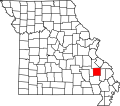
Tin Mountain is an unincorporated community in Madison County, in the U.S. state of Missouri. [1]

The community took its name from nearby Tin Mine Mountain. [2]

Related Research Articles

House Springs, Missouri unincorporated community in Missouri

House Springs is an unincorporated community in Jefferson County, Missouri, United States. It is located just off Route 30, at the intersection with Routes MM and W near Byrnes Mill.

Allbright is an unincorporated community in southeastern Madison County, in the U.S. state of Missouri.

Black Mountain (Missouri) mountain in United States of America

Black Mountain is a summit in western Madison County in the U.S. state of Missouri. The peak has an elevation of 1,503 feet (458 m). The St. Francis River flows past the east side of the mountain at an elevation of about 560 feet. Missouri Route E passes the east and south side of the mountain. The community of French Mills lies adjacent to the St. Francis just to the south of the mountain.

Blue Mountain is a summit in Madison County in the U.S. state of Missouri. It has an elevation of 1,381 feet (421 m).

Buck Mountain is a summit in Madison County in the U.S. state of Missouri. The summit has an elevation of 1,129 feet (344 m).

Buckhorn is an unincorporated community in southeastern Madison County, in the U.S. state of Missouri.

Buckner Mountain is a summit in Madison County in the U.S. state of Missouri. The summit has an elevation of 935 feet (285 m).

Catherine Place is an unincorporated community in Madison County, in the U.S. state of Missouri.

French Mills is an unincorporated community in western Madison County, in the U.S. state of Missouri. The community is on Marble Creek, just west of that stream's confluence with the St. Francis River.

Huzzah Creek is a stream in southern Madison County the U.S. state of Missouri. It is a tributary of the St. Francis River.

Jewett is an unincorporated community in southwest Madison County, in the U.S. state of Missouri.

Leatherwood Creek is a stream in Iron and Madison County in the U.S. state of Missouri. It is a tributary of St. Francis River.

Marsh Creek is a stream in Madison County in the U.S. state of Missouri. It is a tributary of the St. Francis River.

Silver Mountain is a summit in Madison County in the U.S. state of Missouri.The summit has an elevation of 981 feet (299 m).

Silver Mine is an unincorporated community in northwest Madison County, in the U.S. state of Missouri.

Tin Mine Mountain is a summit in Madison County in the U.S. state of Missouri. It has an elevation of 1,115 feet (340 m).

Twelvemile Creek is a stream in Madison County in the U.S. state of Missouri. It is a tributary of St. Francis River.

Twelvemile is an unincorporated community in Madison County, in the U.S. state of Missouri.

Mitchells Corner is an unincorporated community in Texas County, in the U.S. state of Missouri. The community is approximately eight miles northwest of Houston on Missouri Route 17. Success is about two miles north on Route 17.

Gray Mountain is a summit in the northwestern of Wayne County in the U.S. state of Missouri. Gray Mountain has an elevation of 722 feet (220 m). Gray Mountain lies above the St. Francis River to the southeast. The taller Graves Mountain lies just to the northwest and extends into Madison County south of Beulah. Graves Mountain State Forest includes portions of Gray Mountain. Missouri Route 143 passes by to the west.

References

  1. U.S. Geological Survey Geographic Names Information System: Tin Mountain, Missouri
  2. "Madison County Place Names, 1928–1945". The State Historical Society of Missouri. Archived from the original on June 24, 2016. Retrieved November 2, 2016.
Coordinates: 37°31′29″N90°24′32″W / 37.52472°N 90.40889°W / 37.52472; -90.40889