
Juab County is a county in western Utah, United States. As of the 2020 United States Census, the population was 11,786. Its county seat and largest city is Nephi.

Tooele County is a county in the U.S. state of Utah. As of the 2020 United States Census, the population was 72,698. Its county seat and largest city is Tooele. The county was created in 1850 and organized the following year.

Elko County is a county in the northeastern corner of Nevada, United States. As of the 2020 census, the population was 53,702. Its county seat is Elko. The county was established on March 5, 1869, from Lander County.

West Wendover is a small city in Elko County, Nevada, United States. The population was 4,512 at the 2020 census. It is part of the Elko micropolitan area. West Wendover is located on the eastern border of Nevada and the western edge of the Great Salt Lake Desert and is contiguous with Wendover, Utah, with which it is sometimes confused. It is home to five casinos and a cannabis dispensary which attract many visitors from neighboring Utah, where both casino gambling and non-medical cannabis are illegal. Interstate 80 runs just north of the cities, while Interstate 80 Business runs through the two cities.

Eureka is a city in Juab County, Utah, United States. It is part of the Provo–Orem metropolitan area. The population was 669 at the 2010 census, down from 766 in 2000.
Partoun is an unincorporated community in Juab County, Utah, United States. It is located in Snake Valley at latitude 39.64661N and longitude -113.88700W with an elevation of 4,818' (1,469m). It was founded in 1949 by the religious group called the Aaronic Order, and named after a town in Scotland.

U.S. Route 50 (US 50) is a transcontinental highway in the United States, stretching from West Sacramento, California, in the west to Ocean City, Maryland, on the east coast. The Nevada portion crosses the center of the state and was named "The Loneliest Road in America" by Life magazine in July 1986. The name was intended as a pejorative, but Nevada officials seized it as a marketing slogan. The name originates from large desolate areas traversed by the route, with few or no signs of civilization. The highway crosses several large desert valleys separated by numerous mountain ranges towering over the valley floors, in what is known as the Basin and Range province of the Great Basin.
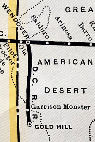
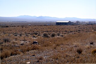
The Deep Creek Railroad is a defunct railroad company that constructed and operated a line between Wendover and Gold Hill, Utah, a distance of about 45 miles. It was constructed in 1917 to serve a mining district in the Gold Hill vicinity and existed for 22 years before succumbing to perennially weak traffic levels.

The Wendover Cut-off, also called the Wendover Road or Wendover Route, is a two-lane highway in the western part of Tooele County in the U.S. state of Utah. Stretching 40.3 miles (64.9 km) from Wendover to Knolls across the Bonneville Salt Flats, a part of the Great Salt Lake Desert, the cut-off was once part of the primary link between the Nevada state line and Salt Lake City. In 2012, between 240 and 250 vehicles used the cut-off near its western terminus in Wendover on an average day.

U.S. Route 395 (US 395) is a United States Numbered Highway, stretching from Hesperia, California to the Canadian border in Laurier, Washington. The California portion of US 395 is a 557-mile (896 km) route which traverses from Interstate 15 (I-15) in Hesperia, north to the Oregon state line in Modoc County near Goose Lake. The route clips into Nevada, serving the cities Carson City and Reno, before returning to California.
Mammoth is an unincorporated community and semi-ghost town in northeastern Juab County, Utah, United States.
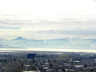
The Provo–Orem, UT Metropolitan Statistical Area, as defined by the United States Office of Management and Budget, is an area consisting of two counties in Utah, anchored by the cities of Provo and Orem. As of the 2020 census, the MSA had a population of 671,185.

U.S. Route 6 (US-6) is an east–west United States Numbered Highway through the central part of the U.S. state of Utah. Although it is only about 40 miles (64 km) longer than US-50, it serves more populated areas and, in fact, follows what had been US-50's routing until it was moved to follow Interstate 70 (I-70) in 1976. In 2009, the Utah State Legislature named part of the route the "Mike Dmitrich Highway", named after the Utah state senator, which generated controversy, as the state of Utah had previously joined with all the other states through which US-6 passes in naming all of US-6 the Grand Army of the Republic Highway.
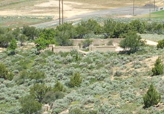
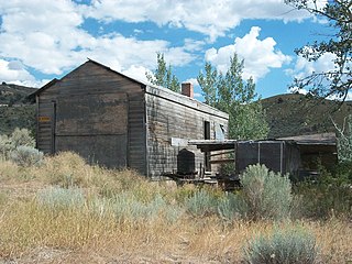
Knightsville is a ghost town located in the East Tintic Mountains on the northern slope of Godiva Mountain, approximately 2 miles (3.2 km) east of Eureka, in the northeastern corner of Juab County in central Utah, United States. A silver mining camp, Knightsville was established and operated as a company town by local mining entrepreneur Jesse Knight. The town was inhabited from 1896 until approximately 1940.
Trout Creek is an unincorporated community, in far western Juab County, Utah, United States.
The East Tintic Mountains are a mountain range in central Juab, Utah, and Tooele counties in Utah, United States on the east margin of the Great Basin just west of the Wasatch Front about 50 miles (80 km) south-southeast of Salt Lake City. The community of Eureka is an old mining town near the center of the range. U.S. Route 6 Passes through the central part of the range and through Eureka.

Juab School District is a school district located in eastern Juab County, Utah, United States. It serves the far eastern part of Juab County, while the Tintic School District serves the remaining portion of Juab County. The district is the eleventh smallest of the 41 school districts within the state Juab School District is part of the Digital Promise League of Innovative Schools and winner of the Digital School Districts Survey 2017-2018.
Diamond is a ghost town in eastern Juab County, Utah, United States. The Diamond Cemetery is listed on the National Register of Historic Places.

The Eureka City Cemetery, located west of Eureka, Utah, United States, was established at its current location in 1894 and was listed on the National Register of Historic Places (NRHP) in 1979.
The Fitch Cemetery, located west of Eureka, Utah, United States, was established in 1920 and was listed on the National Register of Historic Places in 1979.

