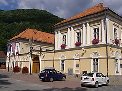
Tisovec (Hungarian: Tiszolc, German: Theissholz or Theissholcz, Latin: Taxovia) is a town in central Slovakia. Its population was around 3,648 in the latest census held in 2021.[4]
Tisovec is situated in the valley of the river Rimava, at the foot of the Muránska planina plateau. The landscape there gives the impression of a small town in the mountains. Some other towns close to it are Brezno, Hnúšťa and Revúca.
The first settlement in the area dates all the way to the Bronze Age, and was located in Hradová in Tisovec.[6] The first written evidence of the town comes from the year 1334 during the reign of King Charles I of Hungary as Tizolc.[7]
The name "Tisovec" comes from the yew tree (in Hungarian "tiszafa", in Slovak "tis"), which can be found in the hills around the town. Tisovec received its charter as a town at the end of the 15th century. The development of the town was halted by raids of the Ottoman Turks in the 16th and 17th centuries. The town's renaissance came in 1780, when Maria Theresia renewed its market privileges.
The difference between the population numbers above and in the census (here and below) is that the population numbers above are mostly made up of permanent residents, etc.; and the census should indicate the place where people actually mainly live. For example, a student is a citizen of a village because he has permanent residence there (he lived there as a child and has parents), but most of the time he studies at a university in the city.
Nowadays, there are two major employers in the town.
The Calmit company owns the local mine and produces lime. History of the mine goes all the way back to 1870.
CSM Tisovec is a machine building company with 530 employees and annual turnover of 0.5 billion Korunas. The company produces special extensions for trucks which enable them to work in severe conditions or build on the number of jobs that a particular truck can do. The company exports its products to several countries.
The town has touristic potential for its proximity to Muránska planina mountain karst. Also, the mineral water spring is worth mentioning.
Education
Besides the Vladimír Clementis Elementary School, there are two secondary education schools in Tisovec. An "industrial school" (technical college) founded in 1953 is able to board more students than it currently does. The Lutheran Gymnasium Tisovec, founded in 1992, The LutheranGymnasium is perceived to be among the better high schools in Slovakia. It is mostly a boarding school and has approximately 300 students
Vladimír Clementis (1902–1952), Communist journalist, politician and a founder of the magazine DAV. Clementis was sentenced to death by Communists as a part of the cleansing in the bloody 1950s.
Pavol Jozeffy (1775–1848), was a leading personality in the Gemer area during the revolution era of 1848–1849 and later. He was a town priest and became a bishop in 1823. He also defended Ľudovít Štúr in his fight to sustain a department of Slovak language and literature at the Evangelical lycee in Bratislava.
Štefan Marko Daxner, politician and lawyer, one of the most significant persons in 19th-century Slovak history.
Terézia Vansová, a writer from the era of realism. She lived in Tisovec for more than 30 years and wrote some of her important pieces there. She also propagated women's emancipation.
Ladislav Záborský (1921–2016), a painter, book illustrator, and church artist (stained glass windows in 25 churches and 21 "Stations of the Cross") was born in Tisovec; due to his Christian activities became a political prisoner and lived in Martin.
In 1715, the famous outlaw, Jakub Surovec, was born in Tisovec.
Tim Flakoll, Senator from North Dakota was among the volunteers who helped remodel and build the Christian Gymnasium in the early 1990s.
This page is based on this Wikipedia article Text is available under the CC BY-SA 4.0 license; additional terms may apply. Images, videos and audio are available under their respective licenses.