Tongoy Airport | |||||||||||
|---|---|---|---|---|---|---|---|---|---|---|---|
| Summary | |||||||||||
| Airport type | Defunct | ||||||||||
| Serves | Tongoy, Chile | ||||||||||
| Elevation AMSL | 49 ft / 15 m | ||||||||||
| Coordinates | 30°15′59″S71°29′02″W / 30.26639°S 71.48389°W | ||||||||||
| Map | |||||||||||
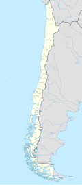 SCTG Location of Tongoy Airport in Chile | |||||||||||
| Runways | |||||||||||
| |||||||||||
| Source: GCM [1] Landings.com [2] Google Maps [3] | |||||||||||
Tongoy Airport Spanish : Aeropuerto de Tongoy, ( ICAO : SCTG) was an airstrip serving Tongoy, a Pacific coastal town in the Coquimbo Region of Chile.
The airport is closed.
The Tongoy non-directional beacon (Ident: TOY) is located on the field. The Tongoy VOR-DME (Ident: TOY) is located 0.7 nautical miles (1.3 km) southeast of the runway. [4] [5]