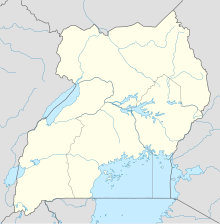
Soroti Airport is an airport serving Soroti, a town in the Eastern Region of Uganda, approximately 290 kilometres (180 mi), by road, north-east of Kampala, Uganda's capital and largest city. The main runway and apron are asphalt and can support aircraft up to the size of a Boeing 737, without damage to the surface. The airport is at an altitude of 3,697 feet (1,127 m), above sea level.
Arua Airport is a civilian airport serving the city of Arua in the Northern Region of Uganda. As of November 2016, it is one of the 47 airports in the country.

Moyo Airport is an airport in Moyo, Uganda.
Kasese Airport is an airport in Uganda.
Masindi Airport is an airport in Uganda.
Kisoro Airport is an airport serving the town of Kisoro in Uganda and nearby Bwindi Impenetrable National Park and Mgahinga Gorilla National Park. It is in extreme southwestern Uganda, 6 kilometres (4 mi) north of the Rwanda border, and approximately 343 kilometres (213 mi) by air southwest of Entebbe International Airport, the country's largest civilian and military airport. It is one of twelve upcountry airports administered by the Civil Aviation Authority of Uganda.
Kidepo Airport is an airfield in Northern Region, Uganda. The airport is at Lomej, approximately 3 kilometres (2 mi) south of the headquarters of Kidepo Valley National Park, and 456 kilometres (283 mi) northeast of Entebbe International Airport, the country's largest civilian and military airport.
Kakira Airport is one of the 46 airports in Uganda. It is a small private, civilian airport in Kakira, Jinja District, Eastern Region. The geographic coordinates of this airport are 00 degrees, 29 minutes, 56 seconds north and 33 degrees, 16 minutes, 57 seconds east. It is approximately 107 kilometres (66 mi), by air, east of Entebbe International Airport, the country's largest civilian and military airport.
Lira Airport is an airport serving Lira, a town in the Lira District of Uganda. Lira Airport is one of twelve upcountry airports that are administered by the Civil Aviation Authority of Uganda. It is also one of the 46 airports in the country.
Adjumani Airport is an airport that serves the town of Adjumani in the Northern Region of Uganda, close to the international border with South Sudan. It is approximately 376 kilometres (234 mi) by air north of Entebbe International Airport, the country's largest civilian and military airport.

Kajjansi is a town in Central Uganda. It is one of the urban centers in Wakiso District.
Kabale Airport is an airstrip serving Kabale, a town in the Kabale District in the Western Region of Uganda. It is one of the 46 airports in the country.
Kasenyi Airport is an airport in Uganda. It is one of the forty six airports in the country.
Tororo Girls Secondary School, commonly known as Tororo Girls School (TGS), is an all-girls boarding school covering grades 8 -13 in the Eastern Region of Uganda.
Isiolo Airport, also Isiolo International Airport is an airport located in Isiolo, Isiolo County, and Meru County, Kenya.
Bugungu Airstrip is an airport serving the Bugungu Wildlife Reserve in the Murchison Falls National Park (MFNP), in Western Region of Uganda.
Rhamu Airport is an airport in Kenya.
Moriah Aviation Training Centre (MATC), is an aviation training school in Uganda, that provides training for prospective pilots, cabin crew staff, aviation customer managers and related courses in the aviation industry.
Pader Airfield is an airfield serving Pader and Patongo, two towns, 33 kilometres (21 mi) apart, in the south-eastern part of Pader District, in the Northern Region of Uganda.
Pangea Aviation Academy (PAA), is an aviation training school in Uganda, which provides training for prospective pilots, destined for service in the UPDF Air Force, the Uganda Police Air Wing, Uganda National Airlines Company and in General Aviation, in the country and the region.


