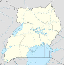
Entebbe International Airport is the only international airport in Uganda. It is located about 6 kilometres (3.7 mi) southwest of the town of Entebbe, on the northern shores of Lake Victoria. This is approximately 40 kilometres (25 mi) by road south-west of the central business district of Kampala, the capital city of Uganda.

Gulu Airport is a civilian and military airport in the Northern Region of Uganda. It is a designated entry and exit point in and out of the country.
Moyo, is the main municipal, administrative, and commercial center of Moyo District in the Northern Region of Uganda. The district headquarters are located here.
Arua Airport is a civilian airport serving the city of Arua in the Northern Region of Uganda. As of November 2016, it is one of the 47 airports in the country.
Kasese Airport is an airport in Uganda.
Pakuba Airfield is an airfield serving Pakuba and Murchison Falls National Park in the Nwoya District of northern Uganda.
Masindi Airport is an airport in Uganda.
Tororo Airport is an airport serving the town of Tororo in the Eastern Region of Uganda.
Kisoro Airport is an airport serving the town of Kisoro in Uganda and nearby Bwindi Impenetrable National Park and Mgahinga Gorilla National Park. It is in extreme southwestern Uganda, 6 kilometres (4 mi) north of the Rwanda border, and approximately 343 kilometres (213 mi) by air southwest of Entebbe International Airport, the country's largest civilian and military airport. It is one of twelve upcountry airports administered by the Civil Aviation Authority of Uganda.
Kidepo Airport is an airfield in Northern Region, Uganda. The airport is at Lomej, approximately 3 kilometres (2 mi) south of the headquarters of Kidepo Valley National Park, and 456 kilometres (283 mi) northeast of Entebbe International Airport, the country's largest civilian and military airport.
Jinja Airport is a small civilian and military airport in Uganda. It serves the town of Jinja in Jinja District, Busoga, Eastern Region. It is adjacent to the Uganda Senior Command and Staff College of the Uganda People's Defence Force at Kimaka, a suburb of Jinja. It is approximately 95 kilometres (59 mi), by air, east of Entebbe International Airport, the country's largest airport. Jinja Airport is one of 13 upcountry airports that are administered by the Uganda Civil Aviation Authority.
Kakira Airport is one of the 46 airports in Uganda. It is a small private, civilian airport in Kakira, Jinja District, Eastern Region. The geographic coordinates of this airport are 00 degrees, 29 minutes, 56 seconds north and 33 degrees, 16 minutes, 57 seconds east. It is approximately 107 kilometres (66 mi), by air, east of Entebbe International Airport, the country's largest civilian and military airport.
Nebbi Airport is an airport in Uganda. It is one of the 46 airports in the country.
Kitgum Airport is an airport in Uganda. It is one of the 46 airports in the country.
Mweya Airport is a small civilian airport in Uganda. It is one of the 46 airports in the country.
Kasenyi Airport is an airport in Uganda. It is one of the forty six airports in the country.
Bugungu Airstrip is an airport serving the Bugungu Wildlife Reserve in the Murchison Falls National Park (MFNP), in Western Region of Uganda.
Air Serv Limited also Air Serv Uganda Limited, is a Ugandan based aviation company, which offers air charter services to the countries of the African Great Lakes, aircraft maintenance and repairs, as well as humanitarian cargo deliveries in the region. Air Serv Limited is the for-profit subsidiary of the non-profit organisation Air Serv International.

Aerolink Uganda is a privately owned airline in Uganda, licensed by the Uganda Civil Aviation Authority with an air operator's certificate. It specializes in transporting tourists to Uganda's National Parks, saving their time and allowing them to see more.


