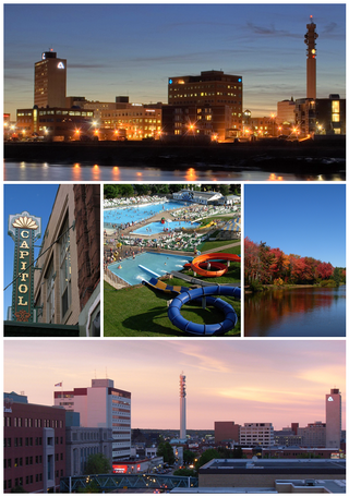
Moncton is the most populous city in the Canadian province of New Brunswick. Situated in the Petitcodiac River Valley, Moncton lies at the geographic centre of the Maritime Provinces. The city has earned the nickname "Hub City" because of its central inland location in the region and its history as a railway and land transportation hub for the Maritimes. As of the 2021 Census, the city had a population of 79,470. The metropolitan population in 2022 was 171,608, making it the fastest growing CMA in Canada for the year with a growth rate of 5.3%. Its land area is 140.67 km2 (54.31 sq mi).

The Bay of Fundy is a bay between the Canadian provinces of New Brunswick and Nova Scotia, with a small portion touching the U.S. state of Maine. It is an arm of the Gulf of Maine. Its tidal range is the highest in the world. The name is probably a corruption of the French word fendu, meaning 'split'.

Miramichi ( ) is the largest city in northern New Brunswick, Canada. It is situated at the mouth of the Miramichi River where it enters Miramichi Bay. The Miramichi Valley is the second longest valley in New Brunswick, after the Saint John River Valley.
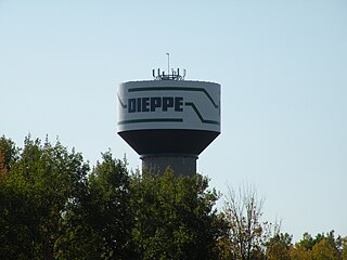
Dieppe is a city in the Canadian maritime province of New Brunswick. Statistics Canada counted the population at 28,114 in 2021, making it the fourth-largest city in the province. On 1 January 2023, Dieppe annexed parts of two neighbouring local service districts; revised census figures have not been released.

Canada has a large domestic and foreign tourism industry. The second largest country in the world, Canada's wide geographical variety is a significant tourist attractor. Much of the country's tourism is centred in the following regions: Toronto, Montreal, Quebec City, Vancouver/Whistler, Niagara Falls, Vancouver Island, Canadian Rockies, British Columbia's Okanagan Valley, Churchill, Manitoba and the National Capital Region of Ottawa-Gatineau. The large cities are known for their culture, diversity, as well as the many national parks and historic sites.

Sackville is a former town in southeastern New Brunswick, Canada. It held town status prior to 2023 and is now part of the town of Tantramar.

Memramcook, sometimes also spelled Memramcouke or Memramkouke, is a village in Westmorland County, New Brunswick, Canada. Located in south-eastern New Brunswick, the community is predominantly people of Acadian descent who speak the Chiac derivative of the French language. An agricultural village, it has a strong local patrimony, key to the history of the region. It was home to Mi'kmaqs for many years and was the arrival site of Acadians in 1700. A large part of these Acadians were deported in 1755, but the village itself survived.

Beauséjour riding is a federal electoral district in southeastern New Brunswick, Canada, which has been represented in the House of Commons of Canada since 1988. It replaced Westmorland—Kent, which was represented from 1968 to 1988.
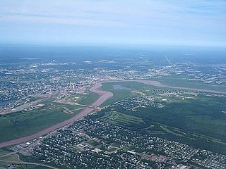
The Petitcodiac River is a river located in south-eastern New Brunswick, Canada. Local tourist businesses often refer to it as the "chocolate river" due to its distinctive brown mud floor and brown waters. Stretching across a meander length of 79 kilometres, the river traverses Westmorland, Albert, and Kings counties, draining a watershed area of about 2,071 square kilometres (800 sq mi). The watershed features valleys, ridges, and rolling hills, and is home to a diverse population of terrestrial and aquatic species. Ten named tributaries join the river in its course toward its mouth in Shepody Bay. Prior to the construction of a causeway in 1968, the Petitcodiac River had one of the world's largest tidal bores, which ranged from 1 to 2 metres (3.3–6.6 ft) in height and moved at speeds of 5 to 13 kilometres per hour (3.1–8.1 mph). With the opening of the causeway gates in April 2010, the river is flushing itself of ocean silts, and the bore is returning to its former size.
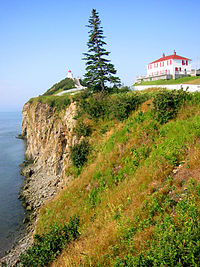
Beaubassin was an important Acadian village and trading centre on the Isthmus of Chignecto in what is now Nova Scotia, Canada. The area was a significant place in the geopolitical struggle between the British and French empires. It was established in the 1670s on an upland close to an extensive area of saltwater marsh. Settlers reclaimed the land to engage in cattle ranching and trade.
The 1973 New Brunswick electoral redistribution was the most radical redistribution of electoral districts in the history of New Brunswick, Canada. Under this redistribution, New Brunswick changed from a mixture of multi-member districts and single-member districts to a scheme of only single-member districts, from bloc voting electoral system to first past the post.

Grand Bay-Westfield is a town in New Brunswick, Canada, on the west bank of the Saint John River immediately north of the boundary between Kings County and Saint John County.

Route 106 is a highway in New Brunswick, Canada; running from an intersection with Route 1 and the western terminus of Route 905 in Three Rivers to the intersection of Trans-Canada Highway and the southern terminus of Route 940 in Sackville; a distance of 91.8 kilometres.
Route 114 is a 137.6 km (85.5 mi) Canadian secondary highway in southeastern New Brunswick.

New Brunswick is one of Canada's three Maritime provinces. While New Brunswick is one of Canada's Maritime Provinces, it differs from its neighbours both ethnoculturally and physiographically. Both Nova Scotia and Prince Edward Island are either wholly or nearly surrounded by water and the ocean, therefore, tends to define their climate, economy and culture. New Brunswick, on the other hand, although having a significant seacoast, is sheltered from the Atlantic Ocean proper and has a large interior that is removed from oceanic effects. New Brunswick, therefore, tends to be defined by its rivers rather than its seacoast.
The history of Moncton extends back thousands of years, with its first inhabitants being the First Nations of the region, such as the Mi'kmaq. Located in New Brunswick, Moncton's motto is Resurgo, which is Latin for I rise again. This motto was originally chosen in celebration of the city's rebirth in 1875 after the recovery of the economy from the collapse of the shipbuilding industry. The city again lived up to its motto in more recent times, when the economy of the city was devastated once more during the 1980s as a result of the city's largest employers all departing the city in short order. The city has since rebounded due to growth in the light manufacturing, technology, distribution, tourism, and retail sectors of the economy and is now the fastest growing city in Canada east of Toronto.
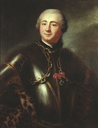
The Battle of Petitcodiac was an engagement which occurred during the Bay of Fundy campaign of the French and Indian War. The battle was fought between the British colonial forces from Massachusetts and Acadian militiamen led by French officer Charles Deschamps de Boishébert et de Raffetot on September 4, 1755. It took place at the Acadian village of Village-des-Blanchard on the Petitcodiac River.

This is a timeline of the history of Moncton. This page includes major weather, progress, and infrastructure events in Greater Moncton. You may also want to see List of entertainment events in Greater Moncton, or History of Moncton.

LaPlanche Street is the historic connector between Nova Scotia and New Brunswick, Canada. Located on the Isthmus of Chignecto, LaPlanche crosses the Tantramar Marshes between Amherst, NS and Sackville, NB. Historically, it hosted the key forts of peninsular Nova Scotia and continental Acadia and witnessed the Battle of Fort Beauséjour, the key battle between the two colonies during the Seven Years' War, and the Battle of Fort Cumberland of the American Revolutionary War.