Broadmoor is a neighborhood of the city of New Orleans. A subdistrict of the Uptown/Carrollton Area, its boundaries as defined by the New Orleans City Planning Commission are: Eve Street to the north, Washington Avenue and Toledano Street to the east, South Claiborne Avenue to the south, and Jefferson Avenue, South Rocheblave Street, Nashville Avenue, and Octavia Street to the west. It includes the Broadmoor Historic District which was listed on the National Register of Historic Places in 2003 and increased in its boundaries in 2007.

Central City is a neighborhood of the city of New Orleans. It is located in the 11th Ward of New Orleans in Uptown, just above the Garden District, on the "lakeside" of St. Charles Avenue. A subdistrict of the Central City/Garden District Area, its boundaries as defined by the City Planning Commission are: MLK Boulevard, South Claiborne Avenue and the Pontchartrain Expressway to the north, Magazine, Thalia, Prytania and Felicity Streets and St. Charles Avenue to the south and Toledano Street, Louisiana Avenue and Washington Avenue to the west. This old predominantly African-American neighborhood has been important in the city's brass band and Mardi Gras Indian traditions.
East Carrollton is a neighborhood of the city of New Orleans. A subdistrict of the Uptown/Carrollton Area, its boundaries as defined by the New Orleans City Planning Commission are: Spruce Street to the northeast, Lowerline Street to the southeast, St. Charles Avenue to the southwest and South Carrollton Avenue to the northwest.

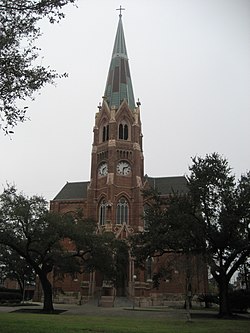
Audubon is a neighborhood of the city of New Orleans. A subdistrict of the Uptown/Carrollton Area, its boundaries as defined by the New Orleans City Planning Commission are: South Claiborne Avenue to the north, Jefferson Avenue to the east, the Mississippi River and Magazine Street to the south, and Lowerline Street to the west. The name Audubon comes from Audubon Park, one of the largest parks in the city, which is located in the southern portion of the district. The area is also known as the "University District," as it is also home of Tulane and Loyola Universities, as well as the former St. Mary’s Dominican College, and Newcomb College. The Audubon neighborhood was also the home of the original campus of Leland University. The section of the neighborhood upriver from Audubon Park incorporates what was the town of Greenville, Louisiana until it was annexed to New Orleans in the 19th century; locals still sometimes call that area "Greenville".

Uptown is a primarily residential neighborhood of the city of New Orleans. A subdistrict of the Uptown/Carrollton Area, its boundaries as defined by the New Orleans City Planning Commission are: LaSalle Street to the north, Napoleon Avenue to the east, Magazine Street to the south and Jefferson Avenue to the west.

Black Pearl is a neighborhood of the city of New Orleans. A subdistrict of the Uptown/Carrollton Area, its boundaries as defined by the New Orleans City Planning Commission are: South Carrollton Avenue and St. Charles Avenue to the north, Lowerline, Perrier and Broadway Streets to the east, and the Mississippi River to the west.

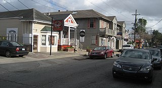
Freret is a neighborhood of the city of New Orleans, Louisiana. The Freret neighborhood contains a thriving commercial corridor. A subdistrict of the Uptown/Carrollton Area, its boundaries as defined by the New Orleans City Planning Commission are: South Claiborne Avenue to the north, Napoleon Avenue to the east, LaSalle Street to the south and Jefferson Avenue to the west. The name of the neighborhood stems from Freret Street, which was named for William Freret, a mid-19th-century New Orleans mayor.

Fontainebleau and Marlyville are jointly designated as a neighborhood of the city of New Orleans. A subdistrict of the Uptown/Carrollton Area, its boundaries as defined by the New Orleans City Planning Commission are: Colapissa and Broadway Streets and MLK Boulevard to the north, Norman C. Francis Parkway, Octavia Street, Fontainebleau Drive, Nashville Avenue, South Rocheblave, Robert and South Tonti Street and Jefferson Avenue to the east, South Claiborne Avenue, Lowerline and Spruce Streets to the south and South Carrollton Avenue to the west.

West Riverside is a neighborhood of the city of New Orleans. A subdistrict of the Uptown/Carrollton Area, its boundaries as defined by the New Orleans City Planning Commission are: Magazine Street to the north, Napoleon Avenue to the east, the Mississippi River to the south and Exposition, Tchoupitoulas and Webster Streets to the west. This has not traditionally been a separate neighborhood as most of this area has been considered part of Uptown New Orleans throughout most of its history. This name was only artificially created by the New Orleans City Planning Commission and most residents do not identify with it.

East Riverside is a neighborhood of the city of New Orleans. A subdistrict of the Central City/Garden District Area, its boundaries as defined by the City Planning Commission are: Magazine Street to the north, Toledano Street to the east, Tchoupitoulas Street to the south and Napoleon Avenue to the west.

Milan is a neighborhood of the city of New Orleans, Louisiana, U.S.A. A sub-district of the Central City/Garden District Area, its boundaries as defined by the New Orleans City Planning Commission are: South Claiborne Avenue to the north, Toledano Street and Louisiana Avenue to the east, St. Charles Avenue to the south, and Napoleon Avenue to the west.

Tulane/Gravier is a neighborhood of the city of New Orleans, Louisiana, U.S.A. A subdistrict of the Mid-City District Area, its boundaries as defined by the New Orleans City Planning Commission are: St. Louis Street to the north, North Claiborne Avenue, Iberville Street, North and South Derbigny Street, Cleveland Street, South Claiborne Avenue to the east, the Pontchartrain Expressway to the south and South Broad Street to the west.
City Park is a neighborhood of the city of New Orleans, US. A subdistrict of the Lakeview District Area, its boundaries as defined by the City Planning Commission are: Allen Toussaint Boulevard to the north, Bayou St. John to the east, Orleans Avenue, North Carrollton Avenue and Toulouse Street to the south and City Park and Orleans Avenues to the west. The neighborhood is named after and dominated by City Park.
Dillard is a neighborhood of the city of New Orleans. A subdistrict of the Gentilly District Area, its boundaries as defined by the City Planning Commission are: Mirabeau Avenue to the north, Elysian Fields Avenue to the east, Benefit Street and I-610 to the south and Paris Avenue, Pratt Drive and the London Avenue Canal to the west.

Filmore is a neighborhood of the city of New Orleans. A subdistrict of the Gentilly District Area, its boundaries as defined by the City Planning Commission are: * Allen Toussaint Boulevard to the north, London Avenue Canal to the east, Press Drive, Paris Avenue and Harrison Avenue to the south and Bayou St. John to the west.

Gentilly Terrace is a neighborhood of the city of New Orleans. A subdistrict of the Gentilly District Area, its boundaries as defined by the City Planning Commission are: Filmore Avenue to the north, People's Avenue to the east, Gentilly Boulevard to the south and Elysian Fields Avenue to the west. Gentilly Terrace may be further divided into Gentilly Terrace & Gardens, Edgewood Park and Fairmont Park, all three of which possess organized, distinct, and active neighborhood associations.
St. Anthony is a neighborhood of the city of New Orleans. A subdistrict of the Gentilly District Area, its boundaries as defined by the City Planning Commission are: New York Street to the north, Elysian Fields Avenue to the east, Mirabeau Avenue to the south and the London Avenue Canal to the west.
Desire Area is a neighborhood of the city of New Orleans. A subdistrict of the Bywater District Area, its boundaries as defined by the City Planning Commission are: Gentilly Boulevard to the north; the Industrial Canal to the east; Florida Boulevard, Alvar Street, Higgins Boulevard, Piety Street, Pleasure Street, Oliver White Avenue, and Desire Street to the south; and People's Avenue to the west. It is part of the Upper 9th Ward.
Florida Area is a neighborhood of the city of New Orleans. A subdistrict of the Bywater District Area, its boundaries as defined by the City Planning Commission are: Florida Boulevard, Gallier, Law, Congress and North Dorgenois Streets to the north; Mazant Street to the east; North Galvez Street to the south; and Montegut Street, Law Street, and Almonaster Avenue to the west.
St. Claude is a neighborhood of the city of New Orleans. A subdistrict of the Bywater District Area, its boundaries as defined by the City Planning Commission are: Law, Montegut and North Galvez Streets to the north, Lesseps Street to the east, Burgundy Street, Clouet Street and St. Claude Avenue to the south and Franklin Avenue to the west.