Milan, New Orleans

Last updated
Milan
UptownNO22May07FineArtsTheaterFront.jpg
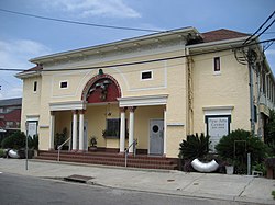
"Fine Arts Theater" building in the Milan neighborhood
Coordinates: 29°55′59″N90°05′50″W / 29.93306°N 90.09722°W / 29.93306; -90.09722 Coordinates: 29°55′59″N90°05′50″W / 29.93306°N 90.09722°W / 29.93306; -90.09722
CountryUnited States
StateLouisiana
City New Orleans, Louisiana
Planning DistrictDistrict 2, Central City/Garden District
Area
  Total0.52 sq mi (1.3 km2)
  Land0.52 sq mi (1.3 km2)
  Water0.00 sq mi (0.0 km2)
Elevation
0 ft (0 m)
Population
 (2010)
  Total2,835
  Density5,500/sq mi (2,100/km2)
Time zone UTC-6 (CST)
  Summer (DST) UTC-5 (CDT)
Area code(s) 504

Milan is a neighborhood of the city of New Orleans, Louisiana, U.S.A. A sub-district of the Central City/Garden District Area, its boundaries as defined by the New Orleans City Planning Commission are: South Claiborne Avenue to the north, Toledano Street and Louisiana Avenue to the east, St. Charles Avenue to the south, and Napoleon Avenue to the west.

Contents

Geography

Milan is located at 29°55′59″N90°05′50″W / 29.93306°N 90.09722°W / 29.93306; -90.09722 [1] and has an elevation of 0 feet (0.0 m). [2] According to the United States Census Bureau, the district has a total area of 0.52 square miles (1.3 km2). 0.52 square miles (1.3 km2) of which is land and 0.00 square miles (0.0 km2) (0.0%) of which is water.

Adjacent neighborhoods

Boundaries

The New Orleans City Planning Commission defines the boundaries of Milan as these streets: South Claiborne Avenue, Toledano Street, Louisiana Avenue, St. Charles Avenue, and Napoleon Avenue. [3]

Demographics

As of the census of 2000, there were 7,480 people, 3,175 households, and 1,693 families living in the neighborhood. [4] The population density was 14,385 /mi2 (5,754 /km2).

As of the census of 2010, there were 5,286 people, 2,372 households, and 1,118 families living in the neighborhood. [4]

See also

Related Research Articles

Faubourg Marigny New Orleans neighborhood in Louisiana, United States

The Faubourg Marigny is a neighborhood of the city of New Orleans, Louisiana, United States.

New Orleans Central Business District New Orleans neighborhood in Louisiana, United States

The Central Business District (CBD) is a neighborhood of the city of New Orleans, Louisiana, United States.

Broadmoor, New Orleans New Orleans Neighborhood in Louisiana, United States

Broadmoor is a neighborhood of the city of New Orleans. A subdistrict of the Uptown/Carrollton Area, its boundaries as defined by the New Orleans City Planning Commission are: Eve Street to the north, Washington Avenue and Toledano Street to the east, South Claiborne Avenue to the south, and Jefferson Avenue, South Rocheblave Street, Nashville Avenue, and Octavia Street to the west. It includes the Broadmoor Historic District which was listed on the National Register of Historic Places in 2003 and increased in its boundaries in 2007.

Central City, New Orleans New Orleans Neighborhood in Louisiana, United States

Central City is a neighborhood of the city of New Orleans. It is located at the lower end of Uptown, just above the New Orleans Central Business District, on the "lakeside" of St. Charles Avenue. A subdistrict of the Central City/Garden District Area, its boundaries as defined by the City Planning Commission are: MLK Boulevard, South Claiborne Avenue and the Pontchartrain Expressway to the north, Magazine, Thalia, Prytania and Felicity Streets and St. Charles Avenue to the south and Toledano Street, Louisiana Avenue and Washington Avenue to the west. This old predominantly African-American neighborhood has been important in the city's brass band and Mardi Gras Indian traditions.

Navarre, New Orleans New Orleans Neighborhood in Louisiana, United States

Navarre is a neighborhood of the city of New Orleans. A subdistrict of the Lakeview District Area, its boundaries as defined by the City Planning Commission are: I-610, Canal Boulevard and Florida Boulevard to the north, Orleans Avenue to the east, City Park Avenue to the south and the Pontchartrain Expressway and Pontchartrain Boulevard to the west.

Milneburg, New Orleans New Orleans neighborhood in Louisiana, United States

Milneburg is a neighborhood of the city of New Orleans. A subdistrict of the Gentilly District Area, its boundaries as defined by the City Planning Commission are: Leon C. Simon Drive to the north, People's Avenue to the east, Filmore Ave to the south and Elysian Fields Avenue to the west, putting it within the 8th Ward of New Orleans. The Milneburg neighborhood takes its name from Milneburg, a historic town and neighborhood formerly located a short distance north of the modern neighborhood.

Iberville Projects New Orleans Neighborhood in Louisiana, United States

Iberville Projects was a neighborhood in the city of New Orleans and one of the low-income Housing Projects of New Orleans. The Iberville was the last of the New Deal-era public housing remaining in the city. Its boundaries were St. Louis Street, Basin Street, Iberville Street, and North Claiborne Avenue. It is located in the 6th ward of downtown New Orleans, on the former site of the Storyville district. The area has recently been redeveloped into a modernized apartment complex called the Bienville Basin Apartments.

East Carrollton, New Orleans New Orleans Neighborhood in Louisiana, United States

East Carrollton is a neighborhood of the city of New Orleans. A subdistrict of the Uptown/Carrollton Area, its boundaries as defined by the New Orleans City Planning Commission are: Spruce Street to the northeast, Lowerline Street to the southeast, St. Charles Avenue to the southwest and South Carrollton Avenue to the northwest.

Audubon, New Orleans New Orleans Neighborhood in Louisiana, United States

Audubon is a neighborhood of the city of New Orleans. A subdistrict of the Uptown/Carrollton Area, its boundaries as defined by the New Orleans City Planning Commission are: South Claiborne Avenue to the north, Jefferson Avenue to the east, the Mississippi River and Magazine Street to the south, and Lowerline Street to the west. The name Audubon comes from Audubon Park, one of the largest parks in the city, which is located in the southern portion of the district. The area is also known as the "University District," as it is also home of Tulane and Loyola Universities, as well as the former St. Mary’s Dominican College, and Newcomb College. The Audubon neighborhood was also the home of the original campus of Leland University. The section of the neighborhood upriver from Audubon Park incorporates what was the town of Greenville, Louisiana until it was annexed to New Orleans in the 19th century; locals still sometimes call that area "Greenville".

Hollygrove, New Orleans New Orleans Neighborhood in Louisiana, United States

Hollygrove is a neighborhood of the city of New Orleans, Louisiana, located in the city's 17th Ward. A subdistrict of the Uptown/Carrollton area, its boundaries as defined by the New Orleans City Planning Commission are: Palmetto Street to the north, Cambronne, Edinburgh, Forshey, Fig and Leonidas Streets to the east, Earhart Boulevard to the south and the Jefferson Parish boundary to the west. Conrad playground, the Cuccia-Byrnes playground and Larry Gilbert baseball stadium are located in Hollygrove. The Hollygrove Market and Farm is also located in Hollygrove. Notable people, including rapper Lil Wayne, have grown up in the neighborhood.

Gentilly Woods, New Orleans New Orleans Neighborhood in Louisiana, United States

Gentilly Woods is a neighborhood of the city of New Orleans. A subdistrict of the Gentilly District Area, its boundaries as defined by the City Planning Commission are: Dreux Avenue to the north, Industrial Canal to the east, Gentilly Boulevard to the south and People's Avenue to the west.

Uptown, New Orleans New Orleans Neighborhood in Louisiana, United States

Uptown is a primarily residential neighborhood of the city of New Orleans. A subdistrict of the Uptown/Carrollton Area, its boundaries as defined by the New Orleans City Planning Commission are: LaSalle Street to the north, Napoleon Avenue to the east, Magazine Street to the south and Jefferson Avenue to the west.

Freret, New Orleans New Orleans neighborhood in Louisiana, United States

Freret is a neighborhood of the city of New Orleans. The Freret neighborhood contains a thriving commercial corridor. A subdistrict of the Uptown/Carrollton Area, its boundaries as defined by the New Orleans City Planning Commission are: South Claiborne Avenue to the north, Napoleon Avenue to the east, LaSalle Street to the south and Jefferson Avenue to the west.

Fontainebleau, New Orleans New Orleans Neighborhood in Louisiana, United States

Fontainebleau and Marlyville are jointly designated as a neighborhood of the city of New Orleans. A subdistrict of the Uptown/Carrollton Area, its boundaries as defined by the New Orleans City Planning Commission are: Colapissa and Broadway Streets and MLK Boulevard to the north, Norman C. Francis Parkway, Octavia Street, Fontainebleau Drive, Nashville Avenue, South Rocheblave, Robert and South Tonti Street and Jefferson Avenue to the east, South Claiborne Avenue, Lowerline and Spruce Streets to the south and South Carrollton Avenue to the west.

West Riverside, New Orleans New Orleans Neighborhood in Louisiana, United States

West Riverside is a neighborhood of the city of New Orleans. A subdistrict of the Uptown/Carrollton Area, its boundaries as defined by the New Orleans City Planning Commission are: Magazine Street to the north, Napoleon Avenue to the east, the Mississippi River to the south and Exposition, Tchoupitoulas and Webster Streets to the west. This has not traditionally been a separate neighborhood as most of this area has been considered part of Uptown New Orleans throughout most of its history. This name was only artificially created by the New Orleans City Planning Commission and most residents do not identify with it.

East Riverside, New Orleans New Orleans Neighborhood in Louisiana, United States

East Riverside is a neighborhood of the city of New Orleans. A subdistrict of the Central City/Garden District Area, its boundaries as defined by the City Planning Commission are: Magazine Street to the north, Toledano Street to the east, Tchoupitoulas Street to the south and Napoleon Avenue to the west.

Lower Garden District, New Orleans New Orleans neighborhood in Louisiana, United States

Lower Garden District is a neighborhood of the city of New Orleans. A subdistrict of the Central City/Garden District Area, its boundaries as defined by the New Orleans City Planning Commission are: St. Charles Avenue, Felicity, Prytania, Thalia, Magazine, and Julia Streets to the north; the New Orleans Morial Convention Center, Crescent City Connection, and Mississippi River to the east; Felicity Street, Magazine Street, Constance Street, Jackson Avenue, Chippewa Street, Soraparu Street, and St. Thomas Street to the south; and 1st Street to the west.

Touro, New Orleans New Orleans Neighborhood in Louisiana, United States

Touro is a neighborhood of the city of New Orleans. A subdistrict of the Central City/Garden District Area, its boundaries as defined by the New Orleans City Planning Commission are: St. Charles Avenue to the north, Toledano Street to the east, Magazine Street to the south and Napoleon Avenue to the west.

Tulane/Gravier, New Orleans New Orleans Neighborhood in Louisiana, United States

Tulane/Gravier is a neighborhood of the city of New Orleans, Louisiana, U.S.A. A subdistrict of the Mid-City District Area, its boundaries as defined by the New Orleans City Planning Commission are: St. Louis Street to the north, North Claiborne Avenue, Iberville Street, North and South Derbigny Street, Cleveland Street, South Claiborne Avenue to the east, the Pontchartrain Expressway to the south and South Broad Street to the west.

City Park, New Orleans New Orleans Neighborhood in Louisiana, United States

City Park is a neighborhood of the city of New Orleans, USA. A subdistrict of the Lakeview District Area, its boundaries as defined by the City Planning Commission are: Robert E. Lee Boulevard to the north, Bayou St. John to the east, Orleans Avenue, North Carrollton Avenue and Toulouse Street to the south and City Park and Orleans Avenues to the west. The neighborhood is named after and dominated by City Park.

References

  1. "US Gazetteer files: 2010, 2000, and 1990". United States Census Bureau. 2011-02-12. Retrieved 2011-04-23.
  2. "US Board on Geographic Names". United States Geological Survey. 2007-10-25. Retrieved 2008-01-31.
  3. Greater New Orleans Community Data Center. "Milan Neighborhood" . Retrieved 2008-06-21.
  4. 1 2 "Milan Neighborhood". Greater New Orleans Community Data Center. Retrieved 6 January 2012.