Garden District, New Orleans

Last updated

Garden District
20080622 St. Charles St. Trolley behind tree with Mardi Gras beads.JPG
Streetcar on St. Charles Avenue in the Garden District with Mardi Gras beads on a tree in the foreground
Garden District, New Orleans
Coordinates: 29°55′40″N90°05′05″W / 29.92778°N 90.08472°W / 29.92778; -90.08472
CountryUnited States
StateLouisiana
CityNew Orleans
Planning DistrictDistrict 2, Central City/Garden District
Area
  Total0.21 sq mi (0.5 km2)
  Land0.21 sq mi (0.5 km2)
  Water0.00 sq mi (0.0 km2)
Elevation
3 ft (0.9 m)
Population
 (2010)
  Total1,179
  Density5,600/sq mi (2,200/km2)
Time zone UTC-6 (CST)
  Summer (DST) UTC-5 (CDT)
Area code 504

The Garden District is a neighborhood of the city of New Orleans, Louisiana, United States. A subdistrict of the Central City/Garden District Area, its boundaries as defined by the New Orleans City Planning Commission are: St. Charles Avenue to the north, 1st Street to the east, Magazine Street to the south, and Toledano Street to the west. The National Historic Landmark district extends a little farther. [1]

Contents

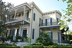
The area was originally developed between 1832 and 1900 and is considered one of the best-preserved collections of historic mansions in the Southern United States. The 19th-century origins of the Garden District illustrate wealthy newcomers building opulent structures based upon the prosperity of New Orleans in that era.

History

Garden District
Colonel-Short's-Villa-818.JPG
Colonel Short's Villa
USA Louisiana location map.svg
Red pog.svg
Usa edcp location map.svg
Red pog.svg
LocationBounded by Carondelet, Josephine, and Magazine Sts., and Louisiana Ave., New Orleans, Louisiana
Built1835
ArchitectMultiple
Architectural styleMid 19th Century Revival, Late Victorian
NRHP reference No. 71000358
Significant dates
Added to NRHPJune 21, 1971 [2]
Designated NHLDMay 30, 1974 [1]

This whole area was once a number of plantations, including the Livaudais Plantation. It was sold off in parcels to mainly wealthy Americans who did not want to live in the French Quarter with the Creoles. It became a part of the city of Lafayette in 1833, and was annexed by New Orleans in 1852. [3] The district was laid out by New Orleans architect, planner, and surveyor Barthelemy Lafon.

Originally the area was developed with only a couple of houses per block, each surrounded by a large garden, giving the district its name. In the late 19th century, some of these large lots were subdivided, as uptown New Orleans became more urban. This has produced a pattern for much of the neighborhood: of any given block having a couple of early 19th-century mansions surrounded by "gingerbread"-decorated late Victorian period houses. Thus, the "Garden District" is now known for its architecture more than for its gardens per se.

A slightly larger district (one block further west to Louisiana, one block farther north to Carondelet, and three blocks farther east to Josephine) was declared a National Historic Landmark in 1974. [1] [4]

Geography

The Garden District is located at 29°55′40″N90°05′05″W / 29.92778°N 90.08472°W / 29.92778; -90.08472 [5] and has an elevation of 3 feet (0.9 m). [6] According to the United States Census Bureau, the district has a total area of 0.21 square miles (0.5 km2), all of which is land.

Adjacent neighborhoods

Boundaries

The Garden District Association defines the boundaries as both sides of Carondelet Street, Josephine Street, both sides of Louisiana Avenue, and Magazine Street. [7]

Demographics

As of the census of 2000, there were 1,970 people, 1,117 households, and 446 families residing in the neighborhood. [8] The population density was 9,381 /mi2 (3,940 /km2).

As of the census of 2010, there were 1,926 people, 1,063 households, and 440 families residing in the neighborhood. [8]

Landmarks

Adam-Jones House Adam-Jones-House-809.JPG
Adam-Jones House
Women's Guild of the New Orleans Opera Association Women's-Guild-of-the-New-Orleans-Opera-Association-811.JPG
Women's Guild of the New Orleans Opera Association
Claiborne Cottage Claiborne-Cottage-840.JPG
Claiborne Cottage
Penrose-Sere House, New Orleans Penrose-Sere House, New Orleans.jpg
Penrose-Sere House, New Orleans
Brevard-Rice House 1239 First NOLA.jpg
Brevard-Rice House
Home used in the 2008 film The Curious Case of Benjamin Button 2009-0301-NOLA-002-BenjaminButtonhouse.jpg
Home used in the 2008 film The Curious Case of Benjamin Button
Entrance to Buckner Mansion/former Soule College building JacksonAv27Dec07SouleGate.jpg
Entrance to Buckner Mansion/former Soule College building
St. Mary's Chapel St. Mary's Chapel, Garden District, New Orleans.jpg
St. Mary's Chapel
Squires House Squires-House-848.JPG
Squires House
Alfred Grima House Alfred-Grima-House-830.JPG
Alfred Grima House

Hydrology and storms

The flooding potential in New Orleans has been noted since at least the 1820s. (Bernhard, 1828) Although experiencing wind damage from Hurricane Katrina in 2005, this area on old high ground escaped the extensive flooding of much of the rest of the city (see: Effects of Hurricane Katrina in New Orleans). Wind damage from Katrina was the most noticeable effect. The rate of return of residents after Katrina was almost 100 percent. (National Trust, 2006) Part of the area nearest St. Charles Avenue was surveyed to be only four feet above mean sea level, compared to a Mississippi River height of 14 feet (4.3 m) above sea level; (Hogan, 1990) nevertheless, the Garden District suffered little from Katrina flooding.

Government and infrastructure

The Garden District is within the 6th District of the New Orleans Police Department.[ citation needed ]

Transportation

The New Orleans Regional Transit Authority provides public transportation.[ citation needed ] The streetcar is easily accessible from St. Charles Avenue. Streetcar fare is $1.25 per person.

Education

The Garden District is zoned to schools in the New Orleans Public Schools and the Recovery School District.

The charter school Batiste Cultural Arts Academy, in the former Live Oak Elementary School building, [29] is located in the Irish Channel community near the Garden District. [30] Other public elementary schools in the vicinity include Laurel Elementary School (Lower Garden District) and Benjamin Franklin Elementary School. Public high schools in the vicinity include McMain High School and McDonogh 35 High School.[ citation needed ]

The McGehee School, a private girls' school, is within the boundaries of the Garden District and Association. [7] [31] In addition the Trinity School of New Orleans is in the area.[ citation needed ]

After 1923, Soule Business College, a private professional school, was located in the Garden District. [32] There was a private school named the Garden District Academy, formed in 1959. [33]

Notable residents

See also

Related Research Articles

<span class="mw-page-title-main">Carrollton, New Orleans</span> United States historic place

Carrollton is a historic neighborhood of Uptown New Orleans, Louisiana, USA, which includes the Carrollton Historic District, recognized by the Historic District Landmark Commission. It is the part of Uptown New Orleans farthest upriver while still being easily accessible to the French Quarter. It was historically a separate town, laid out in 1833 and incorporated on March 10, 1845. Carrollton was annexed by New Orleans in 1874, but it has long retained some elements of distinct identity.

<span class="mw-page-title-main">Bywater, New Orleans</span> Neighborhood in New Orleans, Louisiana, United States

Bywater is a neighborhood of the city of New Orleans. A subdistrict of the Bywater District Area, its boundaries as defined by the City Planning Commission are: Florida Avenue to the north, the Industrial Canal to the east, the Mississippi River to the south, and the railroad tracks along Homer Plessy Way to the west. Bywater is part of the Ninth Ward of New Orleans. It includes part or all of Bywater Historic District, which is listed on the National Register of Historic Places.

<span class="mw-page-title-main">Uptown New Orleans</span> United States historic place

Uptown is a section of New Orleans, Louisiana, United States, on the east bank of the Mississippi River, encompassing a number of neighborhoods between the French Quarter and the Jefferson Parish line. It remains an area of mixed residential and small commercial properties, with a wealth of 19th-century architecture. It includes part or all of Uptown New Orleans Historic District, which is listed on the National Register of Historic Places.

<span class="mw-page-title-main">Central City, New Orleans</span> Neighborhood in New Orleans, Louisiana, United States

Central City is a neighborhood of the city of New Orleans. It is located in the 11th Ward of New Orleans in Uptown, just above the Garden District, on the "lakeside" of St. Charles Avenue. A subdistrict of the Central City/Garden District Area, its boundaries as defined by the City Planning Commission are: MLK Boulevard, South Claiborne Avenue and the Pontchartrain Expressway to the north, Magazine, Thalia, Prytania and Felicity Streets and St. Charles Avenue to the south and Toledano Street, Louisiana Avenue and Washington Avenue to the west. This old predominantly African-American neighborhood has been important in the city's brass band and Mardi Gras Indian traditions.

<span class="mw-page-title-main">Irish Channel, New Orleans</span> New Orleans neighborhood in Louisiana, United States

Irish Channel is a neighborhood of the city of New Orleans. It is a subdistrict of the Central City/Garden District Area. Although the original site was located predominantly on the east side of Jackson Avenue, its boundaries as defined by the Historic District Landmarks Commission are: Magazine Street to the north, Jackson Avenue to the east, the Mississippi River to the south and Delachaise Street to the west.

<span class="mw-page-title-main">Touro Infirmary</span> Non-profit hospital in New Orleans, Louisiana

Touro Infirmary is a non-profit hospital located in New Orleans, Louisiana. Founded by Judah Touro in 1852, it is a part of the LCMC Health System.

<span class="mw-page-title-main">Lafayette Park, Detroit</span> Neighborhood of Detroit in Wayne County, Michigan, United States

Lafayette Park is a neighborhood located east of Downtown Detroit. It contains a residential area of some 4,900 people and covers 0.37 sq mi.

<span class="mw-page-title-main">Gallier House</span> United States historic place

Gallier House is a restored 19th-century historic house museum located on Royal Street in the French Quarter of New Orleans, Louisiana.
<span class="mw-page-title-main">Hermann–Grima House</span> Historic house in Louisiana, United States

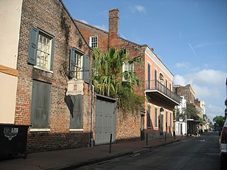
The Hermann–Grima House is a historic house museum in the French Quarter of New Orleans, Louisiana, United States. The meticulously restored home reflects 19th century New Orleans. It is a Federal-style mansion with courtyard garden, built in 1831. It has the only extant horse stable and 1830s open-hearth kitchen in the French Quarter.

<span class="mw-page-title-main">Lower Garden District, New Orleans</span> New Orleans neighborhood in Louisiana, United States

Lower Garden District is a neighborhood of the city of New Orleans. A subdistrict of the Central City/Garden District Area, its boundaries as defined by the New Orleans City Planning Commission are: St. Charles Avenue, Felicity, Prytania, Thalia, Magazine, and Julia Streets to the north; the New Orleans Morial Convention Center, Crescent City Connection, and Mississippi River to the east; Felicity Street, Magazine Street, Constance Street, Jackson Avenue, Chippewa Street, Soraparu Street, and St. Thomas Street to the south; and 1st Street to the west.

<span class="mw-page-title-main">National Register of Historic Places listings in St. Landry Parish, Louisiana</span>

This is a list of the National Register of Historic Places listings in St. Landry Parish, Louisiana.
<span class="mw-page-title-main">William Alfred Freret</span> American architect

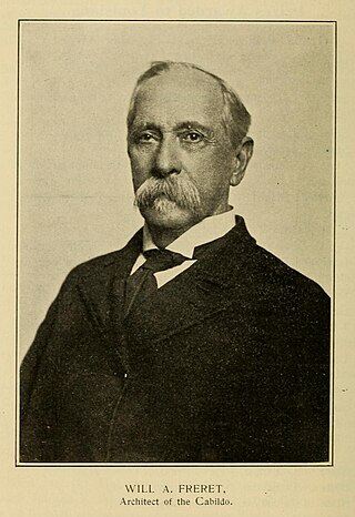
William Alfred Freret Jr. was an American architect. He served from 1887 to 1888 as head of the Office of the Supervising Architect, which oversaw construction of Federal buildings.

<span class="mw-page-title-main">McGehee School</span> School in New Orleans, Louisiana, USA

The Louise S. McGehee School is an all-girls private, independent school in the Garden District in New Orleans, Louisiana, United States. The McGehee campus, which is one city block, has ten buildings and at least 100,000 square feet (9,300 m2) of space.

<span class="mw-page-title-main">Favrot & Livaudais</span> Architectural firm (defunct)

Favrot & Livaudais (1891–1933) was an architectural firm in New Orleans, Louisiana. The firm designed many buildings that are listed on the National Register of Historic Places.

<span class="mw-page-title-main">James Freret</span> American architect

James Freret (1838–1897) was an American architect who practiced in New Orleans, Louisiana, prolific in designing many homes in that area.
<span class="mw-page-title-main">Faubourg Lafayette</span> Part of the 10th Ward of New Orleans


The neighborhood of the Faubourg Lafayette is a division in the city of New Orleans, Louisiana. It is a portion of the 10th Ward of New Orleans, and part of Central City, New Orleans. The boundaries are the lake side of St. Charles Avenue from Jackson Avenue to the Pontchartrain Expressway, back to Simon Bolivar Avenue.

The Faubourg Livaudais is a name of a neighborhood in central New Orleans that some people have re-adopted based upon the name of a former plantation that was in the area. The neighborhood is largely residential and contains mostly modest sized homes.

<span class="mw-page-title-main">Soule Business College</span> Former New Orleans educational institution

Soule Business College was an educational institution focused primary on practical business skills, established by George Soule in New Orleans, Louisiana in 1856, and operating until 1983.
<span class="mw-page-title-main">William Fitzner</span> German-American architect

William Fitzner, was a German-American architect who practiced in New Orleans, Louisiana, between the 1850s and his death. He was one of the most prolific designers in the city during the late nineteenth century and a major contributor to the city's expansion in the decades after the American Civil War.

References

  1. 1 2 3 "Garden District". National Historic Landmark summary listing. National Park Service. Archived from the original on March 25, 2009. Retrieved January 28, 2008.
  2. "National Register Information System". National Register of Historic Places . National Park Service. January 23, 2007.
  3. Louisiana Department of Culture, Recreation and Tourism. "Garden District Historical Marker" . Retrieved August 9, 2009.
  4. Paul Goeldner (January 17, 1974). "National Register of Historic Places Inventory-Nomination: The Garden District of New Orleans". National Park Service. and Accompanying 13 photos, exteriors, from 1973 and undated.  (4.71 MB)
  5. "US Gazetteer files: 2010, 2000, and 1990". United States Census Bureau. February 12, 2011. Retrieved April 23, 2011.
  6. "US Board on Geographic Names". United States Geological Survey. October 25, 2007. Retrieved January 31, 2008.
  7. 1 2 "About the Association Archived February 12, 2010, at the Wayback Machine ." Garden District Association. Retrieved on March 31, 2010.
  8. 1 2 "Garden District Neighborhood". Greater New Orleans Community Data Center. Archived from the original on June 14, 2012. Retrieved January 6, 2012.
  9. "Gilmour – Parker House". HMdb.org, The Historical Marker Database . Retrieved April 3, 2017.
  10. "Bradish Johnson House". HMdb.org, The Historical Marker Database . Retrieved April 3, 2017.
  11. "Adams – Jones House". HMdb.org, The Historical Marker Database . Retrieved April 3, 2017.
  12. "Edward A. Davis House". HMdb.org, The Historical Marker Database . Retrieved April 3, 2017.
  13. "R.N. Girling's "English Apothecary"". HMdb.org, The Historical Marker Database . Retrieved April 3, 2017.
  14. "Claiborne Cottage". Wikimedia Commons. Retrieved April 3, 2017.
  15. "Penrose-Sere House". Wikimedia commons. Retrieved April 3, 2017.
  16. Charles Erasmus Fenner (1834-1911) Archived September 23, 2010, at the Wayback Machine in the Dictionary of Louisiana Biography, retrieved 10 April 2017.
  17. "Jefferson Davis". HMdb.org, The Historical Marker Database . Retrieved April 3, 2017.
  18. "Brevard-Rice House". HMdb.org, The Historical Marker Database . Retrieved April 3, 2017.
  19. "Colonel Short's Villa". HMdb.org, The Historical Marker Database . Retrieved April 3, 2017.
  20. "The Manse". HMdb.org, The Historical Marker Database . Retrieved April 3, 2017.
  21. "Goldsmith-Godchaux House". HMdb.org, The Historical Marker Database . Retrieved April 3, 2017.
  22. "Trinity Church Episcopal". HMdb.org, The Historical Marker Database . Retrieved April 3, 2017.
  23. "Lafayette Cemetery No. 1". HMdb.org, The Historical Marker Database . Retrieved April 3, 2017.
  24. "St. Mary's Chapel". HMdb.org, The Historical Marker Database . Retrieved April 3, 2017.
  25. "Mayor Isaac W. Patton House". HMdb.org, The Historical Marker Database . Retrieved April 3, 2017.
  26. "Commander's Palace". HMdb.org, The Historical Marker Database . Retrieved April 3, 2017.
  27. "Squires House". Wikimedia Commons. Retrieved April 3, 2017.
  28. "Alfred Grima House". Wikimedia Commons. Retrieved April 3, 2017.
  29. Chang, Cindy. "Katrina rewrites the book on education in New Orleans." The Times-Picayune . Thursday August 26, 2010. Updated Monday May 28, 2012. Retrieved on April 1, 2013. "Last year, the Batiste building on Constance Street in the Garden District was occupied by Live Oak Elementary."
  30. Vanacore, Andrew. "Batiste Academy in Irish Channel chosen for federal arts program." The Times-Picayune . April 23, 2012. Retrieved on March 30, 2013. "Batiste Cultural Arts Academy, a K-8 charter school of more than 600 students in the Irish Channel neighborhood,[...]" and "Batiste, located on the site of the old Live Oak Elementary, is in the second year of a turnaround effort led by the charter management organization ReNew."
  31. "Garden District Historic District." (Archive) City of New Orleans Historic District Landmarks Commission. Retrieved on March 30, 2013.
  32. Sargent, Porter. Private Schools, Volume 27 (Handbook series, Sargent's handbook series). 1940. p. 464. "In the old Garden District are the McGehee School on Prytania Street, and Soulé College at 1410 Jackson Street."
  33. Carl, p. 52.
  34. "John Goodman moved to Louisiana to get away from Hollywood". The New York Post . June 22, 2023.
  35. "A Saint in His City: Archie Manning in New Orleans". The New York Times . January 27, 2013.

Other sources

Further reading