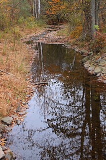
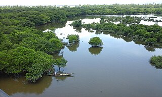
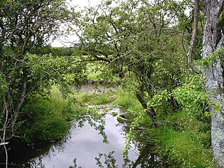
Beaver Creek is a tributary of Buttermilk Creek in Lackawanna County and Wyoming County, in Pennsylvania, in the United States. It is approximately 5.5 miles (8.9 km) long and flows through West Abington Township in Lackawanna County and Overfield Township and Falls Township in Wyoming County. The watershed of the creek has an area of 9.81 square miles (25.4 km2) and contains Lake Winola. The creek is not designated as an impaired waterbody. The surficial geology in its vicinity consists of alluvium, Wisconsinan Till, Wisconsinan Outwash, alluvial fan, Wisconsinan Ice-Contact Stratified Drift, Wisconsinan Bouldery Till, wetlands, and peat bogs.

Beaver Run is a tributary of Bowman Creek in Luzerne County and Wyoming County, in Pennsylvania, in the United States. It is approximately 7.7 miles (12.4 km) long and flows through Lake Township in Luzerne County and Noxen Township in Wyoming County. The watershed of the stream has an area of 10.6 square miles (27 km2). It is not designated as an impaired waterbody. The surficial geology in its vicinity includes alluvial fan, alluvial terrace, alluvium, Wisconsinan Till, Wisconsinan Ice-Contact Stratified Drift, fill, wetlands, and bedrock.

Swale Brook is a tributary of Tunkhannock Creek in Wyoming County, Pennsylvania, in the United States. It is approximately 2.9 miles (4.7 km) long and flows through Tunkhannock Township and Tunkhannock. The watershed of the stream has an area of 4.01 square miles (10.4 km2). The stream is not designated as an impaired waterbody. The surficial geology near it consists of alluvium, alluvial terrace, Wisconsinan Outwash, Wisconsinan Till, Wisconsinan Ice-Contact Stratified Drift, fill, and a wetland.

Kern Glen Creek is a tributary of Billings Mill Brook in Wyoming County, Pennsylvania, in the United States. It is approximately 3.1 miles (5.0 km) long and flows through Lemon Township and Tunkhannock Township. The watershed of the creek has an area of 2.71 square miles (7.0 km2). The creek is not designated as an impaired waterbody. The surficial geology in its vicinity mostly consists of Wisconsinan Till.

Monroe Creek is a tributary of Tunkhannock Creek in Susquehanna County and Wyoming County, in Pennsylvania, in the United States. It is approximately 6.1 miles (9.8 km) long and flows through Springville Township in Susquehanna County and Nicholson Township in Wyoming County. The watershed of the creek has an area of 6.64 square miles (17.2 km2). The creek is not designated as an impaired waterbody. The surficial geology in its vicinity consists mostly of alluvium, Wisconsinan Till, and other things. Its watershed is designated as a Coldwater Fishery and a Migratory Fishery.

Field Brook is a tributary of Tunkhannock Creek in Susquehanna County and Wyoming County, in Pennsylvania, in the United States. It is approximately 5.8 miles (9.3 km) long and flows through Lathrop Township in Susquehanna County and Nicholson Township in Wyoming County. The watershed of the stream has an area of 7.41 square miles (19.2 km2). The stream has one named tributary, which is known as East Branch Field Brook. The surficial geology in the vicinity of Field Brook consists of alluvium, Wisconsinan Till, alluvial terrace, alluvial fan, bedrock, wetlands, and a lake. The watershed of the stream is designated as a Coldwater Fishery and a Migratory Fishery.

Horton Creek is a tributary of Tunkhannock Creek in Susquehanna County and Wyoming County, in Pennsylvania, in the United States. It is approximately 11 miles (18 km) long and flows through Brooklyn Township and Lathrop Township in Susquehanna County and Nicholson Township and Nicholson in Wyoming County. The watershed of the creek has an area of 16.9 square miles (44 km2). The creek is not designated as an impaired waterbody and has no named tributaries. The topography of the creek's watershed has been described as "rough and hilly" and its channel is sinuous.
East Branch Martins Creek is a tributary of Martins Creek in Susquehanna County, Pennsylvania, in the United States. It is approximately 5.1 miles (8.2 km) long and flows through New Milford Township and Harford Township. The watershed of the creek has an area of 7.36 square miles (19.1 km2). The creek is not designated as an impaired waterbody. The surficial geology in its vicinity consists of Wisconsinan Till, alluvium, alluvial fan, Wisconsinan Ice-Contact Stratified Drift, and bedrock.
Utley Brook is a tributary of Tunkhannock Creek in Susquehanna County and Wyoming County, in Pennsylvania, in the United States. It is approximately 4.5 miles (7.2 km) long and flows through Lenox Township in Susquehanna County and Nicholson Township in Wyoming County. The stream is in the United States Geological Survey quadrangles of Hop Bottom and Lenoxville. The surficial geology in its vicinity consists of Wisconsinan Till, alluvium, bedrock, wetlands, and lakes. The creek is a Coldwater Fishery and a Migratory Fishery. It has one named tributary, which is known as Willow Brook.
Willow Brook is a tributary of Utley Brook in Susquehanna County and Wyoming County, in Pennsylvania, in the United States. It is approximately 3.7 miles (6.0 km) long and flows through Lenox Township in Susquehanna County and Nicholson Township in Wyoming County. The surfcial geology in the vicinity of the stream consists mainly of Wisconsinan Till, bedrock, alluvium, wetlands, and a lake. A number of bridges have been constructed across it. The stream is classified as a Coldwater Fishery and a Migratory Fishery.
Millard Creek is a tributary of Tunkhannock Creek in Susquehanna County, Pennsylvania. It is approximately 6.2 miles (10.0 km) long and flows through Harford Township and Lenox Township. The watershed of the creek has an area of 5.66 square miles (14.7 km2). The creek is not designated as an impaired waterbody. The surficial geology in its vicinity includes Wisconsinan Till, alluvium, wetlands, lakes, bedrock, and alluvial fan. The dominant land uses in the creek's watershed include forested land and agricultural land. A number of bridges have been constructed over the creek. Its drainage basin is designated as a Coldwater Fishery and a Migratory Fishery.
Partners Creek is a tributary of Tunkhannock Creek in Susquehanna County, Pennsylvania, in the United States. It is approximately 6.4 miles (10.3 km) long and flows through Harford Township and Lenox Township. The watershed of the creek has an area of 5.84 square miles (15.1 km2). The creek has one named tributary, which is known as Sterling Brook. The drainage basin of Partners Creek is classified as a Coldwater Fishery and a Migratory Fishery. The surficial geology in the vicinity of the creek consists of Wisconsinan Till, alluvium, bedrock, wetlands, lakes, and alluvial fan.
Nine Partners Creek is a tributary of Tunkhannock Creek in Susquehanna County, Pennsylvania, in the United States. It is approximately 10 miles (16 km) long and flows through New Milford Township, Harford Township, and Lenox Township. The watershed of the creek has an area of 38.6 square miles (100 km2). The creek has two named tributaries: Butler Creek and Leslie Creek. The surficial geology in the vicinity of Nine Partners Creek includes Wisconsinan Till, alluvium, bedrock, alluvial fan, and wetlands. The creek's drainage basin is designated as a Coldwater Fishery and a Migratory Fishery.
Leslie Creek is a tributary of Nine Partners Creek in Susquehanna County, Pennsylvania, in the United States. It is approximately 4.7 miles (7.6 km) long and flows through New Milford Township and Harford Township. The watershed of the creek has an area of 4.59 square miles (11.9 km2). The creek is not designated as an impaired waterbody. It flows through a lake known as Tingley Lake in its upper reaches. The surficial geology in the vicinity of Leslie Creek mainly includes Wisconsinan Till and alluvium, with some alluvial fan, wetlands, and lakes.

Bell Creek is a tributary of Tunkhannock Creek in Susquehanna County, Pennsylvania, in the United States. It is approximately 5.2 miles (8.4 km) long and flows through Gibson Township. The watershed of the creek has an area of 5.64 square miles (14.6 km2). The surficial geology the creek's vicinity includes Wisconsinan Till, alluvium, bedrock, wetlands, lakes, and alluvial fan. It has no named tributaries, but does flow through a lake known as Potter Lake. A bridge on the National Register of Historic Places crosses Bell Creek as well. The creek's watershed is designated as a Coldwater Fishery and a Migratory Fishery.
Bear Swamp Creek is a tributary of Tunkhannock Creek in Susquehanna County, Pennsylvania, in the United States. It is approximately 4.3 miles (6.9 km) long and flows through Gibson Township and Clifford Township. The watershed of the creek has an area of 3.92 square miles (10.2 km2). The creek has no named tributaries, and is not designated as an impaired waterbody. It does pass through a wetland known as Bear Swamp. The drainage basin of the creek is designated as a Coldwater Fishery and a Migratory Fishery.
Tinker Creek is a tributary of East Branch Tunkhannock Creek in Susquehanna County, Pennsylvania, in the United States. It is approximately 4.3 miles (6.9 km) long and flows through Clifford Township. The watershed of the creek has an area of 5.02 square miles (13.0 km2). The creek is not designated as an impaired waterbody and has no named tributaries. It is classified as Class A Wild Trout Waters.
Dundaff Creek is a tributary of East Branch Tunkhannock Creek in Susquehanna County and Lackawanna County, in Pennsylvania, in the United States. It is approximately 6.7 miles (10.8 km) long and flows through Clifford Township in Susquehanna County and Greenfield Township in Lackawanna County. The watershed of the creek has an area of 10.3 square miles (27 km2). The creek has no named tributaries and is not designated as an impaired waterbody.
Idlewild Creek is a tributary of East Branch Tunkhannock Creek in Susquehanna County, Pennsylvania, in the United States. It is approximately 5.1 miles (8.2 km) long and flows through Clifford Township. The watershed of the creek has an area of 8.14 square miles (21.1 km2). The creek is not designated as an impaired waterbody and has no named tributaries. A 68.4 acres (27.7 ha) lake known as Lake Idlewild is located in the creek's watershed. Wild trout naturally reproduce in the creek.
Taques Creek is a tributary of the Susquehanna River in Wyoming County, Pennsylvania, in the United States. It is approximately 2.9 miles (4.7 km) long and flows through Washington Township and Tunkhannock Township. The watershed of the creek has an area of 4.96 square miles (12.8 km2). The creek is not designated as an impaired waterbody and has no named tributaries. Its watershed is designated as a Coldwater Fishery and a Migratory Fishery.


