
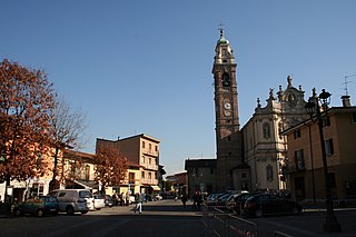
Brembate di Sopra is a comune (municipality) in the Province of Bergamo in the Italian region of Lombardy, located about 45 kilometres northeast of Milan and about 7 km (4 mi) northwest of Bergamo. As of 31 December 2004, it had a population of 7,190 and an area of 4.3 square kilometres.

Cenate Sopra is a comune (municipality) in the Province of Bergamo in the Italian region of Lombardy, located about 60 kilometres (37 mi) northeast of Milan and about 12 kilometres (7.5 mi) east of Bergamo. As of 31 December 2004, it had a population of 2,248 and an area of 6.9 square kilometres (2.7 sq mi).

Cenate Sotto is a comune (municipality) in the Province of Bergamo in the Italian region of Lombardy, located about 60 kilometres (37 mi) northeast of Milan and about 12 kilometres (7 mi) east of Bergamo. As of 31 December 2004, it had a population of 2,947 and an area of 4.5 square kilometres (1.7 sq mi).

Filago is a comune (municipality) in the Province of Bergamo in the Italian region of Lombardy, located about 35 kilometres (22 mi) northeast of Milan and about 12 kilometres (7 mi) southwest of Bergamo.

Mapello is a comune (municipality) in the Province of Bergamo in the Italian region of Lombardy, located about 40 kilometres (25 mi) northeast of Milan and about 9 kilometres (6 mi) west of Bergamo. As of 31 December 2004, it had a population of 5,806 and an area of 8.5 square kilometres (3.3 sq mi).
Osio Sotto is a comune (municipality) in the Province of Bergamo in the Italian region of Lombardy, located about 40 kilometres (25 mi) northeast of Milan and about 11 kilometres (7 mi) southwest of Bergamo. As of 31 December 2004, it had a population of 11,097 and an area of 7.5 square kilometres (2.9 sq mi).
San Nicolò di Comelico is a comune (municipality) in the province of Belluno in the Italian region of Veneto, located about 130 kilometres (81 mi) north of Venice.

Forni di Sotto is a comune (municipality) in the Regional decentralization entity of Udine in the Italian region of Friuli-Venezia Giulia, located about 120 kilometres (75 mi) northwest of Trieste and about 60 kilometres (37 mi) northwest of Udine. As of 31 December 2004, it had a population of 701 and an area of 93.0 square kilometres (35.9 sq mi).

Preone is a comune (municipality) in the Regional decentralization entity of Udine in the Italian region of Friuli-Venezia Giulia, located about 110 kilometres (68 mi) northwest of Trieste and about 45 kilometres (28 mi) northwest of Udine.
Savogna is a comune (municipality) in the Regional decentralization entity of Udine in the Italian region of Friuli-Venezia Giulia, located about 60 kilometres (37 mi) northwest of Trieste and about 25 kilometres (16 mi) northeast of Udine, on the border with Slovenia.
Socchieve is a comune (municipality) in the Regional decentralization entity of Udine in the Italian region Friuli-Venezia Giulia, located about 110 kilometres (68 mi) northwest of Trieste and about 45 kilometres (28 mi) northwest of Udine.

Verzegnis is a comune (municipality) in the Regional decentralization entity of Udine in the Italian region of Friuli-Venezia Giulia, located about 100 kilometres (62 mi) northwest of Trieste and about 40 kilometres (25 mi) northwest of Udine.
Castelnovo del Friuli is a comune (municipality) in the Regional decentralization entity of Pordenone, in the Italian region of Friuli-Venezia Giulia, located about 90 kilometres (56 mi) northwest of Trieste and about 30 kilometres (19 mi) northeast of Pordenone.

Claut is a comune (municipality) in the Regional decentralization entity of Pordenone in the Italian region of Friuli-Venezia Giulia, located about 120 kilometres (75 mi) northwest of Trieste and about 35 kilometres (22 mi) northwest of Pordenone.

Clauzetto is a comune (municipality) in the Regional decentralization entity of Pordenone, in the Italian region of Friuli-Venezia Giulia, located about 100 kilometres (62 mi) northwest of Trieste and about 35 kilometres (22 mi) northeast of Pordenone.
Meduno is a comune (municipality) in the Regional decentralization entity of Pordenone in the Italian region of Friuli-Venezia Giulia, located about 100 kilometres (62 mi) northwest of Trieste and about 30 kilometres (19 mi) northeast of Pordenone. As of 31 December 2004, it had a population of 1,737 and an area of 31.2 square kilometres (12.0 sq mi).
Tramonti di Sotto is a comune (municipality) in the Regional decentralization entity of Pordenone, in the Italian region of Friuli-Venezia Giulia. It is located about 110 kilometres (68 mi) northwest of Trieste and about 35 kilometres (22 mi) northeast of Pordenone. As of 31 December 2004, it had a population of 444 and an area of 84.6 square kilometres (32.7 sq mi).
Travesio is a comune (municipality) in the Regional decentralization entity of Pordenone, in the Italian region of Friuli-Venezia Giulia, located about 100 kilometres (62 mi) northwest of Trieste and about 30 kilometres (19 mi) northeast of Pordenone. As of 31 December 2004, it had a population of 1,816 and an area of 28.8 square kilometres (11.1 sq mi).

Vito d'Asio is a comune (municipality) in the Regional decentralization entity of Pordenone, in the Italian region of Friuli-Venezia Giulia, located about 90 kilometres (56 mi) northwest of Trieste and about 35 kilometres (22 mi) northeast of Pordenone.

Quarna Sopra is a comune (municipality) in the Province of Verbano-Cusio-Ossola in the Italian region Piedmont, located about 75 kilometres (47 mi) from Malpensa Airport in Milan, 140 kilometres (87 mi) northeast of Turin and about 15 kilometres (9 mi) southwest of Verbania.


