Tudu | |
|---|---|
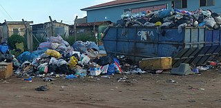
 The main tudu area | |
| Country | |
| Region | Greater Accra Region |
| District | Accra Metropolitan |
| Elevation | 187 ft (57 m) |
| Time zone | GMT |
| • Summer (DST) | GMT |
Tudu is a suburb of Accra in the Greater Accra Region of Ghana.
Tudu | |
|---|---|
| The main tudu area | |
| Country | |
| Region | Greater Accra Region |
| District | Accra Metropolitan |
| Elevation | 187 ft (57 m) |
| Time zone | GMT |
| • Summer (DST) | GMT |
Tudu is a suburb of Accra in the Greater Accra Region of Ghana.
Tudu is located within the central business district of Accra. [1]
The Accra Polytechnic and Kinbu Secondary Technical School both located at Kinbu.

Accra is the capital and largest city of Ghana, located on the southern coast at the Gulf of Guinea, which is part of the Atlantic Ocean. As of 2021 census, the Accra Metropolitan District, 20.4 km2 (7.9 sq mi), had a population of 284,124 inhabitants, and the larger Greater Accra Region, 3,245 km2 (1,253 sq mi), had a population of 5,455,692 inhabitants. In common usage, the name "Accra" often refers to the territory of the Accra Metropolitan District as it existed before 2008, when it covered 199.4 km2 (77.0 sq mi). This territory has since been split into 13 local government districts: 12 independent municipal districts and the reduced Accra Metropolitan District (20.4 km2), which is the only district within the capital to be granted city status. This territory of 199.4 km2 contained 1,782,150 inhabitants at the 2021 census, and serves as the capital of Ghana, while the district under the jurisdiction of the Accra Metropolitan Assembly proper (20.4 km2) is distinguished from the rest of the capital as the "City of Accra".

The Accra Metropolitan District is one of the 254 Metropolitan, Municipal and Districts in Ghana, and among the 26 such districts in the Greater Accra Region with a population of 284,124 as of 2021. As of March 2018, it spans an area of approximately 60 km2 (23 sq mi) and encompasses the Ablekuma South, Ashiedu Keteke, and Okaikoi South sub-metropolitan district councils.
Republic Bank Ghana Limited is a commercial bank in Ghana. It is one of the commercial banks licensed by the Bank of Ghana, the central bank and national banking regulator.
The Ghana Institute of Languages is located in Accra, the capital of Ghana, and teaches English, French, German, Arabic, Spanish, Portuguese and Russian languages. It was established in 1961 by the first President of Ghana, Dr. Kwame Nkrumah. Initially, it was directly under the control of the office of the President at the Castle. It was formed to enhance the linguistic competence in modern languages of Foreign Service personnel and civil servants. Currently, The Institute is under the Ministry of Education with the National Council for Tertiary Education (NCTE) having oversight responsibility. The head office of the Ghana Institute of Languages is currently located in the centre of the metropolis of Accra. It lies off Barnes Road in the education loop and houses the School of Languages and the administrative staff. The School of Translators and the School of Bilingual Secretaryship are located in the new branch offices in Accra at East Legon.

Ada Foah is a town on the southeast coast of Ghana, where the Volta River meets the Atlantic Ocean. The town is located along the Volta River, off of the Accra-Aflao motorway. Known for palm-lined beaches and estuary islands, Ada Foah is also the capital of the Ada East District and the seat of the District Assembly.

West Ridge is a neighbourhood of Accra, Ghana, bounded to the south by Kinbu Gardens. Barnes Road serves as the neighbourhood's western boundary, while the Independence Avenue/Liberation Avenue is the eastern boundary. Castle Road separates West Ridge from the northern neighbourhood of North Ridge. The Accra branch of the British Council is located in West Ridge, off Liberia Road.

The city of Accra, capital of Ghana, is officially divided into five geographical regions: North, West, East, Central and south - and eleven sub-metropolitan areas: Osu Klottey, Ablekuma North, Ablekuma South, Ayawaso Central, Ayawaso East, Ayawaso North, Ayawaso West, La, Okaikoi North, Okaikoi South, Abossey Okai, and Ashiedu Keteke. The word "neighbourhood" can take on various official and unofficial meanings. There are, however, 50 official neighbourhoods within the city limits of Accra.

The Accra Mall is a shopping centre in Accra, Ghana, located on the Spintex road adjacent to the Tema Motorway. The mall was commissioned on 4 July 2008. It was founded by late Joseph Owusu Akyaw (1938-2010). It is owned by Atterbury Property Development, Sanlam and the Owusu-Akyaw family.
Taifa is a town in the Ga East Municipal District, a district in the Greater Accra Region of south-eastern Ghana near the capital Accra. Taifa is the twenty-sixth largest settlement in Ghana, in terms of population, with a population of 68,459 people. Taifa is located in the northwest suburbs area of Accra. It has a breakpoint on a railway line and a small park located on the northern edge of the location of the Taifa Ghana Atomic Energy Commission. At the Ghana 2000 census of 26 March 2000, the population was 26,145 inhabitants living in the city. Projections of 1 January 2007 estimated the population to be 48,927 inhabitants. In the census of 1984 there was only 1,009 inhabitants. The strong population growth of the Town is influenced by, among other things, many illegal immigrants from west African countries who move to towns and villages near the industrial town of Tema to find a job.

Abokobi is a small town and is the capital of Ga East Municipal District, an MMDA located within the Greater Accra Region of Ghana.

Dansoman is a suburban town in the Greater Accra Region of Ghana, located near Accra and Takoradi district of the Accra Metropolitan Area. The town is known for being one of the largest estates in West Africa.
O'Reilly Senior High School ,popularly known as "O'REISCO" is a co-educational boarding school located at Okpoi-Gonno in the Ledzokuku-KroworMunicipal District, Accra, Ghana.

The 2011–12 Ghanaian Premier League season was the 53rd season of top-tier football in Ghana. The competition began on 5 September 2011, and ended on 27 May 2012.
Kokomlemle is a town in the Accra Metropolitan District, a district of the Greater Accra Region of Ghana and noted for the location of Joy FM and Accra Technical Training Center (ATTC), among other institutions.
Mamprobi is a town in the Accra Metropolitan district, a district of the Greater Accra Region of Ghana. It is located south of Lartebiokorshie, northeast of Old Dansoman and north of Chorkor.

The Octagon is a business and retail center in the heart of Accra, the capital of Ghana. The building complex offers ca. 75,000 m2 usable area for luxury offices and retail inclusively a five-star hotel. Opened in 2013, it is located in Tudu a suburb of Accra on an area closed by the Independence Avenue and the Barnes Road, northern of the Kinbu Gardens.

The Accra Technical University was established in 1949 as a Technical School in Ghana and commissioned in 1957 as Accra Technical Institute and converted into a Technical University by the Parliament of Ghana in 2013.
Ayawaso Central Municipal District is one of the twenty-nine districts in Greater Accra Region, Ghana. Originally it was formerly part of the then-larger Accra Metropolitan District in 1988, until a small portion of the district was split off to create Ayawaso Central Municipal District on 9 February 2019; thus the remaining part has been retained as Accra Metropolitan District. The municipality is located in the central part of Greater Accra Region and has Kokomlemle as its capital town.
Ayawaso East Municipal District is one of the twenty-nine districts in Greater Accra Region, Ghana. Originally it was formerly part of the then-larger Accra Metropolitan District in 1988, until a small portion of the district was split off to create Ayawaso East Municipal District on 15 March 2018; thus the remaining part has been retained as Accra Metropolitan District. The municipality is located in the central part of Greater Accra Region and has Nima as its capital town.
Ablekuma West Municipal District is one of the twenty-nine districts in Greater Accra Region, Ghana. Originally it was formerly part of the then-larger Accra Metropolitan District in 1988, until a small portion of the district was split off to create Ablekuma West Municipal District on 15 March 2018; thus the remaining part has been retained as Accra Metropolitan District. The municipality is located in the central part of Greater Accra Region and has Dansoman as its capital town.
Coordinates: 5°33′N0°12′W / 5.550°N 0.200°W