
Mount Ruapehu is an active stratovolcano at the southern end of the Taupo Volcanic Zone in New Zealand. It is 23 kilometres (14 mi) northeast of Ohakune and 23 km (14 mi) southwest of the southern shore of Lake Taupo, within Tongariro National Park. The North Island's major ski resorts and only glaciers are on its slopes.

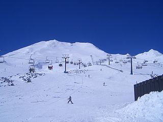
Whakapapa skifield is a commercial skifield on the northern side of Mount Ruapehu in Tongariro National Park, New Zealand. It is one of three skifields on the mountain, the others being Turoa, which is on Ruapehu's south-western slopes and Tukino on the eastern slopes. The ski season is generally from late June to late October, depending on snow and weather conditions. The terrain at Whakapapa Skifield is divided up as 25% beginner, 50% intermediate and 25% advanced.

Tongariro National Park is the oldest national park in New Zealand, located in the central North Island. It has been acknowledged by UNESCO as a World Heritage Site of mixed cultural and natural values.
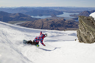
Treble Cone is the closest ski area to Wānaka, New Zealand.
Turoa is a skifield on the south western side of Mount Ruapehu, the highest mountain in the North Island of New Zealand, in Tongariro National Park. The area has been used for skiing since before the completion of the Mountain Road, but the first lifts opened in 1978.

Chateau Tongariro, also known as the Grand Chateau, is a New Zealand hotel and resort complex, located close to Whakapapa skifield on the slopes of Mount Ruapehu, It is close to the volcanic peaks of Mount Tongariro and Mount Ngauruhoe, within the boundaries of Tongariro National Park, New Zealand's oldest. The building was completed in 1929 and, despite extensive refurbishment, still retains much of the style of the pre-Depression era.

Perisher Valley, commonly called Perisher, is a valley formed below Mount Perisher, a mountain that is located in the Snowy Mountains of New South Wales, Australia.

Mount Mawson is a mountain and club skifield situated within the Mount Field National Park in southern Tasmania, Australia.
Broken River is a club skifield in South Island, New Zealand. Run by the Broken River Ski Club, it is located at about 110 km (68 mi) from Christchurch. The skifield claims to often have the longest ski season anywhere in Australasia. Also, by connecting with Craigieburn Valley, it claims to have the largest skiable area in New Zealand, at 900 hectares.

Craigieburn Valley Ski Area is a club skifield in the Southern Alps of New Zealand's South Island, about 104 km west from Christchurch. Catering only to intermediate and advanced skiers, it features a vertical range of 1308–1811 m, 600 hectares of skiable area and 3 fast rope tows. The resort has several ski lodges but no gear hire. It is also the base for ski touring expeditions when conditions permit. It is immediately adjacent to the Broken River Ski Area, with which it shares a ski pass system. Skiing between the two is possible with some skinning involved.
In New Zealand, a club skifield is a small ski resort run by a ski club to provide affordable skiing to its members. While members of the public can ski, members of the club receive heavily discounted rates, in exchange for a yearly membership fee and usually several days of voluntary work maintaining the resort.

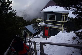
Temple Basin is a club skifield in Arthur's Pass, in New Zealand's South Island. Operated by two clubs, the Temple Basin Ski Club, and the Canterbury University Snow Sports Club, the ski area has 3 rope tows, two on-site lodges, two shelters and a ski school and ski shop. The tows cover an elevation range of 1326–1753 metres, for a skiable domain of 320 hectares. Its natural terrain has been highly recommended by adventure skiers on several occasions.

Mount Olympus Ski Area, dubbed "playground of the gods", is a club skifield in Craigieburn Range, on New Zealand's South Island. Near the town of Windwhistle, and in the vicinity of other club fields such as Mount Cheeseman and Broken River, it is approximately 2 hours' drive from Christchurch. The skifield is run by the Windwhistle Ski Club. Ranging in elevation from 1430m to 1880m, the terrain distribution is 10% beginner, 55% intermediate and 35% advanced. There are four rope tows, and with a bit of walking, 60 hectares of terrain is available.
Manganui Ski Area, located in Taranaki, in New Zealand's North Island is a club skifield. Like all club fields, it has accommodation onsite, in the form of the 33-bed Manganui Lodge. It has 3 rope ski tows and a T-bar covering a beginner-intermediate terrain of 59 hectares. The elevation ranges from 1260-1680 m.

The Awakino ski field is located in St. Marys Range, in the Canterbury, New Zealand part of Waitaki District near Kurow. It is run by the Waitaki Ski Club. The field is little changed from when it was established in the late 1940s. Run by volunteers only, it operates most weekends in the winter season, which normally lasts from July to October. The field has one and a half high-speed rope tows, queues are unheard of and a busy day means more than 10 people.

Skiing in Australia takes place in the high country of the states of New South Wales, Victoria and Tasmania, as well as in the Australian Capital Territory, during the southern hemisphere winter.

Windwhistle is a small farming settlement in the Selwyn District of New Zealand. It is located on State Highway 77 near the Rakaia Gorge. Windwhistle is 81 kilometers drive to the west of Christchurch and 22 kilometers north of Methven. Windwhistle's name comes from the way the wind sounds when the Canterbury north west wind blows.

Perisher Ski Resort is the largest ski resort in the Southern Hemisphere. Located in the Australian Snowy Mountains, the resort is an amalgamation of four villages and their associated ski fields, covering approximately 12 square kilometres (5 sq mi), with the base elevation at 1,720 metres (5,640 ft) AHD, and the summit elevation of 2,054 metres (6,739 ft) at the top of Mount Perisher. 4.4 square kilometres (1.7

Skiing in Tasmania takes place in the high country of the state of Tasmania, Australia, during the Southern Hemisphere winter. Cross country skiing is possible within the Tasmanian Wilderness and two small downhill ski-fields have been developed at Ben Lomond and Mount Mawson.


