A dos Francos is one of twelve civil parishes (freguesias) in the municipality of Caldas da Rainha, Portugal. The population in 2011 was 1,701, in an area of 18.93 km2. It includes the settlements A dos Francos, Broeiras, Carreiros, Casais da Aramanha, Casais da Bica, Casais da Paraventa, Casais de Santa Helena, Casais Gaiolas, Casal da Palmeira, Casal das Cheiras, Casal das Sesmarias, Casal Sobreiro, Casal Pinheiro, Casal Val Covo, Salgueirinha, Santa Susana and Vila Verde de Matos.
Vila do Porto is the single municipality, the name of the main town and one of the civil parishes on the island of Santa Maria, in the Portuguese archipelago of Azores. Its nearest neighbor, administratively, is the municipality of Povoação on the southern coast of São Miguel, and it is physically southwest of the islets of the Formigas. The population in 2021 was 5,408, in an area of 96.89 km2 (37.41 sq mi).

São José is a civil parish in the municipality of Ponta Delgada on the island of São Miguel in the Portuguese archipelago of the Azores. It is one of the constituent parts of the city of Ponta Delgada, and location of many of the island's more significant cultural and historical, commercial and residential buildings. Extending a short distance along the coast it, nevertheless includes a large mixed urban-rural constituency from the shore north to the main freeway, the Via-Rápida. The population in 2011 was 5,934, in an area of 1.66 km2.

Povoação is a municipality located in the southeastern corner of the island of São Miguel in the Portuguese archipelago of the Azores. The population in 2011 was 6,327, in an area of 106.41 km2.

Algoz is a town and the seat of the civil parish of Algoz e Tunes in the municipality of Silves, in Algarve, Portugal. It has about 3000 inhabitants.

Nelas is a municipality located in the Centro Region of continental Portugal. The population in 2011 was 14,037, in an area of 125.71 km².

Lagoa is a city and municipality in the district of Faro, in the Portuguese region of Algarve. The population of the municipality in 2011 was 22,975, in an area of 88.25 km2. Its urban population, in the city of Lagoa proper, is 6,100 inhabitants. An important travel destination, its coast has won numerous accolades. Marinha Beach was considered by the Michelin Guide as one of the 10 most beautiful beaches in Europe and as one of the 100 most beautiful beaches in the world.
Vila do Porto is a civil parish in the municipality of Vila do Porto, located on the island of Santa Maria, in the Portuguese autonomous region of Azores. It is the southernmost and easternmost parish in the archipelago of Azores. The population in 2011 was 3,119, in an area of 25.55 km².

Alcantarilha is a former civil parish in the municipality of Silves, Portugal. In 2013, the parish merged into the new parish Alcantarilha e Pêra. With an area of 19.54 square kilometres (7.54 sq mi) the population of 2347 inhabitants is dispersed throughout the territory.

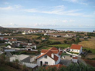
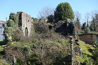
Paderne is a village and civil parish in the municipality (concelho) of Albufeira, in the Portuguese region of Algarve. The population in 2011 was 3,304, in an area of 52.56 km2.

Ferreiras is a civil parish in the southern Portuguese municipality of Albufeira. The population in 2011 was 6,406 in an area of 20.13 km².
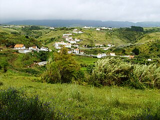
Guia is a town and civil parish in the Portuguese municipality of Albufeira in the Algarve, 5 kilometres (3.1 mi) from the coast. The population in 2011 was 4,376, in an area of 26.80 km².
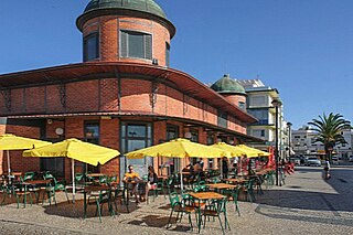
Olhão is a civil parish in the municipality of Olhão, in the Portuguese Algarve. The population in 2011 was 14,914, in an area of 12.25 km². Olhão is the largest parish by population density in the municipality.

Mexilhoeira Grande is a civil parish in the municipality (concelho) of Portimão in the southern Portuguese region of the Algarve. The population in 2011 was 4,029, in an area of 91.15 km².
Ferreiros is a former civil parish of the municipality of Amares in the Portuguese intermunicipal community Cávado. In 2013, the parish merged into the new parish Ferreiros, Prozelo e Besteiros. The population in 2011 was 3,212, in an area of 2.65 km2.
Avanca is a civil parish in the municipality of Estarreja, in the central subregion of Baixo Vouga. The population in 2011 was 6,189, in an area of 21.07 km2.
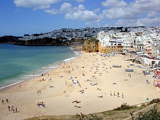
Albufeira is a city and municipality of Faro District in the Algarve region of southern Portugal. The population in 2021 was 44,158, in an area of 140.66 square kilometres. The city proper had a population of 28,645 in 2021. It is 250 kilometres (160 mi) from Lisbon, close to Paderne Castle. Lagoa is 30 kilometres (19 mi) to the west, and Faro 45 kilometres (28 mi) to the southeast. A tourist destination due to its coastal conditions, Albufeira's population expands to around 300,000 in the summer and at Christmas and New Year owing to the number of hotels that includes marina facilities, golf courses, restaurants and bars.

The Roman Ruins of Cerro da Vila are the remnants of a historical villa in the Algarve region of southern Portugal. Its vestiges lie in the vicinity of the resort and marina of Vilamoura, in the civil parish of Quarteira, municipality of Loulé Municipality.

The Campanhã Railway Station is a 19th-century railway station in the civil parish of Campanhã, in the municipality of Porto, district of Porto. Opened in 1877, it is connected to the Metro do Porto, and provides access to local commuter trains to Aveiro, Braga, Guimarães and Marco de Canaveses, Intercity and Alfa Pendular trains to Lisbon, inter-regional trains to Valença, and the historical train to Pocinho.