
Russia is the largest country in the world, covering over 17,125,191 km2 (6,612,073 sq mi), and encompassing more than one-eighth of Earth's inhabited land area. Russia extends across eleven time zones, and has the most borders of any country in the world, with sixteen sovereign nations.
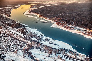
The Ob is a major river in Russia. It is in western Siberia, and with its tributary the Irtysh forms the world's seventh-longest river system, at 5,410 kilometres (3,360 mi). The Ob forms at the confluence of the Biya and Katun which have their origins in the Altai Mountains. It is the westernmost of the three great Siberian rivers that flow into the Arctic Ocean. Its flow is north-westward, then northward.
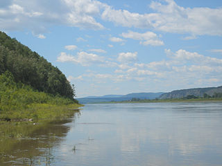
The Amur River or Heilong River is a perennial river in Northeast Asia, forming the natural border between the Russian Far East and Northeast China. The Amur proper is 2,824 km (1,755 mi) long, and has a drainage basin of 1,855,000 km2 (716,000 sq mi). If including its main stem tributary, the Argun, the Amur is 4,444 km (2,761 mi) long, making it the world's tenth longest river.

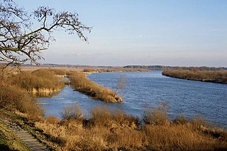
The Don is the fifth-longest river in Europe. Flowing from Central Russia to the Sea of Azov in Southern Russia, it is one of Russia's largest rivers and played an important role for traders from the Byzantine Empire.

The Ural, also known as the Yaik, is a river flowing through Russia and Kazakhstan in the continental border between Europe and Asia. It originates in the southern Ural Mountains and discharges into the Caspian Sea. At 2,428 kilometres (1,509 mi), it is the third-longest river in Europe after the Volga and the Danube, and the 18th-longest river in Asia. The Ural is conventionally considered part of the boundary between the continents of Europe and Asia.

The Lena is a river in the Russian Far East and is the easternmost river of the three, great rivers of Siberia, including the River Ob and the River Yenisey, which flow into the Arctic Ocean. The Lena river is 4,294 km (2,668 mi) long and has a capacious drainage basin of 2,490,000 km2 (960,000 sq mi); thus the Lena is the eleventh-longest river in the world and the longest river entirely within Russia. Geographically, permafrost is the type of soil that underlies most of the Lena river's catchment, twenty per cent (20%) of which is continuous.
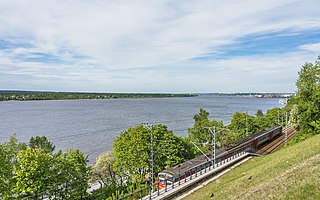
The Kama, also known as the Chulman, is a 1,805-kilometre (1,122 mi) long river in Russia. It has a drainage basin of 507,000 square kilometres (196,000 sq mi). It is the longest left tributary of the Volga and the largest one in discharge. At their confluence, in fact, the Kama is even larger in terms of discharge than the Volga.

The Northern Dvina is a river in northern Russia flowing through Vologda Oblast and Arkhangelsk Oblast into the Dvina Bay of the White Sea. Along with the Pechora River to the east, it drains most of Northwest Russia into the Arctic Ocean. It should not be confused with the Western Dvina, with which it is not connected.

The Kuban is a river in Russia that flows through the Western Caucasus and drains into the Sea of Azov. The Kuban runs mostly through Krasnodar Krai for 660 kilometres (410 mi), but also in the Karachay–Cherkess Republic, Stavropol Krai and the Republic of Adygea.

The Kolyma is a river in northeastern Siberia, whose basin covers parts of the Sakha Republic, Chukotka Autonomous Okrug, and Magadan Oblast of Russia.

The Svir is a river in Podporozhsky, Lodeynopolsky, and Volkhovsky districts in the north-east of Leningrad Oblast, Russia. It flows westwards from Lake Onega to Lake Ladoga, thus connecting the two largest lakes of Europe. It is the largest river flowing into Lake Ladoga. The length of the Svir is 224 kilometres (139 mi), whereas the area of its drainage basin is 84,400 square kilometres (32,600 sq mi). The towns of Podporozhye and Lodeynoye Pole, as well as urban-type settlements Voznesenye, Nikolsky, Vazhiny, and Svirstroy are located at the banks of the Svir.
The Bug or Western Bug is a major river in Central Europe that flows through Belarus (border), Poland, and Ukraine, with a total length of 774 kilometres (481 mi). A tributary of the Narew, the Bug forms part of the border between Belarus and Poland for 178 kilometres (111 mi) and part of the border between Ukraine and Poland for 185 kilometres (115 mi).

The Argun or Ergune is a 1,620-kilometre (1,010 mi) long river that forms part of the eastern China–Russia border, together with the Amur. Its upper reaches are known as the Hailar River (海拉尔河) in China. The Argun marks the border between Russia and China for about 944 kilometres (587 mi), until it meets the Amur.
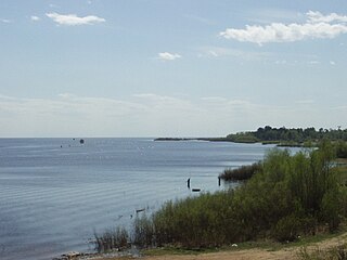
Lake Ilmen is a large lake in Novgorod Oblast, Russia. A historically important lake, it formed a vital part of the medieval trade route from the Varangians to the Greeks. The city of Veliky Novgorod, which is a major trade center of the route, lies six kilometres (3.7 mi) below the lake's sole outflow, via the Volkhov River.

The Indigirka is a river in the Sakha Republic in Russia between the Yana to the west and the Kolyma to the east. It is 1,726 kilometres (1,072 mi) long. The area of its basin is 360,000 square kilometres (140,000 sq mi).

Perm Krai is a federal subject of Russia, located in Eastern Europe. Its administrative center is Perm. The population of the krai was 2,532,405.

The Seym or Seim is a river that flows westward in Russia and Ukraine. It is 748 kilometres (465 mi) long and its basin area about 27,500 square kilometres (10,600 sq mi). It is the largest tributary of the Desna.

Klistervatnet (Norwegian) or Клистерватн (Russian) is a lake that lies on the border between Norway and Russia. The 17.2-square-kilometre (6.6 sq mi) lake lies on the river Pasvikelva in Sør-Varanger Municipality in Finnmark county, Norway and the Pechengsky District of Murmansk Oblast in Russia. The lake is about 10 kilometres (6.2 mi) long and 2 kilometres (1.2 mi) wide. The lake is located north of lake Bjørnevatnet.

The Razdolnaya or Suifen is a river in People's Republic of China and Russia. It flows into the Amur Bay of the Sea of Japan.
