Union Turnpike (Massachusetts)

Last updated
Embossed Union Turnpike Corporate Seal as attached to a stock share Union Turnpike Corporate Seal.jpg
Embossed Union Turnpike Corporate Seal as attached to a stock share

The Union Turnpike was one of over 60 toll roads in operation throughout Massachusetts in the first half of the 19th century. In the early part of 1803, a group of investors headed by Henry Bromfield (1727-1820) petitioned the Massachusetts State Legislature to form a corporation for the purpose of constructing a toll road from the center of Concord to Leominster.

Contents

Union Turnpike Corporation, Stock share certificate No. 1 Union Turnpike Share No. 1.jpg
Union Turnpike Corporation, Stock share certificate No. 1

Petition to the Legislature

Bromfield was a Boston merchant who moved with his family to Harvard, Massachusetts, in 1765 and later served in the Revolutionary War. The Turnpike would connect Concord with the western terminus of the Cambridge and Concord Turnpike and would terminate at the Kendall Tavern in Leominster, where the traveler could continue westward to Greenfield with the Fifth Massachusetts Turnpike.


In their petition to the Legislature, the subscribers indicated:

That the road now travelled … is circuitous, and the length calculation of the distance is twenty nine miles – That a road may be made nearly on a straight line from the termination of said Turnpike to Cambridge and Concord Turnpike on which an actual survey has been made on ground capable of making a good road the distance of which is only twenty three miles and to make a road on said route would be of public convenience. Our Petitioners therefore pray that your Honours would incorporate them and their associates into a body politic for the purpose of building a Turnpike road … and allow your petitioners and their associates such toll as in your wisdom you may think reasonable for the expense of making said road. [2]

On January 24, 1804, the Joint Committee on Turnpikes, Bridges, and Canals approved the petition, and March 2, 1804, the Legislature approved "An Act to Establish a Corporation with the Name of Union Turnpike Corporation." [3]

A letter was sent to potential shareholders promoting the proposed turnpike as a sound investment. The expense of making the road was estimated at $25,000 (approximately $550,000 in current dollars [4] ) and would be covered by the issuance of 500 shares. The letter pointed out that the Fifth Massachusetts Turnpike, to which the Union would connect, had two branches running to the Connecticut River, one ending in Greenfield and other in Northfield. Furthermore, there were additional feeder turnpike roads in Vermont and New Hampshire. "All these branches lead into a large section of the County, thickly settled with inhabitants and will all centre in Leominster where the 5th Mass Turnpike ends. The saving in distance and the ground being equally good for a road…bids fair to be the most productive to the proprietors on any in the Country that distance from the Capitol." [1] The first share was issued on March 1, 1805, to Henry Bromfield, Esq. of Harvard.

The optimism of the proprietors was apparently not shared by the stage coach lines, according to Frederic J. Wood in his Turnpikes of New England.

A study of the routes followed by the different lines of stages shows that generally the turnpikes were followed, but it is seen that the Cambridge and Concord and the Union turnpikes were scrupulously avoided. The Union was not badly located, but it suffered from its associations, for the Cambridge and Concord was built straight without regard to centers along the route, and in one case, at least, with a fatal disregard for grades... [T]he stages from the northwestern part of the state, reaching the western end of the Union Turnpike, diverted over the short Lancaster and Bolton Turnpike and proceeded thence to Boston over the "Great Road" through Sudbury and Waltham. [5]

Concord, MA (c.1839), eastern terminus of the Union Turnpike Central part of Concord, Mass.jpg
Concord, MA (c.1839), eastern terminus of the Union Turnpike
Ephraim Hosmer house, c.1750, Acton, enlarged by son, Joel, in 1807 to serve as a tavern on the Union Turnpike Ephrain Hosmer House, Stow, Massachusetts.jpg
Ephraim Hosmer house, c.1750, Acton, enlarged by son, Joel, in 1807 to serve as a tavern on the Union Turnpike
Turnpike Trail, Oxbow National Wildlife Refuge, former Union Turnpike route Turnpike Trail, Oxbow National Wildlife Refuge, former Union Turnpike Route.jpg
Turnpike Trail, Oxbow National Wildlife Refuge, former Union Turnpike route

Indeed, before the road had been accepted by the county, the proprietors of the corporation held a meeting at Wetherbee's Tavern in Harvard. On the agenda was an item "to determine what disposition shall be made of the shares that remain unsold", [6] followed by an item to consider whether the corporation should consider building public houses for travelers along the road.

Early in its history, the Union Turnpike Corporation was involved in a court case which became a part of the development of corporate liability law in the United States. "[U]ntil around 1800 – there was no notion of the attribute of limited liability and no actual manifestation of it as such… Corporations then were not unlimited but they were not limited either—hence, the question of limited vs. unlimited liability had not yet been formulated." [7] In 1807, Benjamin W. Willard of Worcester County received a judgment in his favor from the county's Court of Common Pleas against "President, Director and Company of the Union Turnpike Corporation" for non-payment of a promissory note which had been made to Willard by Benjamin Kimball, the corporation's treasurer. [8] Willard obtained a writ of execution, a legal document that allows a sheriff to attach personal property of the debtor. Failing to find any personal property in the amount of the debt, the sheriff, Moses Thomas, arrested Kimball. The corporation, in turn, sued the sheriff. The judge in Nichols v. Thomas, Chief Justice Parsons, ruled in favor of the Turnpike Corporation, making it "clear that a judgment against a corporation is not a judgment against its shareholders." [9]

Turnpike route and change to a public road

The eastern terminus of the turnpike was at the junction of what is today the intersection of Elm and Main streets in Concord. The road followed the present Massachusetts Route 111 westward from Concord through Boxborough to Harvard. Here it departed from Rt. 111, rising nearly 500 feet (150 m) in less than 1.5 miles (2.4 km), an incline of nearly 7%. This might have been one of the sections of the road, in Wood's words, "with a fatal disregard for grades." Such grades might require "either a greater number or more powerful horses than would be requisite if the road were entirely level." [10] From Harvard Center, the road went west on Madigan Lane, descending 750 feet (230 m) to what is now the Oxbow National Wildlife Refuge along a causeway named Turnpike Trail where it crossed the Nashua River entering Lancaster. In Lancaster, the turnpike followed the road currently called Old Union Turnpike then entered Leominster, traveled 2 miles (3 km) northwest through what is now a wooded area, then joined the current Prospect Street to Lindell Avenue and finally joined the 5th Massachusetts Turnpike at the Kendall Inn on West Street, for a total length of just over 23 miles (37 km) from Concord.

Over the history of the turnpike, the corporation made several changes in routing. In 1807 they petitioned the legislature to straighten the road slightly as it approached the Kendall Inn, for a saving in length of 825 feet (251 m).

By 1810 the road had still not been completed, and in a petition to the legislature February of that year the proprietors stated, "that from the great Expenses of making Said Road and from unfortunate Accidents they have been prevent from Completing Same… Wherefore your Petitioners humbly pray that they may be allow further time to Complete Said Road." [11]

As with so many of the other 19th century turnpike roads, financial difficulties made upkeep of the Union Turnpike difficult. In 1814 the Town of Boxborough voted "to keep the Turn-pike road in repair as far as it lies in Boxborough for one year, provided the Corporation will admit the inhabitants of said Boxborough passing the gates toll free." [12] The corporation felt required to make further changes several years later. In January 1818, the corporation petitioned the legislature to move the sites for their gates. [13] Nourse in his History of Harvard indicates that a freshet in 1818 destroyed the turnpike's bridge across the Nashua River in Harvard and that the traffic over the road did not justify rebuilding the bridge. [14] The following year, the corporation petitioned the legislature for permission to abandon the bridge and move south about 0.5 miles (0.8 km) to the present Still River and Still River Depot roads. In its petition the proprietors said "that they have expended a large sum of money" building the turnpike, "and have found it impracticable to maintain and keep in repair that part of said Turnpike Road and Bridges where it crosses the Nashua River…and that said Turnpike Road may be so altered as will be for publick utility." On January 31, 1820, the legislature approved this alteration and relieved the corporation the necessity of maintaining the abandoned section of the road. [15]

In 1819, the legislature approved a request by the corporation to discontinue maintenance of the road from its start in Concord at Main Street to where the present Concord Reformatory is located. [16] A legislative committee reviewing this request summarized the financial difficulties faced by the Union Turnpike, difficulties it shared with many of the other early nineteenth century toll roads:

Kendall Tavern, Leominster, western terminus of the Union Turnpike 01-Kendall Inn 642.jpg
Kendall Tavern, Leominster, western terminus of the Union Turnpike

In the year 1809, this Turnpike went into operation, the whole amount of the toll monies from that time to the year 1818, a span of nine year, is $2,789.15. The whole expense of making the Turnpike including money paid for the land, is upwards of $40,000, the toll collection is not more than one percent on the actual cost of the Turnpike. There has never been a dividend. The whole income of the road, together with large assessments has been expended in paying gate keepers and in repairing the road, and there is now due from said Corporation demands of $300 which they have no funds to pay. [17]

In an effort to both raise additional funds and save money on maintenance expenses, the proprietors meeting at the house of Ezra Witherbee in Harvard in June 1826 [18] voted to petition the legislature to allow individual proprietors to purchase more than ten shares from other proprietors wishing to sell shares and "that said Corporation not be holden to make the bridges on said Turnpike more than eighteen feet in width." [19]

After years of unprofitability, the Union Turnpike petitioned the Commissioners of Worcester County to convert the road to a public highway. The petition was accepted by the Commissioners in September 1829. [20] In 1830 the Middlesex County section of the turnpike was declared a public road. Boxborough approved $300 for repairs, and in 1868, in an effort to avoid the steep inclines mention previously, the town discontinued the section of the road over the hill east of Guggin's Brook.

Related Research Articles

Boxborough, Massachusetts Town in Massachusetts, United States

Boxborough is a town in Middlesex County, Massachusetts, United States. The population was 4,996 at the 2010 census. The town name is often simplified to "Boxboro" on highway signs and official documents.

Nashua, New Hampshire City in New Hampshire, United States

Nashua is a city in southern New Hampshire, United States. As of the 2010 census, it had a population of 86,494, the second-largest in northern New England after nearby Manchester. As of 2019 the population had risen to an estimated 89,355. Along with Manchester, it is a seat of New Hampshire's most populous county, Hillsborough.

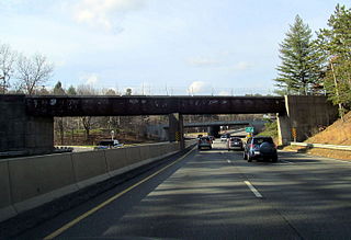
The Massachusetts Turnpike is a toll highway in the U.S. state of Massachusetts that is maintained by the Massachusetts Department of Transportation (MassDOT). The turnpike begins at the New York state line in West Stockbridge, linking with the Berkshire Connector portion of the New York State Thruway. Spanning 138 miles (222 km) along an east–west axis, it is entirely concurrent with the portion of Interstate 90 (I-90) that lies within the state. The turnpike is the longest Interstate Highway in Massachusetts, while I-90 in full is the longest Interstate Highway in the United States.

U.S. Route 3 (US 3) is a United States highway running 277.9 miles (447.2 km) from Boston, Massachusetts, through New Hampshire, to the Canada–US border near Third Connecticut Lake, where it connects to Quebec Route 257.

Greater Boston Metropolitan area in the United States

Greater Boston is the metropolitan region of New England encompassing the municipality of Boston, the capital of the U.S. state of Massachusetts and the most populous city in New England, as well as its surrounding areas. The region forms the northern arc of the US northeast megalopolis and as such, Greater Boston can be described either as a metropolitan statistical area (MSA), or as a broader combined statistical area (CSA). The MSA consists of most of the eastern third of Massachusetts, excluding the South Coast region and Cape Cod; while the CSA additionally includes the municipalities of Providence, Rhode Island, Manchester, Worcester, Massachusetts, as well as the South Coast region and Cape Cod in Massachusetts. While the small footprint of the city of Boston itself only contains an estimated 685,094, the urbanization has extended well into surrounding areas; the CSA is one of two in Massachusetts, the only other being Greater Springfield. Greater Boston is the only CSA-form statistical area in New England which crosses into three states.

Route 2 is a 142.29-mile-long (228.99 km) major east–west state highway in Massachusetts. Along with Route 9 and U.S. Route 20 to the south, these highways are the main alternatives to the Massachusetts Turnpike/I-90 toll highway. Route 2 runs the entire length of the northern tier of Massachusetts, beginning at the New York border, where it connects with New York State Route 2, and ending near Boston Common in Boston. Most of the route is a freeway through central Massachusetts, with the longest non-freeway portions being the western and eastern ends. Portions of Route 2 follow the Mohawk Trail, while older alignments are known as Route 2A.

Middlesex Canal barge canal in eastern Massachusetts, US

The Middlesex Canal was a 27-mile (44-kilometer) barge canal connecting the Merrimack River with the port of Boston. When operational it was 30 feet wide, and 3 feet deep, with 20 locks, each 80 feet long and between 10 and 11 feet wide. It also had eight aqueducts.

Levi Lincoln Jr.

Levi Lincoln Jr. was an American lawyer and politician from Worcester, Massachusetts. He was the 13th Governor of Massachusetts (1825–1834) and represented the state in the U.S. Congress (1834–1841). Lincoln's nine-year tenure as governor is the longest consecutive service in state history; only Michael Dukakis, John Hancock and Caleb Strong served more years, but they were not consecutive.

Massachusetts Avenue (metropolitan Boston)

Massachusetts Avenue is a major thoroughfare in Boston, Massachusetts, and several cities and towns northwest of Boston. According to Boston magazine, "Its 16 miles of blacktop run from gritty industrial zones to verdant suburbia, passing gentrified brownstones, college campuses and bustling commercial strips."

The Frederick E. Everett Turnpike, also called the Central New Hampshire Turnpike, is a toll road in the U.S. state of New Hampshire, running 44 miles (71 km) from the Massachusetts border at Nashua north to Concord. The Everett Turnpike is named for Frederick Elwin Everett, the first Commissioner of the New Hampshire Department of Transportation.

Route 111 is a 27.282-mile-long (43.906 km) state highway in Massachusetts, a continuation of New Hampshire Route 111. The route has a north–south component and an east–west one, though it is signed exclusively as a north–south route on newer signs. The east–west portion of the route largely follows the path of the Union Turnpike, built in the early 19th century to connect the communities of Leominster and Concord.

Route 225 is a state highway in the U.S. state of Massachusetts. The highway runs 31.100 miles (50.051 km) from Route 2A in Lunenburg in northeastern Worcester County east to Route 2 in Lexington. Route 225 serves the western Middlesex County towns of Shirley, Groton, Westford, and Carlisle. The highway also passes through Bedford along its concurrency with Route 4, which terminates at the same junction with Route 2.

Cambridge and Concord Turnpike

The Cambridge and Concord Turnpike was an early turnpike between Cambridge and Concord, Massachusetts. Portions have been incorporated into today's Massachusetts Route 2; the remainder forms other major local roads.

Middlesex Turnpike (Massachusetts)

The Middlesex Turnpike was an early turnpike between Cambridge and Tyngsborough, Massachusetts and the New Hampshire border, where it connected with the Amherst Turnpike and thence Nashua and Claremont, New Hampshire.

The Heart of New England Council is a Boy Scouts of America council serving Cub Scout packs, Scouts BSA troops, Exploring posts and Venturing crews in central Massachusetts with administrative support, program resources, activities, events, and camping properties.

Montachusett Regional Transit Authority

The Montachusett Regional Transit Authority (MART) is a public, nonprofit organization established under Chapter 161B of the Massachusetts General Laws to provide public transportation to the Montachusett Region. MART is one of Massachusetts' 15 regional transit authorities and provides public transportation to 21 communities within the Montachusett region consisting of the cities of Fitchburg, Leominster and Gardner, and the towns of Athol, Ashburnham, Ashby, Ayer, Bolton, Boxborough, Hardwick, Harvard, Hubbardston, Lancaster, Littleton, Lunenburg, Royalston, Shirley, Sterling, Stow, Templeton, Westminster, and Winchendon.

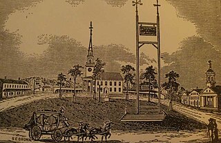
The Fifth Massachusetts Turnpike was one of over 60 toll roads in operation throughout Massachusetts in the first half of the 19th century. An act establishing the Corporation was approved by the Massachusetts legislature on March 1, 1799. The Preamble to the act reads:

Fitchburg and Worcester Railroad

The Fitchburg and Worcester Railroad was a railroad in Massachusetts. It was incorporated in 1840 to provide a rail connection between Fitchburg and Worcester. Service began on February 11, 1850, running 18 miles from Fitchburg through Leominster and Sterling to Sterling Junction, where it connected with the Worcester and Nashua Railroad.

Beacon Park Yard Former rail freight yard in Boston planned for redevelopment

Beacon Park Yard was a CSX Transportation rail yard in Allston, Boston, now owned by Harvard University. The yard opened in 1890 on the site of a former trotting park, from which it took its name. It was closed in 2013 following the relocation of the yard's container operations to Worcester, Massachusetts and opening of a transload facility in Westborough, Massachusetts. Plans for the yard include relocation of the Massachusetts Turnpike Allston exit, construction of a new MBTA commuter rail station and layover yard, and a major real estate development.

Barre Turnpike

The Barre Turnpike was one of over 60 toll roads in operation throughout Massachusetts in the first half of the 19th century. As described in the Act of Incorporation, February 5, 1822, the road ran

from the Common, near the meeting house in Barre; thence easterly, in the best course to Hubbardston line thence through the southerly part of Hubbardston, in the best direction to Princeton line; thence, in the best course, through part of Princeton, and through the land of David Rice; and thence through land of Jason Woodward, to a road crossing a town road, and to a road leading to Edward Goodenow's.

References

  1. 1 2 3 Henry Bromfield papers, 1731-1830, Ms. N-1938, Massachusetts Historical Society
  2. Legislative packet, Union Turnpike Corporation, June 13, 1803, Massachusetts Archives
  3. Acts and Laws of the Commonwealth of Massachusetts, Vol. 12
  4. "CPI Inflation Calculator".
  5. Wood, Frederick J.,The Turnpikes of New England (1919)
  6. Legislative packet, Union Turnpike Corporation, Jan. 29, 1818, Massachusetts Archives
  7. Harris, Ron, A New Understanding of the History of Limited Liability: An Invitation for Theoretical Reframing, Abstract, Aug. 29, 2019
  8. Nichols v. Thomas, Supreme Judicial Court of Massachusetts, March Term, 1808
  9. Dodd, Edwin Merrick, American Business Corporation Until 1860, p. 370 (1954), Harvard University Press.
  10. Spon, Edward, Spons Dictionary of Engineering, Vol. 7 "p. 2779". 1873. (1873)
  11. Legislative packet, Union Turnpike Corporation, Feb. 7, 1810, Massachusetts Archives
  12. Hager, Lucie Caroline, Boxborough: A New England Town and Its People (1891), p. 25
  13. Legislative packet, Union Turnpike Corporation, Jan. 26, 1820, Massachusetts Archives
  14. Nourse, Henry Stedman, History of the Town of Harvard, Massachusetts: 1732-1893 (1894) p. 146
  15. Private and Special Statutes of the Commonwealth of Massachusetts, Chap. 80
  16. Notice published in the Worcester Spy , 1819
  17. Legislative packet, Union Turnpike Corporation, Feb. 10, 1819, Massachusetts Archives
  18. Legislative packet, Union Turnpike Corporation, Jun. 1, 1826, Massachusetts Archives
  19. Legislative packet, Union Turnpike Corporation, June 1, 1826, Massachusetts Archives
  20. Records of the Worcester County Commissioners, Vol. 9 P. 264.