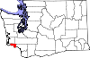
Wahkiakum County is a county located in the U.S. state of Washington. As of the 2020 census, the population was 4,422, making it one of the least populous counties in Washington. The county seat and only incorporated town is Cathlamet. The county was formed out of Cowlitz County in April 1854 and is named for Chief Wahkiakum of the Chinook, who is buried in the Pioneer Cemetery in Cathlamet.

Fort Washington is an unincorporated area and census-designated place in Prince George's County, Maryland, United States. It borders the Potomac River, situated 20 miles south of downtown Washington, D.C. As of the 2020 census, it had a population of 24,261. The Fort Washington community is located west of Maryland Route 210, with some additional area to the east of the highway.

Largo is an unincorporated area and census-designated place in Prince George's County, Maryland, United States. The population was 11,605 at the 2020 census.

Banks Lake South is a census-designated place (CDP) in Grant County, Washington, United States. The population was 234 at the 2020 census.

Fall City is an unincorporated community and census-designated place (CDP) in King County, Washington, United States, 25 miles (40 km) east of Seattle. The community lies along the Snoqualmie River and Raging River. The population was 2,032 at the 2020 census.

Ashford is a census-designated place (CDP) mostly within Pierce County, Washington, United States. Its population was 303 as of the 2020 census. The town is west of the main entrance to Mount Rainier National Park. Surrounding mountains and the narrow Nisqually River valley are heavily forested. Some of Ashford is across the Nisqually River in Lewis County.

Cathlamet is a town located along the Ocean Beach Highway in Wahkiakum County, Washington, United States, where it is the county seat. The population was 560 at the 2020 census.

Tornado, also called Upper Falls, is a census-designated place (CDP) in Kanawha County, West Virginia, United States.

Tamuning, also known as Tamuning-Tumon-Harmon, is a village located on the western shore of the United States territory of Guam. The village of Tamuning is the economic center of Guam, containing tourist center Tumon, Harmon Industrial Park, and other commercial districts. Its central location along Marine Corps Drive, the island's main thoroughfare, has aided in its development.

Stewartsville is an unincorporated community and census-designated place (CDP) located within Greenwich Township in Warren County, in the U.S. state of New Jersey, that was created as part of the 2010 United States Census. As of the 2010 Census, the CDP's population was 349.

Port Colden is an unincorporated community and census-designated place (CDP) located within Washington Township, in Warren County, in the U.S. state of New Jersey, that was created as part of the 2010 United States Census. As of the 2010 Census, the CDP's population was 122.
Dr. Henry A. Wise Jr. High School is a public high school in unincorporated Prince George's County, Maryland, United States, with an Upper Marlboro postal address. A part of the Prince George's County Public Schools (PGCPS), it opened in the fall of 2006.

Brock Hall is an unincorporated area and census-designated place in eastern Prince George's County, Maryland, United States, located south of Largo and Bowie, and north of Upper Marlboro. As of the 2020 census, the CDP had a population of 13,181.
Westphalia is a census-designated place in southern Prince George's County, Maryland, United States. The population of the CDP was 11,770 at the 2020 census.
Lower Elochoman is a census-designated place (CDP) in Wahkiakum County, Washington, United States. The population was 185 at the 2010 census.
Washington Park is a census-designated place (CDP) in Gila County, Arizona, United States. The population was 70 at the 2010 United States Census.
Whispering Pines is a census-designated place (CDP) in Gila County, Arizona, United States. It is one of two locations in Arizona with this name, the other being a populated place in Greenlee County. The population was 148 at the 2010 United States Census.
Brown Station is an census designated place in Prince George's County, Maryland, United States. Per the 2020 Census, the population was 3,298.
Rainbow Lakes is a census-designated place (CDP) located in Parsippany–Troy Hills Township, Morris County, New Jersey, United States. It is in the western part of the township and consists of housing built around a cluster of lakes including Rainbow Lake, plus a zone of commercial buildings to the east of the lakes. As of the 2020 census, the population of the CDP was 1,255.