Wahkiakum County is a county located in the U.S. state of Washington. As of the 2020 census, the population was 4,422, making it one of the least populous counties in Washington. The county seat and only incorporated town is Cathlamet. The county was formed out of Cowlitz County in April 1854 and is named for Chief Wahkiakum of the Chinook, who is buried in the Pioneer Cemetery in Cathlamet.

Fairview is a census-designated place (CDP) in Alameda County, California, United States. It borders on the city of Hayward and the census-designated place of Castro Valley. The population was 11,341 at the 2020 census.

Bayview-Montalvin is a former census-designated place (CDP) in Contra Costa County, California, United States. The population was 5,004 at the 2000 census.

Mesa is a census-designated place (CDP) in Inyo County, California, United States. The population was 251 at the 2010 census, up from 214 at the 2000 census.
Meadow Vista is a census-designated place (CDP) in Placer County, California, United States. It is part of the Sacramento–Arden-Arcade–Roseville Metropolitan Statistical Area. The population was 3,217 at the 2010 census, up from 3,096 at the 2000 census.

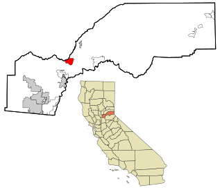
Richgrove is a census-designated place (CDP) in Tulare County, California, United States. The population was 2,358 at the 2020 United States census, down from 2,882 at the 2010 census.
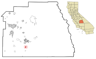
Terra Bella is a census-designated place (CDP) in Tulare County, California, United States. The population was 2,910 at the 2020 census, down from 3,310 at the 2010 census.

Naval Academy is a census-designated place (CDP) in Anne Arundel County, Maryland, United States, which covers the campus of the United States Naval Academy. The population was 4,802 at the 2010 census.

South Gate was a census-designated place (CDP) in Anne Arundel County, Maryland, United States, for the 2000 census, at which time its population was 28,672. It was added primarily to the Glen Burnie CDP for the 2010 census.
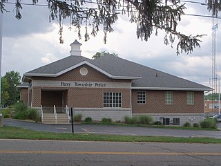
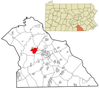
Perry Heights is a census-designated place in Stark County, Ohio, United States. The population was 8,391 at the 2020 census. It is part of the Canton–Massillon metropolitan area.
Watts Community is a former census-designated place (CDP) in Adair County, Oklahoma, United States. The population was 500 at the 2000 census.
West Wyomissing is a census-designated place (CDP) in Spring Township, Berks County, Pennsylvania, United States. The population was 3,407 at the 2010 census.
Summit Station is a census-designated place (CDP) in Schuylkill County, Pennsylvania, United States. The population is 174 as of the 2010 census.

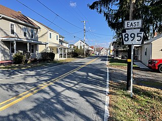
Valley View is a census-designated place (CDP) in York County, Pennsylvania, United States. The population was 2,817 at the 2010 census.
Weigelstown is a census-designated place (CDP) in York County, Pennsylvania, United States. The population was 15,136 at the 2020 census.

Merrifield is a census-designated place (CDP) in Fairfax County, Virginia, United States. The population was 20,488 at the 2020 census.

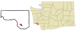
Cathlamet is a town located along the Ocean Beach Highway in Wahkiakum County, Washington, United States, where it is the county seat. The population was 560 at the 2020 census.
Deep River is a census-designated place (CDP) in Wahkiakum County, Washington, northwest of the town of Cathlamet and east of the city of Long Beach. In 2020, the population was estimated to be 159. The CDP includes the Svensens Landing community. The Deep River community is part of the Naselle-Grays River Valley School District, a K-12 school district of about 670 students.
Altoona is a census-designated place (CDP) in Wahkiakum County, Washington, approximately 27 miles northwest of the town of Cathlamet. The population was 39 as of the 2010 census. The CDP includes the communities of Carlson Landing and Dahlia.
Skamokawa Valley is a census-designated place (CDP) in Wahkiakum County, Washington, north of the town of Cathlamet. The population was 401 as of the 2010 census. The CDP includes the Sleepy Hollow community. The Skamokawa Valley community is part of the Wahkiakum School District, a K-12 school district of about 430 students. The unincorporated community of Skamokawa lies directly to the south.