Skamokawa Valley, Washington | |
|---|---|
 Skamokawa Valley, Washington | |
| Coordinates: 46°18′25″N123°26′15″W / 46.30694°N 123.43750°W [1] | |
| Country | United States |
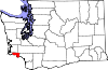
| State | Washington |
| County | Wahkiakum |
| Area | |
• Total | 28.410 sq mi (73.580 km2) |
| • Land | 28.193 sq mi (73.018 km2) |
| • Water | 0.217 sq mi (0.562 km2) 0.76% |
| Elevation | 240 ft (70 m) |
| Population (2010) | |
• Total | 401 [3] |
| Population as of 2010 U.S. Census | |
| Time zone | UTC−8 (PST) |
| • Summer (DST) | UTC−7 (PDT) |
| ZIP code | 98647 |
| Area code | 360 |
| FIPS code | 53-64755 |
| GNIS feature ID | 2585038 [1] |
Skamokawa Valley is a census-designated place (CDP) in Wahkiakum County, Washington, north of the town of Cathlamet. The population was 401 as of the 2010 census. The CDP includes the Sleepy Hollow community. The Skamokawa Valley community is part of the Wahkiakum School District, a K-12 school district of about 430 students. The unincorporated community of Skamokawa lies directly to the south.
Contents
The name of the CDP comes from Wahkiakum Chief Skamokawa who met with Meriwether Lewis and William Clark while their expedition spent the winter of 1805–06 at Fort Clatsop. [4] His name, Skamokawa, is a Chinook word meaning “smoke over the water,” a reference to the area's foggy climate.