
Interstate 215 (I-215) is a 54.5-mile-long (87.7 km) north–south auxiliary Interstate Highway in the Inland Empire region of Southern California. It has portions designated as the Barstow, Escondido, and Armed Forces Freeways. I-215 is a bypass auxiliary route of I-15, running from Murrieta to northern San Bernardino. While I-215 connects the city centers of both Riverside and San Bernardino, its parent I-15 runs to the west through Corona and Ontario.
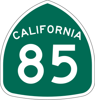
State Route 85 is a state highway which connects the cities of southern San Jose and Mountain View in the U.S. State of California. The highway intersects with major highways such as I-280, SR 17, and SR 87. The route serves as a bypass of U.S. Route 101 in the Santa Clara Valley area, running through the foothill cities of Los Gatos, Saratoga, Cupertino, roughly paralleling the Santa Cruz Mountains up to its interchange with I-280.
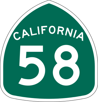
State Route 58 is a major east-west state highway in the U.S. state of California that runs across the Coast Ranges, the southern San Joaquin Valley, the Tehachapi Mountains, which border the southern Sierra Nevada, and the Mojave Desert. It runs between U.S. Route 101 near Santa Margarita and Interstate 15 in Barstow. It has junctions with Interstate 5 near Buttonwillow, State Route 99 in Bakersfield, State Route 202 in Tehachapi, State Route 14 near Mojave, and U.S. Route 395 at Kramer Junction. SR 58 also provides access to Edwards Air Force Base. At various points it is known as the Calf Canyon Highway, Carrisa Highway, Bakersfield-McKittrick Highway, Rosa Parks Highway, Westside Parkway, Barstow-Bakersfield Highway, Bakersfield Tehachapi Highway, Kern County Korean War Veterans Memorial Highway, and Mojave-Barstow Highway.

State Route 92 is a state highway in the U.S. state of California, serving as a major east-west corridor in the San Francisco Bay Area. From its west end at State Route 1 in Half Moon Bay near the coast, it heads east across the San Francisco Peninsula and the San Mateo–Hayward Bridge to downtown Hayward in the East Bay at its junction with State Route 238 and State Route 185. It has interchanges with three freeways: Interstate 280, U.S. Route 101 in or near San Mateo, and Interstate 880 in Hayward. It also connects indirectly to Interstates 238 and 580 by way of Hayward's Foothill Boulevard, which carries Route 238 and flows directly into Route 92.
The Legacy Highway is a proposed and partially completed freeway in northern Utah, United States, that is planned to eventually connect eastern Juab County with eastern Box Elder County, running along the west sides of Utah, Salt Lake, Davis, and Weber counties in between. Its purpose is to provide an alternate north–south transportation corridor to Interstate 15. It was proposed in 1996, but due to lawsuits over issues with the completeness of the environmental impact statement construction was delayed. Construction of one segment began in 2006. That segment, known as the Legacy Parkway, opened on 13 September 2008.

State Route 201 (SR-201) is an east–west expressway and freeway located in Salt Lake County in the U.S. state of Utah. Colloquially known by some as the 21st South Freeway, the route serves as an alternative to Interstate 80 (I-80) through Salt Lake City. From the western terminus of the route west of Magna, the highway heads east through Kennecott Copper property as an expressway before running through the western suburbs of Salt Lake City as a freeway. Shortly after the route returns on a surface route, SR-201 terminates on its eastern end at State Street.

The Foothill Freeway is a freeway in the Los Angeles metropolitan area, California, United States, running from the Sylmar district of Los Angeles east to Redlands. The western segment is signed as Interstate 210 (I-210) from its western end at I-5 to SR 57 in Glendora, while the eastern segment is signed as State Route 210 (SR 210) to its eastern terminus at I-10. Under the California Streets and Highways Code, the entire Foothill Freeway is legally referred to as Route 210.
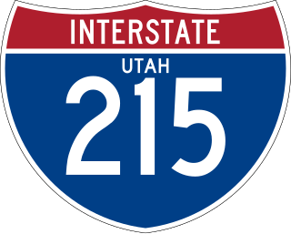
Interstate 215 (I-215), also known locally as the Belt Route, is the only auxiliary Interstate in the U.S. state of Utah, forming a three-quarters loop around Salt Lake City and many of its suburbs. The route begins at the mouth of Parley's Canyon at a junction with I-80 east of the city center, and heads south through the edge of the Salt Lake City metropolitan area's eastern suburbs of Millcreek, Holladay, and Cottonwood Heights. It continues west through Murray before turning north again, passing through the city's first-ring western suburbs of Taylorsville and West Valley City. It then enters North Salt Lake and Davis County for a short distance before reaching I-15 northwest of the city center.
State Route 154 (SR-154) or Bangerter Highway is a partial expressway running west and then north from Draper through western Salt Lake County, eventually reaching the Salt Lake City International Airport in Salt Lake City. Construction began in 1988 after planning for the highway began more than two decades prior. For the next ten years, portions of the highway opened as constructed, with the entire route finished by 1998.
The Mountain View Corridor is a freeway under construction in northern Utah that will run along the western periphery of Salt Lake County and south into northwest Utah County. Except for the last several miles on its southern end the Mountain View Corridor is numerically designated as State Route 85 (SR-85) in the Utah state highway system. The entire Mountain View Corridor is maintained by the Utah Department of Transportation (UDOT).

U.S. Route 101 (US 101) is a major north–south United States Numbered Highway, stretching from Los Angeles, California, to Tumwater, Washington. The California portion of US 101 is one of the last remaining and longest U.S. Routes still active in the state, and the longest highway of any kind in California. US 101 was also one of the original national routes established in 1926. Significant portions of US 101 between the Los Angeles area and the San Francisco Bay Area follow El Camino Real, the commemorative route connecting the former Alta California's 21 missions.

Arizona State Route 303 or Loop 303, also known as the Bob Stump Memorial Parkway, is a freeway that serves the west part of the Phoenix metropolitan area. The freeway, originally a two-lane rural highway, was maintained by Maricopa County until 2004 when the Arizona Department of Transportation again took control of upgrading the interim road to a freeway.

State Route 68 (SR-68) is a state highway in the U.S. state of Utah. It is a major thoroughfare throughout the Wasatch Front as it runs north–south for 70.8 miles (113.9 km), linking US-6 near Elberta to US-89 in Woods Cross. The route intersects several major freeways and highways in the Salt Lake City metropolitan area including I-215, I-80, and I-15. The route is more commonly referred to as Redwood Road, after the street it is routed along throughout Salt Lake County. The highway is also routed for a short distance along 500 South and 200 West in Bountiful and Camp Williams Road in Utah County. The route is a surface street for its entire length.
Interstate 85 (I-85) is a part of the Interstate Highway System that runs from Montgomery, Alabama, to Petersburg, Virginia. In Alabama, the Interstate Highway runs 80 miles (130 km) from I-65 in Montgomery northeast to the Georgia state line near Valley. Although it is nominally north–south as it carries an odd number, I-85 travels east–west through the state. It is the primary highway between Montgomery and Atlanta. The Interstate also connects Montgomery with Tuskegee, Auburn, Opelika, and, indirectly, Phenix City and Columbus, Georgia.

Interstate 80 (I-80) is a part of the Interstate Highway System that runs from San Francisco, California, to Teaneck, New Jersey. The portion of the highway in the US state of Utah is 197.51 miles (317.86 km) long through the northern part of the state. From west to east, I-80 crosses the state line from Nevada in Tooele County and traverses the Bonneville Salt Flats—which are a part of the larger Great Salt Lake Desert. It continues alongside the Wendover Cut-off—the corridor of the former Victory Highway—US Route 40 (US-40) and the Western Pacific Railroad Feather River Route. After passing the Oquirrh Mountains, I-80 enters the Salt Lake Valley and Salt Lake County. A short portion of the freeway is concurrent with I-15 through Downtown Salt Lake City. At the Spaghetti Bowl, I-80 turns east again into the mouth of Parleys Canyon and Summit County, travels through the mountain range, and intersects the eastern end of I-84 near Echo Reservoir before turning northeast toward the Wyoming border near Evanston. I-80 was built along the corridor of the Lincoln Highway and the Mormon Trail through the Wasatch Range. The easternmost section also follows the historical routes of the first transcontinental railroad and US-30S.

Interstate 15 (I-15) runs north–south in the U.S. state of Utah through the southwestern and central portions of the state, passing through most of the state's population centers, including St. George and those comprising the Wasatch Front: Provo–Orem, Salt Lake City, and Ogden–Clearfield. It is Utah's primary and only north–south interstate highway, as the vast majority of the state's population lives along its corridor; the Logan metropolitan area is the state's only Metropolitan Statistical Area through which I-15 does not pass. In 1998, the Utah State Legislature designated Utah's entire portion of the road as the Veterans Memorial Highway.
The metropolitan area of Phoenix in the U.S. state of Arizona contains one of the nation's largest and fastest-growing freeway systems, with over 1,405 lane miles (2,261 km) as of 2005.

State Route 48 (SR-48) is a highway completely within Salt Lake County in northern Utah that connects Bangerter Highway with I-15 and US-89. The route is laid on portions of 7800 South, Redwood Road, and 7200 South. When the route was formed in 1927, it passed through the center of Midvale on Center Street. However, it was moved north onto 7200 South in 1965 to serve an exit of I-15.
State Route 73 (SR-73) is a 36.147-mile-long (58.173 km) state highway in the U.S. state of Utah, connecting the Rush, Cedar, and Utah Valleys. It is a discontinuous route in two segments; one long segment connecting SR-36 to Saratoga Springs, and one short segment within the city of Lehi.

State Route 145 (SR-145), a majority of which is also known as Pioneer Crossing, is a 6.862-mile-long (11.043 km) west–east thoroughfare completely within Utah County in northern Utah that cuts through Saratoga Springs, Lehi, American Fork, and portions of unincorporated Utah County. The portion between Interstate 15 (I-15) and U.S. Route 89 (US-89) has been under state jurisdiction since 1978, while the roadway between SR-68 and I-15 opened in 2010. The road were extended from SR-68 to SR-73 in 2014. The road runs mostly parallel to and south of SR-73, which also connects to SR-68 and I-15. The original portion of the route between I-15 and US-89 is designated as Main Street in American Fork's street grid.


