Valencia de Jesús

Last updated
Valencia de Jesús
Corregimientos of Valledupar - Valencia de Jesus.png
Location in the municipality of Valledupar.
Country Colombia
Department Cesar
Municipality Valledupar
Founded 1590
Government
  Type Corregimiento

Valencia de Jesús is a Colombian town and corregimiento of Valledupar in the Department of Cesar. The village is known for preserving one of the oldest churches in the Americas. [1]

Colombia Country in South America

Colombia, officially the Republic of Colombia, is a sovereign state largely situated in the northwest of South America, with territories in Central America. Colombia shares a border to the northwest with Panama, to the east with Venezuela and Brazil and to the south with Ecuador and Peru. It shares its maritime limits with Costa Rica, Nicaragua, Honduras, Jamaica, Haiti, and the Dominican Republic. Colombia is a unitary, constitutional republic comprising thirty-two departments, with the capital in Bogota.

Valledupar City and municipality in Caribbean, Colombia

Valledupar is a city and municipality in northeastern Colombia. It is the capital of Cesar Department. Its name, Valle de Upar, was established in honor of the Amerindian cacique who ruled the valley; Cacique Upar. The city lies between the mountains of Sierra Nevada de Santa Marta and the Serranía del Perijá to the borders of the Guatapurí and Cesar rivers.

Contents

History

The village was founded by Captain Antonio Florez in c. 1590 with the name Dulce Nombre de Jesus but due to constant attacks from the indigenous Chimila, the town was moved closer to Valledupar. The old village was named; Pueblo Viejo (named changed to Pueblo Bello in the 20th Century) and the new town; Nueva Valencia. [2]

Pueblo Bello village in Caribbean, Colombia

Pueblo Bello, is a village and municipality in the northern region of the Department of Cesar, Colombia. It is located in the mountains of the Sierra Nevada de Santa Marta and is home to Amerindians pertaining to the Arhuaco ethnicity, whom consider Pueblo Bello a sanctuary but by the name of Arumake in their language. Pueblo Bello is the main producer of coffee in the Caribbean Region of Colombia.

During the Spanish conquest and colonization of the Americas Valencia was a Spanish enclave similar in importance to Valledupar, functioning as seat of its municipality and its territory extended from Nabusimake to El Paso. [3]

El Paso, Cesar municipality in Caribbean, Colombia

El Paso is a municipality in the Cesar Department of Colombia. El Paso is mostly known for having the second largest coal mine in Colombia, located in the corregimiento of La Loma.

Valencia was also one of the most important religious centers in the region for the Community of the Dominicans which imposed on the Christian faith on the indigenous. The Parish of Valencia de Jesus back then limited to the north with Valledupar, Azúcar Buena I, to the west with the Garupal River, to the south with Espiritu Santo in between the Cesar River up to a locality named Alto Minas. [4]

Dominican Order Roman Catholic religious order

The Order of Preachers, also known as the Dominican Order, is a mendicant Catholic religious order founded by the Spanish priest Dominic of Caleruega in France, approved by Pope Honorius III via the Papal bull Religiosam vitam on 22 December 1216. Members of the order, who are referred to as Dominicans, generally carry the letters OP after their names, standing for Ordinis Praedicatorum, meaning of the Order of Preachers. Membership in the order includes friars, nuns, active sisters, and affiliated lay or secular Dominicans.

Cesar River river in Colombia

The Cesar River is a river in northern Colombia which is a part of the Magdalena Basin. It flows through the Cesar-Ranchería Basin and separates the Sierra Nevada de Santa Marta from the mountain ranges of the Serranía del Perijá, an extension of the Cordillera Oriental. It flows north to south, down from the Sierra Nevada de Santa Marta in the Guajira Department onto the Cesar Department and flowing into the Zapatosa Marsh where it turns to the southwest and discharges into the Magdalena River. Valledupar is the only major city on its route.

During the independence movement in the 19th Century, Valencia was considered a powerful village with an aristocrat base of inhabitants owners of large haciendas . After the revolt in Valledupar against the Spanish monarchical authorities, Valencia de Jesus sided with the King of Spain, Fernando VII organized and confronted the people of Valledupar, who defeated them. After the independence the village decayed and was added to Valledupar. [3]

A hacienda, in the colonies of the Spanish Empire, is an estate, similar in form to a Roman villa. Some haciendas were plantations, mines or factories. Many haciendas combined these activities. The word is derived from the Spanish word "hacer" or "haciendo", which means: to make or be making, respectively; and were largely business enterprises consisting of various money making ventures including raising farm animals and maintaining orchards.

Notes

Related Research Articles

Cesar Department Department in Caribbean Region, Colombia

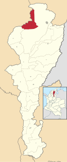
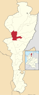
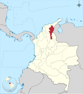
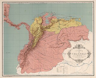
Cesar Department or simply Cesar is a department of Colombia located in the north of the country in the Caribbean region, bordering to the north with the Department of La Guajira, to the west with the Department of Magdalena and Department of Bolivar, to the south with Department of Santander, to the west with the Department of North Santander, and to the east with the country of Venezuela. The department capital city is Valledupar.

The Pueblo Revolt of 1680—also known as Popé's Rebellion—was an uprising of most of the indigenous Pueblo people against the Spanish colonizers in the province of Santa Fe de Nuevo México, present day New Mexico. The Pueblo Revolt killed 400 Spanish and drove the remaining 2,000 settlers out of the province.

San Juan del Cesar Place in Caribbean, Colombia

San Juan del Cesar is a municipality and town located in the La Guajira Department, Colombia.

Los Robles La Paz Place in Caribbean, Colombia

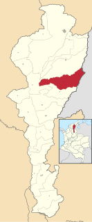
Los Robles La Paz or simply La Paz is a municipality and a town in the Department of Cesar, Colombia. The town is close to the Capital city of the Department of Cesar; Valledupar. The municipality of La Paz borders to the north with La Guajira Department, to the northeast with the municipality of Manaure. To the east with the Bolivarian Republic of Venezuela sharing the Serranía del Perijá mountain range. To the south with the municipality of Codazzi, southwest with the municipality of El Paso, Cesar. To the west with the municipality of San Diego and to the northwest with the municipality of Valledupar.

Chimichagua city in Caribbean, Colombia

Chimichagua is a city and municipality in the central region of the Department of Cesar, Colombia. Approximately one third of the municipality of Chimichagua is water. The municipality seat lies by the Cienaga de Zapatosa marshes.

Chiriguaná Place in Caribbean, Colombia

Chiriguaná is a city and municipality in the Department of Cesar, Colombia.

Becerril town in Caribbean, Colombia

Becerril or Becerril de Campos is a town and municipality of the Colombian Department of Cesar.

Bosconia town in Caribbean, Colombia

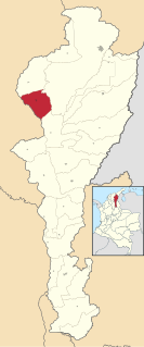
Bosconia is a town and municipality in the Colombian Department of Cesar.

Urumita town in Caribbean, Colombia

Urumita is a town and municipality of the Colombian Department of La Guajira.

Patillal Place in Cesar, Colombia

Patillal is a village and corregimiento in the municipality of Valledupar within the Colombian Department of Cesar. The town lies on the steps of the Sierra Nevada de Santa Marta with a semiarid terrain.

Tourism in Cesar Department

Tourism in Cesar Department refers to the tourism in the Colombian Department of Cesar. Tourism developed primarily in Valledupar during the middle of the 20th century after the creation of Cesar Department, but had its precedents in religious peregrination during the holy week, Catholic church tradition with peregrines going to Valledupar to celebrate processions, religious masses, saint of Ecce Homo veneration, the Virgen del Carmen, among others, these peregrinations were also popular in Atanquez a small village enclaved in the Sierra Nevada de Santa Marta, were the local culture inherited from the Spanish and Indigenous develop the "devil dancers".

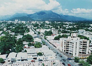
The History of Valledupar refers to the historical events related to the Colombian city of Valledupar. The region of what is now Valledupar was prior to the Spanish conquest of the Americas inhabited by numerous indigenous tribes pertaining to three major language families; the Arawaks, Kalina (Caribs) and Chibchas.

Atanquez Place in Cesar, Colombia

Atanquez or San Sebastian is a Colombian town and corregimiento of Valledupar in the Department of Cesar. Atanquez is located on the Sierra Nevada de Santa Marta mountain range at approximately 2,000 m over sea level. Atanquez is known for being predominantly inhabited by the indigenous ethnic group Kankuamos among others and mestizo groups.

Chimila

The Chimilas or Ette Ennaka are an indigenous people in the Andes of north-eastern Colombia. Their Chimila language is part of the Chibcha language family; there were estimated to be around 1000 speakers in 1998. At the time of the Spanish Conquest the Ariguaní River valley was the strategic centre of their territory. On the Serranía del Perijá mountains the Yukpas were also part of the Chimila confederation of tribes.

Guatapurí Place in Cesar, Colombia

Guatapurí is a Colombian town and corregimiento of Valledupar in the Department of Cesar. Atanquez is located on the Sierra Nevada de Santa Marta mountain range at approximately 2,000 m over the sea level. Guatapurí is known for being predominantly inhabited by the indigenous ethnic group Kankuamos among others and mestizo groups.

Magdalena Campaign

The Magdalena Campaign was a military operation from late 1812 to early 1813 led by the independentists Simón Bolívar and Pierre Labatut against royalists and the crown of Spain in New Granada. The campaign resulted in the revolutionary United Provinces of New Grenada taking control of the Magdalena River, which connects the port city of Cartagena with the interior of Colombia.

References

International Standard Book Number Unique numeric book identifier

The International Standard Book Number (ISBN) is a numeric commercial book identifier which is intended to be unique. Publishers purchase ISBNs from an affiliate of the International ISBN Agency.

Coordinates: 10°18′N73°24′W / 10.300°N 73.400°W / 10.300; -73.400