Pueblo Bello

Last updated
Pueblo Bello
Municipality
NABUSIMAKE, LA PUERTA AL CIELO.jpg
Nabusímake, arhuaco's town
Flag of Pueblobello (Cesar).svg
Motto(s): 
Work, Tenacity and Honesty
(Spanish: Trabajo, teson y honradez)
Colombia - Cesar - Pueblo Bello.svg
Location of the municipality and town of Pueblo Bello in the Department of Cesar.
Country Colombia
Region Caribbean
Department Cesar
Foundation1590
Government
   Mayor Alfredo Bohorquez
(Alas Equipo Colombia) [1]
Population
 (Census 2018 [2] )
  Total22,929
Time zone UTC-5
Website
www.pueblobello-cesar.gov.co

Pueblo Bello (Pretty Village), is a village and municipality in the northern region of the Department of Cesar, Colombia. It is located in the mountains of the Sierra Nevada de Santa Marta and is home to Amerindians pertaining to the Arhuaco ethnicity, whom consider Pueblo Bello a sanctuary but by the name of Arumake in their language. Pueblo Bello is the main producer of coffee in the Caribbean Region of Colombia.

Contents

Geography

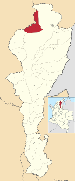
Pueblo Bello is the only municipality that is completely within the Sierra Nevada de Santa Marta mountains. The municipality borders to the north with the Department of Magdalena; to the east and south with the municipality of Valledupar and to the southwest with the municipality of El Copey. The municipality of Pueblo Bello is also part a Forest Reserve, the Sierra Nevada de Santa Marta National Park and the indigenous reserve. The municipality is crossed by two rivers; the Ariguaní River and the Ariguanicito River. [3]

Climate

Pueblo Bello presents an average temperature throughout the year between 16°C and 22°C predominantly characterized by mountain climate. [3]

History

The region was first inhabited by the Arhuaco and Chimila Maconganas. Upon the arrival of the Spanish, during the Spanish colonization of the Americas, the first European explorers to arrive were men under the orders of Lope de Orozco and had named it Valle de Taironaca (Valley of Taironaca). [4]

The village was founded by Captain Antonio Florez in c. 1590 with the name Dulce Nombre de Jesus but due to constant attacks from the Chimilas the town was moved nearer to Valledupar. The old village was named; Pueblo Viejo (named changed to Pueblo Bello in the 20th Century) and the new town; Nueva Valencia. [4]

Pueblo Bello was a corregimiento of Valledupar until 1997 when it was elevated to municipality by Ordinance 037 of December 10, 1997; later Decree 000239 of May 6, 1998 the Ordinance was recognized and enforced. [3]

Culture

Pueblo Bello celebrates the Festival del Café y la Mochila Arhuaca and the "Regional Olympics ". On July 16 of each year the town celebrates the Roman Catholic tradition of the Virgin of El Carmen. [3]

Notes

  1. (in Spanish) Interpolitico.com: Mayors of Cesar - 2008-2011 Archived 2007-11-01 at the Wayback Machine
  2. "Censo Nacional de Población y Vivienda 2018" (in Spanish). Retrieved 23 April 2020.
  3. 1 2 3 4 (in Spanish) National System for Cultural Information: Pueblo Bello
  4. 1 2 Gutierrez Hinojosa 2000 , p. 119

Related Research Articles

<span class="mw-page-title-main">Cesar Department</span> Department of Colombia

Cesar Department or simply Cesar is a department of Colombia located in the north of the country in the Caribbean region, bordering to the north with the Department of La Guajira, to the west with the Department of Magdalena and Department of Bolivar, to the south with Department of Santander, to the east with the Department of North Santander, and further to the east with the country of Venezuela. The department capital city is Valledupar.

<span class="mw-page-title-main">Valledupar</span> Municipality and city in Caribbean, Colombia

Valledupar is a city and municipality in northeastern Colombia. It is the capital of Cesar Department. Its name, Valle de Upar, was established in honor of the Amerindian cacique who ruled the valley; Cacique Upar. The city lies between the mountains of the Sierra Nevada de Santa Marta and the Serranía del Perijá to the borders of the Guatapurí and Cesar rivers.

<span class="mw-page-title-main">El Paso, Cesar</span> Municipality in Caribbean, Colombia

El Paso is a municipality in the Cesar Department of Colombia. El Paso is mostly known for having the second largest coal mine in Colombia, located in the corregimiento of La Loma.

<span class="mw-page-title-main">San Juan del Cesar</span> Municipality and town in Caribbean, Colombia

San Juan del Cesar is a municipality and town located in the La Guajira Department, Colombia.

<span class="mw-page-title-main">Los Robles La Paz</span> Place in Caribbean, Colombia

Los Robles La Paz or simply La Paz is a municipality and a town in the Department of Cesar, Colombia. The town is close to the Capital city of the Department of Cesar; Valledupar. The municipality of La Paz borders to the north with La Guajira Department, to the northeast with the municipality of Manaure. To the east with the Bolivarian Republic of Venezuela sharing the Serranía del Perijá mountain range. To the south with the municipality of Codazzi, southwest with the municipality of El Paso, Cesar. To the west with the municipality of San Diego and to the northwest with the municipality of Valledupar.

<span class="mw-page-title-main">Arhuaco</span> Indigenous Chibchan ethnic group of northern Colombia

The Arhuaco are an indigenous people of Colombia. They are Chibchan-speaking people and descendants of the Tairona culture, concentrated in northern Colombia in the Sierra Nevada de Santa Marta.

<span class="mw-page-title-main">Chimichagua</span> City in Caribbean, Colombia

Chimichagua is a city and municipality in the central region of the Department of Cesar, Colombia. Approximately one third of the municipality of Chimichagua is water. The municipality seat lies by the Cienaga de Zapatosa marshes.

<span class="mw-page-title-main">La Guajira Department</span> Department of Colombia

La Guajira is a department of Colombia. It occupies most of the Guajira Peninsula in the northeast region of the country, on the Caribbean Sea and bordering Venezuela, at the northernmost tip of South America. The capital city of the department is Riohacha.

<span class="mw-page-title-main">Guatapurí River</span> River in Colombia

The Guatapurí River, or Rio Guatapurí in Spanish, is a river that flows from the eastern side of the Sierra Nevada de Santa Marta into the Cesar River in northern Colombia by the city of Valledupar. In the indigenous Chimila language, Guatapurí means "cold water".

<span class="mw-page-title-main">Becerril</span> Town in Caribbean, Colombia

Becerril or Becerril de Campos is a town and municipality of the Colombian Department of Cesar.

<span class="mw-page-title-main">Villanueva, La Guajira</span> Municipality and town in Caribbean, Colombia

Villanueva is a town and municipality located in the northern Department of La Guajira, Colombia. Villanueva is known in Colombia for being the cradle of many vallenato singers and composers. The economy of the town relies heavily on agriculture and farming.

<span class="mw-page-title-main">Urumita</span> Town in Caribbean, Colombia

Urumita is a town and municipality of the Colombian Department of La Guajira.

Art of Cesar Department refers to the expressions of art in the Colombian Department of Cesar in the Caribbean Region of Colombia. The diverse range of human activities and artifacts, painting, sculpture, printmaking, musical and dance expressions, literature and other forms of visual and auditory arts.

<span class="mw-page-title-main">Tourism in Cesar Department</span>

Tourism in Cesar Department refers to the tourism in the Colombian Department of Cesar. Tourism developed primarily in Valledupar during the middle of the 20th century after the creation of Cesar Department, but had its precedents in religious peregrination during the Holy Week, Catholic Church tradition with peregrines going to Valledupar to celebrate processions, religious masses, saint of Ecce Homo veneration, the Virgen del Carmen, among others, these peregrinations were also popular in Atanquez a small village enclaved in the Sierra Nevada de Santa Marta, were the local culture inherited from the Spanish and Indigenous develop the "devil dancers".

<span class="mw-page-title-main">Architecture of Cesar Department</span> Colombian architecture

The Architecture of Cesar Department refers to the architecture in the Cesar Department of Colombia, which still preserves much of the colonial architecture inherited by the Spanish colonization and the architecture developed by the numerous tribes of indigenous peoples of the Cesar Department that included the Tairona, Chimila, Motilon and Kalina.

The History of Valledupar refers to the historical events related to the Colombian city of Valledupar. The region of what is now Valledupar was prior to the Spanish conquest of the Americas inhabited by numerous indigenous tribes pertaining to three major language families; the Arawaks, Kalina (Caribs) and Chibchas.

<span class="mw-page-title-main">Valencia de Jesús</span> Place in Cesar, Colombia

Valencia de Jesús is a Colombian town and corregimiento of Valledupar in the Department of Cesar. The village is known for preserving one of the oldest churches in the Americas.

<span class="mw-page-title-main">Atanquez</span> Place in Cesar, Colombia

Atanquez or San Sebastian is a Colombian town and corregimiento of Valledupar in the Department of Cesar. Atanquez is located on the Sierra Nevada de Santa Marta mountain range at approximately 2,000 m over sea level. Atanquez is known for being predominantly inhabited by the indigenous ethnic group Kankuamos among others and mestizo groups.

<span class="mw-page-title-main">Chimila people</span> Indigenous people in the Andes of north-eastern Colombia

The Chimilas or Ette Ennaka are an indigenous people in the Andes of north-eastern Colombia. Their Chimila language is part of the Chibcha language family, of which there were estimated to be around 1000 speakers in 1998. At the time of the Spanish Conquest the Ariguaní River valley was the strategic centre of their territory. On the Serranía del Perijá mountains the Yukpas were also part of the Chimila confederation of tribes.

<span class="mw-page-title-main">Guatapurí</span> Place in Cesar, Colombia

Guatapurí is a Colombian town and corregimiento of Valledupar in the Department of Cesar. Atanquez is located on the Sierra Nevada de Santa Marta mountain range at approximately 2,000 m over the sea level. Guatapurí is known for being predominantly inhabited by the indigenous ethnic group Kankuamos among others and mestizo groups.

References

10°25′N73°35′W / 10.417°N 73.583°W / 10.417; -73.583