Pailitas

Last updated
Pailitas
Town
Flag of Pailitas, Cesar.svg
Colombia - Cesar - Pailitas.svg
Location of the municipality and town of Pailitas in the Department of Cesar.
Country Colombia
Region Caribbean
Department Cesar
Government
   Mayor Luis Carlos Galván
(Alas Equipo Colombia) [1]
Area
[2]
  Total521 km2 (201 sq mi)
Population
 (Census 2018 [3] )
  Total16,800
  Density32/km2 (84/sq mi)
Time zone UTC-5
Website
www.pailitas.gov.co

Pailitas is a town and municipality in the Colombian Department of Cesar.

Contents

Climate

Climate data for Pailitas (Col Agro Pailitas), elevation 50 m (160 ft), (1981–2010)
MonthJanFebMarAprMayJunJulAugSepOctNovDecYear
Mean daily maximum °C (°F)33.5
(92.3)
34.5
(94.1)
34.3
(93.7)
33.4
(92.1)
32.6
(90.7)
32.6
(90.7)
33.4
(92.1)
32.9
(91.2)
32.5
(90.5)
31.9
(89.4)
31.9
(89.4)
32.5
(90.5)
33.0
(91.4)
Daily mean °C (°F)27.7
(81.9)
28.8
(83.8)
28.9
(84.0)
28.2
(82.8)
27.7
(81.9)
27.8
(82.0)
28.2
(82.8)
27.9
(82.2)
27.3
(81.1)
26.9
(80.4)
26.9
(80.4)
27.1
(80.8)
27.9
(82.2)
Mean daily minimum °C (°F)21.1
(70.0)
21.7
(71.1)
22.5
(72.5)
23.0
(73.4)
23.1
(73.6)
22.9
(73.2)
23.0
(73.4)
22.7
(72.9)
22.7
(72.9)
22.4
(72.3)
22.4
(72.3)
21.9
(71.4)
22.5
(72.5)
Average precipitation mm (inches)34.0
(1.34)
28.3
(1.11)
107.8
(4.24)
209.0
(8.23)
303.9
(11.96)
188.0
(7.40)
135.6
(5.34)
180.0
(7.09)
274.0
(10.79)
284.8
(11.21)
271.4
(10.69)
74.8
(2.94)
2,091.7
(82.35)
Average precipitation days23712161514171819156144
Average relative humidity (%)76727477818181818385858180
Mean monthly sunshine hours 251.1214.5201.5159.0167.4177.0207.7201.5162.0164.3165.0217.02,288
Mean daily sunshine hours 8.17.66.55.35.45.96.76.55.45.35.57.06.3
Source: Instituto de Hidrologia Meteorologia y Estudios Ambientales [4]

Related Research Articles

<span class="mw-page-title-main">El Paso, Cesar</span> Municipality in Caribbean, Colombia

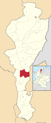
El Paso is a municipality in the Cesar Department of Colombia. El Paso is mostly known for having the second largest coal mine in Colombia, located in the corregimiento of La Loma.

<span class="mw-page-title-main">Los Robles La Paz</span> Place in Caribbean, Colombia

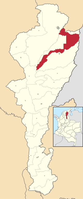
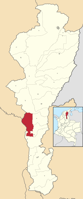
Los Robles La Paz or simply La Paz is a municipality and a town in the Department of Cesar, Colombia. The town is close to the Capital city of the Department of Cesar; Valledupar. The municipality of La Paz borders to the north with La Guajira Department, to the northeast with the municipality of Manaure. To the east with the Bolivarian Republic of Venezuela sharing the Serranía del Perijá mountain range. To the south with the municipality of Codazzi, southwest with the municipality of El Paso, Cesar. To the west with the municipality of San Diego and to the northwest with the municipality of Valledupar.

<span class="mw-page-title-main">La Gloria, Cesar</span> Place in Caribbean, Colombia

La Gloria is a municipality and town in the Department of Cesar, northern Colombia by the Magdalena River.

<span class="mw-page-title-main">Pueblo Bello</span> Municipality in Caribbean, Colombia

Pueblo Bello, is a village and municipality in the northern region of the Department of Cesar, Colombia. It is located in the mountains of the Sierra Nevada de Santa Marta and is home to Amerindians pertaining to the Arhuaco ethnicity, whom consider Pueblo Bello a sanctuary but by the name of Arumake in their language. Pueblo Bello is the main producer of coffee in the Caribbean Region of Colombia.

<span class="mw-page-title-main">Aguachica</span> Municipality and city in Caribbean, Colombia

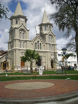
Aguachica, is a small city and municipality in the southern region of the Cesar Department, Colombia. There is no historical support on the date of its foundation; however, August 16, 1748 has been chosen by the community. Saint Roch is the patron saint of the municipality and August 16 is the date on which the Catholic Church celebrates its festival.

<span class="mw-page-title-main">Chimichagua</span> City in Caribbean, Colombia

Chimichagua is a city and municipality in the central region of the Department of Cesar, Colombia. Approximately one third of the municipality of Chimichagua is water. The municipality seat lies by the Cienaga de Zapatosa marshes.

<span class="mw-page-title-main">Chiriguaná</span> Place in Caribbean, Colombia

Chiriguaná is a city and municipality in the Department of Cesar, Colombia.

<span class="mw-page-title-main">Astrea, Cesar</span> Town in Caribbean, Colombia

Astrea is a municipality and town of the Department of Cesar in northern Colombia.

<span class="mw-page-title-main">Becerril</span> Town in Caribbean, Colombia

Becerril or Becerril de Campos is a town and municipality of the Colombian Department of Cesar.

<span class="mw-page-title-main">Curumaní</span> Municipality and town in Caribbean, Colombia

Curumaní is a town and municipality in the Colombian Department of Cesar.

<span class="mw-page-title-main">El Copey</span> Town in Caribbean, Colombia

El Copey is a town and municipality in the Colombian Department of Cesar, in the northeast of Colombia. It is 105 km away from the Capitol of the department, Valledupar.

<span class="mw-page-title-main">Gamarra, Cesar</span> Town in Caribbean, Colombia

Gamarra is a town and municipality in the Colombian Department of Cesar.

<span class="mw-page-title-main">Pelaya</span> Town in Caribbean, Colombia

Pelaya is a town and municipality in the Colombian Department of Cesar.

<span class="mw-page-title-main">Río de Oro, Cesar</span> Town in Caribbean, Colombia

Río de Oro is a town and municipality in the Colombian Department of Cesar.

<span class="mw-page-title-main">San Alberto, Cesar</span> Town in Caribbean, Colombia

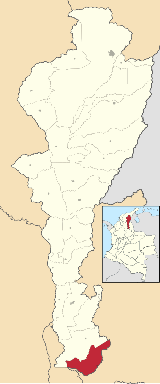
San Alberto is a town and municipality in the Colombian Department of Cesar.

<span class="mw-page-title-main">San Diego, Cesar</span> Town in Caribbean, Colombia

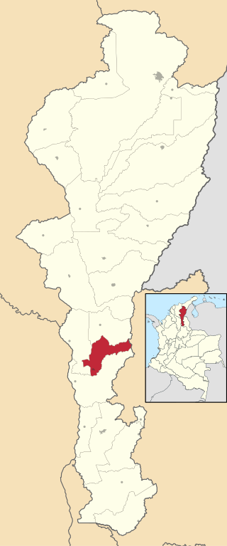
San Diego is a town and municipality in the Colombian Department of Cesar. It was founded on 19 July 1609.

<span class="mw-page-title-main">San Martín, Cesar</span> Town in Caribbean, Colombia

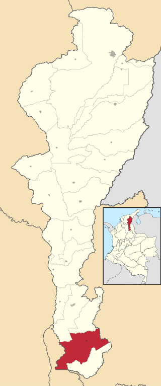
San Martín is a town and municipality in the Colombian Department of Cesar.

<span class="mw-page-title-main">Tamalameque</span> Town in Caribbean, Colombia

Tamalameque is a town and municipality in the Colombian Department of Cesar. It was originally the site of a Chimila settlement, Thamara. Tamalameque is located on the right bank of the Magdalena River and borders Chimichagua and Pailitas in the north, Pelaya in the east, La Gloria in the south and in the west the departments of Bolívar and Magdalena.

<span class="mw-page-title-main">Simití</span> Municipality and town in Bolívar Department, Colombia

Simiti is a town and municipality located in the Bolívar Department, northern Colombia.

<span class="mw-page-title-main">Mogotes</span> Municipality and town in Santander Department, Colombia

Mogotes is a town and municipality in the Santander Department, in northeastern Colombia.

References

  1. (in Spanish) Interpolitico.com: Mayors of Cesar - 2008-2011 Archived 2007-11-01 at the Wayback Machine
  2. "Municipalities of Colombia". statoids. Retrieved 26 April 2020.
  3. "Censo Nacional de Población y Vivienda 2018" (in Spanish). DANE . Retrieved 26 April 2020.
  4. "Promedios Climatológicos 1981–2010" (in Spanish). Instituto de Hidrologia Meteorologia y Estudios Ambientales. Archived from the original on 15 August 2016. Retrieved 17 June 2024.

8°58′N73°38′W / 8.967°N 73.633°W / 8.967; -73.633