Caesar Department or simply Caesar is a department of Colombia located in the north of the country in the Caribbean region, bordering to the north with the Department of La Guajira, to the west with the Department of Magdalene and Department of Bolivar, to the south with Department of Santander, to the east with the Department of North Santander, and further to the east with the country of Venezuela. The department capital city is Valledupar.

Duitama is a city and municipality in the department of Boyacá. It is the capital of the Tundama Province. Duitama is located 195 kilometres (121 mi) northeast of Bogotá, the capital city of Colombia and 50 kilometres (31 mi) northeast of Tunja, the capital Boyacá. Duitama has existed since pre-Columbian times, when the Muisca inhabited the hills surrounding a former lake in the valley. The original name of Duitama was "Tundama", named after cacique Tundama. The elevation of the city is about 2,590 metres (8,500 ft) above sea level and the average temperature is 16 °C. Duitama is known as "The Pearl of Boyacá".

San Miguel de Sema is a town and municipality in Boyacá Department, Colombia, part of the subregion of the Western Boyacá Province. It is one of the 123 municipalities of the department of Boyacá, Colombia, located to the west of the department with the urban centre at an altitude of 2,615 metres (8,579 ft). It is bordered by the municipalities Chiquinquirá, Simijaca, Fúquene (Cundinamarca), and the Boyacá municipalities Ráquira and Tinjacá.

El Paso is a municipality in the Cesar Department of Colombia. El Paso is mostly known for having the second largest coal mine in Colombia, located in the corregimiento of La Loma.

San Juan del Cesar is a municipality and town located in the La Guajira Department, Colombia.
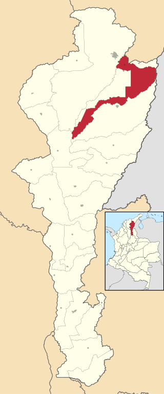
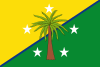
Los Robles La Paz or simply La Paz is a municipality and a town in the Department of Cesar, Colombia. The town is close to the Capital city of the Department of Cesar; Valledupar. The municipality of La Paz borders to the north with La Guajira Department, to the northeast with the municipality of Manaure. To the east with the Bolivarian Republic of Venezuela sharing the Serranía del Perijá mountain range. To the south with the municipality of Codazzi, southwest with the municipality of El Paso, Cesar. To the west with the municipality of San Diego and to the northwest with the municipality of Valledupar.

La Jagua de Ibirico is a town and municipality in the Department of Cesar, Colombia. This region of La Jagua is rich in coal which is exploited extensively and is second only to El Cerrejon in La Guajira. The area is also known for being a hot spot in the Colombian conflict.

Pueblo Bello, is a village and municipality in the northern region of the Department of Cesar, Colombia. It is located in the mountains of the Sierra Nevada de Santa Marta and is home to Amerindians pertaining to the Arhuaco ethnicity, whom consider Pueblo Bello a sanctuary but by the name of Arumake in their language. Pueblo Bello is the main producer of coffee in the Caribbean Region of Colombia.

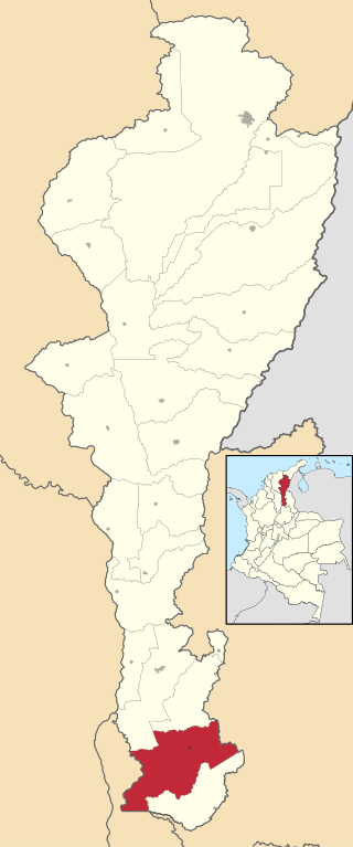
Aguachica, is a small city and municipality in the southern region of the Cesar Department, Colombia. There is no historical support on the date of its foundation; however, August 16, 1748 has been chosen by the community. Saint Roch is the patron saint of the municipality and August 16 is the date on which the Catholic Church celebrates its festival.

Chimichagua is a city and municipality in the central region of the Department of Cesar, Colombia. Approximately one third of the municipality of Chimichagua is water. The municipality seat lies by the Cienaga de Zapatosa marshes.

Astrea is a municipality and town of the Department of Cesar in northern Colombia.

Becerril or Becerril de Campos is a town and municipality of the Colombian Department of Cesar.

Bosconia is a town and municipality in the Colombian Department of Cesar.

El Copey is a town and municipality in the Colombian Department of Cesar, in the northeast of Colombia. It is 105 km away from the Capitol of the department, Valledupar.

Gamarra is a town and municipality in the Colombian Department of Cesar.

González is a town and municipality in the Colombian Department of Cesar.

Pailitas is a town and municipality in the Colombian Department of Cesar.

Río de Oro is a town and municipality in the Colombian Department of Cesar.

San Diego is a town and municipality in the Colombian Department of Cesar. It was founded on 19 July 1609.
San Martín is a town and municipality in the Colombian Department of Cesar.