
The Black Rock Desert is a semi-arid region of lava beds and playa, or alkali flats, situated in the Black Rock Desert–High Rock Canyon Emigrant Trails National Conservation Area, a silt playa 100 miles (160 km) north of Reno, Nevada, that encompasses more than 300,000 acres (120,000 ha) of land and contains more than 120 miles (200 km) of historic trails. It is in the northern Nevada section of the Great Basin with a lakebed that is a dry remnant of Pleistocene Lake Lahontan.

The Wasatch Range or Wasatch Mountains is a mountain range in the western United States that runs about 160 miles (260 km) from the Utah-Idaho border south to central Utah. It is the western edge of the greater Rocky Mountains, and the eastern edge of the Great Basin region. The northern extension of the Wasatch Range, the Bear River Mountains, extends just into Idaho, constituting all of the Wasatch Range in that state.

The Great Basin Desert is part of the Great Basin between the Sierra Nevada and the Wasatch Range. The desert is a geographical region that largely overlaps the Great Basin shrub steppe defined by the World Wildlife Fund, and the Central Basin and Range ecoregion defined by the U.S. Environmental Protection Agency and United States Geological Survey. It is a temperate desert with hot, dry summers and snowy winters. The desert spans large portions of Nevada and Utah, and extends into eastern California. The desert is one of the four biologically defined deserts in North America, in addition to the Mojave, Sonoran, and Chihuahuan Deserts.
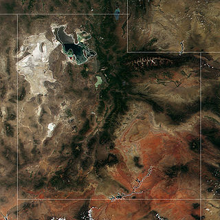
The Great Salt Lake Desert is a large dry lake in northern Utah, United States, between the Great Salt Lake and the Nevada border. It is a subregion of the larger Great Basin Desert, and noted for white evaporite Lake Bonneville salt deposits including the Bonneville Salt Flats.

The South Mountains, known locally as simply South Mountain, is a mountain range in central Arizona in south Phoenix, Arizona. The majority of the range is public land managed by the City of Phoenix as South Mountain Park, but a small portion extends into the Gila River Indian Community.

Utah Valley is a valley in North Central Utah located in Utah County, and is considered part of the Wasatch Front. It contains the cities of Provo, Orem, and their suburbs, including Alpine, American Fork, Cedar Hills, Elk Ridge, Highland, Lehi, Lindon, Mapleton, Payson, Pleasant Grove, Salem, Santaquin, Saratoga Springs, Spanish Fork, Springville, Vineyard and Woodland Hills. It is known colloquially as "Happy Valley".
For other uses, see Shadow Mountain (disambiguation)

The Silurian Hills are a small range of hills in the Mojave Desert, southeast of Death Valley National Park, in southern California. The surrounding lower elevation lands provide important connectivity habitat between nearby mountain ranges. The area provides critical habitat and movement corridors for bighorn sheep, desert tortoises, nesting golden eagles, kit foxes and burrowing owls. The Silurian Valley is a largely undisturbed valley that supports wildlife and is an important link for this portion of the northern Mojave Desert.

The Northern Basin and Range ecoregion is a Level III ecoregion designated by the United States Environmental Protection Agency (EPA) in the U.S. states of Oregon, Idaho, Nevada, Utah, and California. It contains dissected lava plains, rolling hills, alluvial fans, valleys, and scattered mountain ranges in the northern part of the Great Basin. Although arid, the ecoregion is higher and cooler than the Snake River Plain to the north and has more available moisture and a cooler climate than the Central Basin and Range to the south. Its southern boundary is determined by the highest shoreline of Pleistocene Lake Bonneville, which once inundated the Central Basin and Range. The western part of the region is internally drained; its eastern stream network drains to the Snake River system.
The Dumont Hills are a low mountain range in the Mojave Desert, in northeastern San Bernardino County, southern California.
The Saddle Peak Hills are a mountain range in the Mojave Desert, in northern San Bernardino County, southern California.

The Salt Spring Hills are a low mountain range in the Mojave Desert, in northern San Bernardino County, California. They are just outside the southeastern corner of Death Valley National Park, southeast of the Saddle Peak Hills. The road between Shoshone and Baker passes through the hills.
The Sperry Hills are a low mountain range in the northern Mojave Desert—southern Amargosa Desert region, in northeastern San Bernardino County, southern California.

The Arizona/New Mexico Mountains ecoregion is a Level III ecoregion designated by the United States Environmental Protection Agency (EPA) in the U.S. states of Arizona and New Mexico.
The West Hills are a 20-mile long (32 km) mountain range located in northeast Box Elder County, Utah, United States, that extends slightly north into Oneida County, Idaho. The range is connected to the Samaria Mountains, a small range on the north in southern Idaho. The West Hills are also connected to another section on the southwest, the Blue Spring Hills. West of the Blue Spring and West Hills is a long north–south valley, the Blue Creek Valley.

Skull Valley is a 40-mile (64 km) long valley located in east Tooele County, Utah, United States at the southwest of the Great Salt Lake. The valley trends north–south, but turns slightly northeast to meet Stansbury Bay,.
Silurian Valley is a valley in the Mojave Desert, in San Bernardino County, California. The valley trends in a north–south direction, its mouth located just southeast of the south end of Death Valley at 35°37′17″N116°16′07″W. Its head is at 35°23′36″N116°08′02″W. The valley is drained by Salt Creek a tributary of the Amargosa River and contains Silurian Lake and Dry Sand Lake.
The Molas Formation is a geologic formation that is found in the Four Corners region of the United States. Its age is poorly constrained but is thought to be Namurian.

