Anantnag district is a district in the Indian union territory of Jammu and Kashmir. It is one of ten districts which make up the Kashmir Valley. The district headquarters is Anantnag city. As of 2011, it was the third most populous district of Jammu and Kashmir, after Jammu and Srinagar.

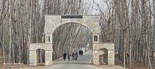
Bijbehara (Urdu pronunciation: [bɪd͡ʒbɪhaːɽaː], known as Vejibror in Kashmiri, is a town and a notified area committee in Anantnag district of the Indian administered union territory of Jammu and Kashmir. It is located on NH 44, and jehlum bank. Bijbehara town is also known as "Town of Chinars" because of a number of Chinars there especially two Chinar gardens. Bijbehara is the home to oldest chinar tree in the region. The town is situated about 45 km from the summer capital of union territory of Jammu and Kashmir, Srinagar.
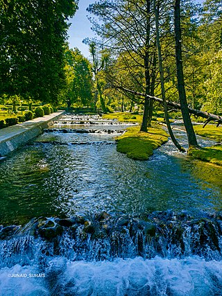
Kokernag is a sub-district town and a notified area committee in Breng Valley, Anantnag district in the Indian union territory of Jammu and Kashmir. The place is known for the botanical gardens, pristine freshwater springs, and rainbow trout farm. It is 25.3 km from Anantnag via NH244. It is one of the most popular weekend getaways from the state capital of Srinagar.
Kulgam, known as Kolgom in Kashmiri, is a town, an administrative division and capital of the Kulgam district in the Indian union territory of Jammu and Kashmir. It is located at a distance of 67 km (42 mi) from the summer state capital of Jammu and Kashmir, Srinagar. The city is divided into 16 electoral wards that has a population of 23,584, of which 12,605 are males while 10,979 are females.

Shopian district, known as Shupyan in Kashmiri, is a hill district with its administrative division in Shopian town, located in the Indian union territory of Jammu and Kashmir, since it is situated on the historical road commonly known as Mughal Road, most of its area is occupied by forests. Shopian district comes under the Pir Panjal Range which makes it very cold in winter. After partition of India, it was a tehsil of Pulwama district. In March, 2007, the district status was granted by the Government of India. The economy of the district depends on agriculture, particularly apple growing.
Batagund Bijbehara is a village in the Anantnag district in the Indian-administered union territory of Jammu and Kashmir. Its post office is at Bijbehara and the nearest medical center is at Veeri. As of 2012, its population was approximately 181. There is a high school located in this village. It is an ancient village and as according the village contains fabulous past of Hindus. There is also a temple located at the bank of a river "Tarbal". This is a short populated village with mere a total number of 3 dozen households. The neighbouring villages are Laribal, Joibal, Veeri and Gadiseer.
Gantali Pora is a village in Bijbehara tehsil, Anantnag district, of the Indian union territory of Jammu and Kashmir. As of 2011 the village had a population of 713 split into 80 households with males forming 353(49.5%) of the populace and females 360(51.5). Its elevation is approximately 890m above MSL. While Urdu is the official language, Kashmiri is also mostly spoken.
Shangus is a village Panchayat and a tehsil in Anantnag district of the Indian union territory of Jammu and Kashmir.
Dialgam is a large village situated in Anantnag tehsil, in Anantnag district of Jammu and Kashmir. It is one of 150 villages in Anantnag Block along with villages like Hardu Shichan and Pal Pora.
Sangam is village situated on Jammu-Srinagar National Highway in Bijbehara tehsil of Anantnag district in Jammu and Kashmir, India.
Sifan is a village in Anantnag tehsil in Anantnag district in Jammu and Kashmir, India.
Shalwan Pora is a village in Anantnag tehsil in Anantnag district in Jammu and Kashmir, India.
Brinty Bat Pora village is located in Anantnag tehsil of Anantnag district in Jammu and Kashmir, India.
Chitra Gam is a tehsil and a town in Shopian district of Jammu and Kashmir. It was upgraded to Tehsil under the administration of Shopian district. It is situated 13 km (8.1 mi) away from Shopian, where its district administrative units and district headquarters are located, and at a distance of 67.4 km (41.9 mi), the state summer capital Srinagar is situated via Srinagar-Pulwama road. This village is bounded by Molo, Maladair, Sugoo, and Handhama villages. It 8.9 km (5.5 mi) away from Achan Rambi Ara Bridge.
Gadiseer is a village in the Anantnag district in the Indian administered union territory of Jammu and Kashmir. It is located on the bank of Jhelum River. PIN code of Gadiseer is 192124 and its postal head office is Bijbehara. The village falls in the vicinity (jurisdiction) of tehsil Bijbehara in Dachnipora Block.
Frisal is a Tehsil in district of Kulgam, Jammu and Kashmir, India. It is 14 km far from district headquarter. Frisal is situated at Bijbehara, Arawani-Kulgam road. It's boundaries connect three districts of South kashmir. Frisal is 2nd largest town as per population in district Kulgam. The main source of income of this tehsil is agriculture. There are many springs in town Frisal and is known as town of springs in district Kulgam. Frisal town is economically and educationally weak and large population is below Poverty Line. Presently there are so many offices like Tehsil office, Block office, social welfare office,Model Hospital(not functional yet) Govt. Degree college,one Higher secondary and several educational institutions.
Abdul Rehman Veeria.k.a.Abdul Rehman Bhat is an Indian politician and the former member of the Jammu and Kashmir Legislative Assembly, who represented Bijbehara constituency from 1999 to June 2018 until the coalition government was ended by the Bhartiya Janata Party and Jammu and Kashmir Peoples Democratic Party in the state.
Zainapora is a village in Shopian district in the Indian union territory of Jammu and Kashmir. It is also known as land of springs because of its countless springs. Zainapora is located 19 km (12 mi) from district headquarter Shopian, 4 km (2.5 mi) from Aglar, 17 km from Pulwama, and 63 km (39 mi) from the capital Srinagar.
Wachi is a sub tehsil in Shopian district of Jammu Kashmir, India. It is situated on the banks of river Rambi Ara. Wachi is located 4 km (2.5 mi) towards east of Litter and 13 km (8.1 mi) from Anantnag.
Aglar is a notified area and a town in Zainapora Sub District of Kashmir. It is situated on the left bank of Rambi Ara which demarcates between Pulwama district with Shopian district. Aglar is located 13 km (8.1 mi) towards east from Pulwama, 4 km (2.5 mi) from Zainapora and 18 km (11 mi) towards west from Anantnag. Aglar is 3rd most populous town, located in Zainapora sub district of the state Jammu & Kashmir in India and 3rd biggest town by area in the sub district. The Pin code of Aglar is 192305.