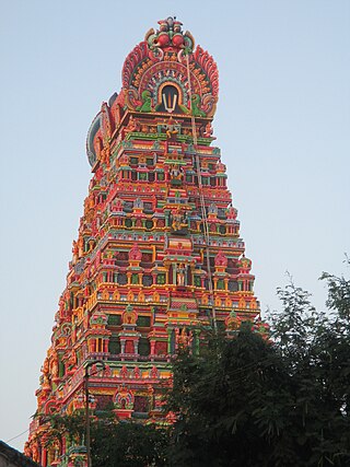
Thottiyam is a Town and Taluk in Tiruchirappalli district in the Indian state of Tamil Nadu. Thamilselvi Thirugnanam is the current President of Thottiyam. It is situated 60 km north-west of Tiruchirapalli on Tiruchy-Namakkal State Highway (SH-25) and further it connects Namakkal-Salem-Bangalore National Highway. It is located near the Kaveri River, about 12 km north-west of Musiri. Koranganatha Temple located in the outskirts of the town is a historic temple built during the Chola period in the 10th century. There is a village near by this town called Thirunarayana puram which has the famous Vedanarayana perumal temple, Thirunarayanapuram.
Arimalam is a Town Panchayath in the district of Pudukkottai, in the state of Tamil Nadu, India. As of 2011 Census, the town had a population of 19,948.
Eruvadi is a town panchayath in Tirunelveli district in the state of Tamil Nadu, India.

Karamadai is a town located near Mettupalayam, in the Indian state of Tamil Nadu. It is located on Coimbatore - Ooty NH 67. Nearby places are Teachers colony, Press Colony, Jodhipuram and Periyanaickenpalayam. The Ranganathaswamy temple and Nanjundeswarar temple are the most prominent landmarks in the town. The place of Karamadai came into limelight due to the presence of ex-steel giant Sri Ramakrishna Steel Industries.
Kariapatti is a town Panchayat city in district of Virudhunagar district, Tamil Nadu. The Kariapatti Town Panchayat has population of 18,984 of which 9,439 are males while 9,545 are females as per report released by Census India 2011. The Kariapatti city is divided into 15 wards for which elections are held every 5 years.
Kilvelur is a panchayat town in kilvelur taluk in the district of Nagapattinam district in the Indian state of Tamil Nadu.
Kolathur is a medium-sized town in Salem district in the Indian state of Tamil Nadu. It is located near Mettur and surrounded by Cavery river.
Komaralingam is a town located in the Tiruppur district of Tamil Nadu, India. It is located at a distance of 8 km from Madathukulam, 16 km from Udumalaipettai, 22 km from Palani, 85 km from Coimbatore and 79 km from Tiruppur.
Mohanur is a taluk in the Namakkal district of the Indian state of Tamil Nadu. The Mohanur Panchayat Union includes Mohanur Town, Pettapalayam, Manappalli, Rasipalayam, Kumaripalayam, Sengappalli, Ediyar, Peramandampalayam, Ariyur, Aniyapuram, and Valayapatti. It is linked to Tiruchirappalli, Salem, Erode, and Karur districts by road.
Nallur (Nalloor) is a panchayat town in Kanniyakumari district in the Indian state of Tamil Nadu.

Pallipalayam is a Municipality in Namakkal district in Komarapalayam taluk in the Indian state of Tamil Nadu. It is the headquarter of the Pallipalayam block
Peranamallur is a panchayat town in Tiruvannamalai district in the Indian state of Tamil Nadu.
Sambavarvadakarai is a Panchayat town in the Tenkasi district of the Indian state of Tamil Nadu. Located on the north shore of the Hanumannathi River in Tenkasi district of Tamil Nadu, Sambavarvadakarai is divided into two sections, Melur and Keelur corresponding to its location along the river. The name is a portmanteau of the Tamil words sambavar, vada (north), and karai (shore).
Sendarapatti, also known as Senthalai, is a panchayat town in Salem district in the Indian state of Tamil Nadu.

Thenthiruperai is a panchayat town in Thoothukudi district in the Indian state of Tamil Nadu. It is located at a distance of 11 km from Tiruvaikuntam, 21 km from Thiruchendur, 30 km from Thoothukudi, 31 km from Tirunelveli and 187 km from Madurai. The village hosts one of the nine temple shrines that constitutes Nava Tirupathi temples. It is also hosts one of the Navakailasams, Then Thiruperai Sri Kailasanathar Temple, the seventh in the series.
Thondi is a Panchayat Town located in the Ramanathapuram district of the southern Indian state of Tamil Nadu.

Thuraiyur is a municipality in the Tiruchirappalli district in the Indian state of Tamil Nadu. It was upgraded to a III Grade Municipality from Town Panchayat on 17 January 1970, and to a II Grade Municipality in May 1998. It was upgraded to Selection Grade Municipality in the year 2008. It is also a taluka. It is located 310 km away from Chennai.
Vettavalam is a first grade panchayat town in Tiruvanamalai district in the Indian state of Tamil Nadu.

Vennandur block is a revenue block in the Namakkal district of Tamil Nadu, India. Vennandur block is located in north eastern region in Namakkal district. It has a total of 24 panchayat villages. Vennanthur town is the head quarter of this block.
Varagur is a village in Senthamangalam Taluk, Namakkal district of Tamil Nadu state. Erumaipatti is 7 kilometers and Thathaiyangarpet is 9 kilometers away from the village. The Varagur village is located in the state Tamil Nadu having state code 33 and having the village code 634663. The Namakkal is the district of this village with district code 609. The total geographical area in which this village is expanded in 1,140 hectares. The village is known for the Varagur Venkatesa Perumal Koil, one of the 108 Abhimana Kshethra temples.


