
Salzgitter is an independent city in southeast Lower Saxony, Germany, located between Hildesheim and Braunschweig. Together with Wolfsburg and Braunschweig, Salzgitter is one of the seven Oberzentren of Lower Saxony. With 101,079 inhabitants and 223.92 square kilometres (86.46 sq mi), its area is the largest in Lower Saxony and one of the largest in Germany. Salzgitter originated as a conglomeration of several small towns and villages, and is today made up of 31 boroughs, which are relatively compact conurbations with wide stretches of open country between them. The main shopping street of the young city is in the borough of Lebenstedt, and the central business district is in the borough of Salzgitter-Bad. The city is connected to the Mittellandkanal and the Elbe Lateral Canal by a distributary. The nearest metropolises are Braunschweig, about 23 kilometres to the northeast, and Hanover, about 51 km to the northwest. The population of the City of Salzgitter has exceeded 100,000 inhabitants since its foundation in 1942, when it was still called Watenstedt-Salzgitter. Beside Wolfsburg, Leverkusen and Eisenhüttenstadt, Salzgitter is therefore one of the few cities in Germany founded during the 20th century.

Virginia is a gold mining town located in the Lejweleputswa District Municipality and on goldfields of the Free State province in South Africa about 140 km (90 mi) northeast of Bloemfontein the provincial capital.

Allanridge is a gold mining town in the Lejweleputswa District Municipality of the Free State province in South Africa. It is the main centre of the Loraine Gold Mining Company and is dominated by the tall headgear and complex reduction works that processes thousands of tons of gold-bearing ore every month.
Hennenman is a small town in the Free State goldfields in the Lejweleputswa District Municipality of the Free State province of South Africa. The settlement is unusual for the district as being supported by agriculture rather than the mining industry.

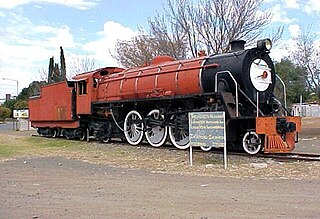
Odendaalsrus is the oldest gold mining town in the Lejweleputswa District Municipality in the goldfields of the Free State province in South Africa.
Theunissen is a small town that has the only wine estate, the Theunissen Wine Farm, in the Free State province of South Africa. It is located about 95 kilometers northeast of Bloemfontein and about 45 kilometers south of Welkom. It was founded by Boer War Commandant Helgaardt Theunissen. Theunissen has a small community which supports the local businesses.

Winburg is a small mixed farming town in the Free State province of South Africa.
Deneysville is a small town on the banks of the Vaal Dam in the Free State province of South Africa.
Jacobsdal is a small farming town in the Free State province of South Africa with various crops under irrigation, such as grapes, potatoes, lucerne and groundnuts. The town was layout in 1859 by Christoffel Jacobs on his farm Kalkfontein, and today houses 6,500 inhabitants.
Lückhoff is a small merino sheep farming town in the Free State province of South Africa. It was established on the farm Koffiekuil in 1892 and named after a Dutch Reformed Church minister Reverend HJ Luckhoff.

Reddersburg is a small ship and cattle farming town in the Free State province of South Africa on the N6 National Route 50 kilometres south of Bloemfontein.

Oudtshoorn, the "ostrich capital of the world", is a town in the Western Cape province of South Africa, located between the Swartberg mountains to the north and the Outeniqua Mountains to the south. Two ostrich-feather booms, during 1865–1870 and 1900–1914, truly established the settlement. With approximately 60,000 inhabitants, it is the largest town in the Little Karoo region. The town's economy is primarily reliant on the ostrich farming and tourism industries. Oudtshoorn is home to the world's largest ostrich population, with a number of specialized ostrich breeding farms, such as the Safari Show Farm and the Highgate Ostrich Show Farm.

The R70 is a provincial route in the Free State Province, South Africa that connects Odendaalsrus with Ficksburg via Ventersburg and Senekal.

Worcester is a town in the Western Cape, South Africa. It is located 120 kilometres (75 mi) north-east of Cape Town on the N1 highway north to Johannesburg.

Heidelberg is a town in the Western Cape, South Africa. It is located near South Africa's south coast, on the N2 highway, 274 km east of Cape Town. Heidelberg is just east of the Overberg region, and some consider it the beginning of the Garden Route. Heidelberg is part of the Hessequa Local Municipality. Fourie House on Fourie Street is the oldest house in Heidelberg.

Beaufort West is a town in the Western Cape province in South Africa. It is the largest town in the arid Great Karoo region, and is known as the "Capital of the Karoo". It forms part of the Beaufort West Local Municipality, with 34 085 inhabitants in 2011.

Beberibe is a municipality in the state of Ceará in Brazil. Its estimated population in 2006 is 46,439.

Loxton is a town in the Karoo region of South Africa's Northern Cape province. Within the Ubuntu Local Municipality of the Pixley ka Seme District Municipality

Victoria West is a town in the central Karoo region of South Africa's Northern Cape province. It is situated on the main N12 route, at an elevation of 1,300 metres (4,300 ft). It is the seat of the Ubuntu Local Municipality within the Pixley ka Seme District Municipality.
Friemersheim is a settlement in Garden Route District Municipality in the Western Cape province of South Africa.


