
The Winston Churchill Range is a mountain range in the central section of the Park Ranges of the Canadian Rockies located in Jasper National Park. The range was named after Sir Winston Churchill, former British prime minister.

The Kananaskis Range is a mountain range west of the Kananaskis River in the Continental Ranges of the Canadian Rockies. Many of the peaks are named after ships and people involved in the Battle of Jutland.

The Blue Range is a mountain range of the Canadian Rockies, located on the Continental Divide in Banff National Park, Canada. The range was so named on account of its blueish colour when viewed from afar. Mount Alcantara is the highest point in the range.

The Rainbow Range is a small subrange of the Park Ranges subdivisions of the Northern Continental Ranges of the Rocky Mountains on the border between Alberta and British Columbia in Mount Robson Provincial Park.
The Ram Range is a mountain range of the Canadian Rockies located in David Thompson Country, Canada. The range extends southeast from Abraham Lake to the Ram River. It is bounded on the southwest by Whiterabbit Creek.

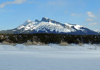
The Maligne Range is a mountain range of the Canadian Rockies located directly southeast of Jasper townsite in Jasper National Park, Canada. The southern tail-end of the range finishes at Endless Chain Ridge.

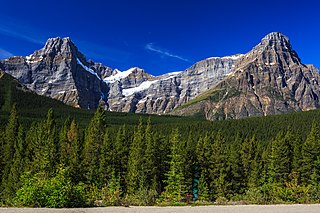
The Bow Range is a mountain range of the Park Ranges in Alberta and British Columbia, Canada. The range is named in association with the Bow River and was officially adopted on March 31, 1917 by the Geographic Board of Canada.

Neptuak Mountain was named by Samuel E.S. Allen in 1894. "Neptuak" is the Stoney Indian word for "nine" as Neptuak Mountain is peak #9 in the Valley of the Ten Peaks. It is located on the Continental Divide, which is also the British Columbia-Alberta border in this region, and is in the Bow Range of the Park Ranges of the Canadian Rockies. The summit is a tripoint for Banff National Park, Kootenay National Park, and Yoho National Park, where the three parks share a common border.
The Tower of London Range is a sub-range of the Northern Rocky Mountains in northern British Columbia, Canada, located northwest of the Tuchodi Lakes at the northwest end of the Northern Rocky Mountains Provincial Park to the southwest of Fort Nelson.
The Waputik Mountains are a mountain range of the Canadian Rockies, located on the Continental Divide between Banff and Yoho National Park. Covering an area of 1,069 square kilometres (413 sq mi), the range is located west of the Howse, Blaeberry and Amiskwi Rivers and east of the Bow and Mistaya Rivers and south to Kicking Horse Pass. Named in 1884 by George M. Dawson, "waputik" is the Stoney Indian word for white goat.

Hewitt Peak is a 3,066-metre (10,059 ft) mountain summit located on the western border of Kootenay National Park, in the Canadian Rockies of British Columbia, Canada. The peak is also known locally as Mammoth Peak, and originally as Mount 10060. The alternate names derive from its outline profile resembling a mammoth, and its elevation as measured in feet. No name for this mountain has been officially adopted yet. Its nearest higher peak is Tumbling Peak, 2.5 km (1.6 mi) to the north-northwest, and both are part of the Vermilion Range. Park visitors can catch a glimpse of the peak from Highway 93, also known as the Banff–Windermere Highway.

Floe Peak is a 3,006-metre (9,862 ft) mountain summit located on the western border of Kootenay National Park, in the Canadian Rockies of British Columbia, Canada. The name for this mountain has not been officially adopted yet. Its nearest higher peak is Foster Peak, 3.0 km (1.9 mi) to the northwest, and both are part of the Vermilion Range. The mountain is part of what is known as the Rockwall in the Vermilion Range, and is named for Floe Lake which is situated below the enormous northern cliffs of the peak. Floe Lake, one of the beauty spots of Kootenay Park, is accessible via the Floe Lake Trail.

Foster Peak is a 3,204-metre (10,512-foot) mountain summit located on the western border of Kootenay National Park. It is the highest point in the Vermilion Range, a sub-range of the Canadian Rockies of British Columbia, Canada. Its nearest higher peak is Mount Ball, 14.96 km (9.30 mi) to the northeast. The mountain is part of what is known as The Rockwall. Floe Lake, southeast of the peak, is one of the beauty spots of Kootenay National Park. The area is accessible via the Floe Lake Trail and Rockwall Trail. The Rockwall Trail is a scenic 55 kilometre traverse of alpine passes, subalpine meadows, hanging glaciers, and limestone cliffs, in some places in excess of 900 metres above the trail.

Mount Drysdale is a 2,932-metre (9,619-foot) mountain summit located on the western border of Kootenay National Park in the Vermilion Range, which is a sub-range of the Canadian Rockies of British Columbia, Canada. Its nearest higher peak is Rockwall Peak, 1.0 km (0.62 mi) to the west. The mountain is part of what is known as the Rockwall which is an escarpment of the Vermilion Range. The Rockwall Trail is a scenic 55 kilometre traverse of alpine passes, subalpine meadows, hanging glaciers, and limestone cliffs, in some places in excess of 900 m (2,950 ft) above the trail.

Mount Gray is a 2,886-metre (9,469-foot) mountain summit located on the western border of Kootenay National Park in the Vermilion Range, which is a sub-range of the Canadian Rockies in British Columbia, Canada. Its nearest higher peak is Tumbling Peak, 3.1 km (1.9 mi) to the southeast. The mountain is part of what is known as the Rockwall which is an escarpment of the Vermilion Range. The Rockwall Trail is a scenic 55 kilometre traverse of alpine passes, subalpine meadows, hanging glaciers, and limestone cliffs, in some places in excess of 900 m (2,953 ft) above the trail.
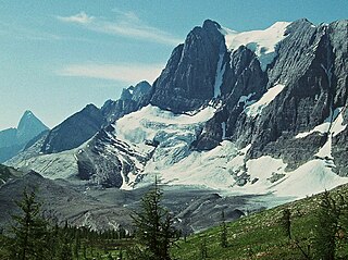
Tumbling Peak is a 3,145-metre (10,318-foot) mountain summit located on the western border of Kootenay National Park in the Vermilion Range, which is a sub-range of the Canadian Rockies of British Columbia, Canada. The mountain takes its name from the Tumbling Glacier located on its northeast flank. Its nearest higher peak is Foster Peak, 6.8 km (4.2 mi) to the southeast. Hewitt Peak is also to the southeast, and Mount Gray is to the immediate northwest. The mountain is situated in an area known as the Rockwall, which is an escarpment of the Vermilion Range. The Rockwall Trail is a scenic 55 kilometers traverse of alpine passes, sub-alpine meadows, hanging glaciers, and limestone cliffs, in some places in excess of 900 meters above the trail.
Mount Selkirk is a 2,930-metre (9,610-foot) mountain summit located in the Vermilion River Valley along the eastern border of Kootenay National Park. Park visitors can see the peak from Highway 93, also known as the Banff–Windermere Highway. It is part of the Mitchell Range, which is a sub-range of the Canadian Rockies of British Columbia, Canada. The nearest higher neighbor is Catlin Peak, 1.6 km (0.99 mi) to the northwest.

Vermilion Peak is a 2,647-metre (8,684-foot) mountain summit located in the Vermilion River Valley of Kootenay National Park, in British Columbia, Canada. It is part of the Ball Range, which is a sub-range of the Canadian Rockies. Its nearest higher peak is Stanley Peak, 2.8 km (1.7 mi) to the east. Vermilion Peak can be seen from the Banff–Windermere Parkway as it traverses the base of the mountain.
Misinchinka Ranges, is the largest subdivision range of the Hart Ranges, of the Northern Rockies in British Columbia, Canada. The boundaries of the Misinchinka Ranges generally lie between the Rocky Mountain Trench to the west, Clearwater Creek and the Sukunka River to the east, the Peace Arm of Williston Reservoir to the north and Monkman Provincial Park to the south.

The Flathead Range is a mountain range of the Canadian Rockies in Alberta and British Columbia, Canada. It is located on the Continental Divide, east of Fernie, in the Kootenay Land District. It stretches 27 km (17 mi) lengthwise north–south from Crowsnest Pass to North Kootenay Pass. The range's toponym was officially adopted on 30 June 1912 by the Geographic Board of Canada, and was named in association with the Flathead River.

