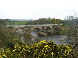
A viaduct is a specific type of bridge that consists of a series of arches, piers or columns supporting a long elevated railway or road. Typically a viaduct connects two points of roughly equal elevation, allowing direct overpass across a wide valley, road, river, or other low-lying terrain features and obstacles. The term viaduct is derived from the Latin via meaning "road", and ducere meaning "to lead". It is a 19th-century derivation from an analogy with ancient Roman aqueducts. Like the Roman aqueducts, many early viaducts comprised a series of arches of roughly equal length.
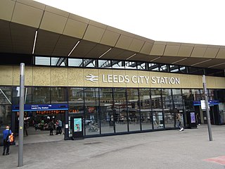
Leeds railway station is the mainline railway station serving the city centre of Leeds in West Yorkshire, England. It is located on New Station Street to the south of City Square, at the foot of Park Row, behind the landmark Queens Hotel. It is one of 20 stations managed by Network Rail. As of December 2023, it was the busiest station in West Yorkshire, as well as in Yorkshire & the Humber, and the entirety of Northern England. It is the second busiest station in the UK outside of London, after Birmingham New Street.

The Harrogate line is a passenger rail line through parts of North Yorkshire and the West Yorkshire area of northern England connecting Leeds to York by way of Harrogate and Knaresborough. Service on the line is operated by Northern, with a few additional workings by London North Eastern Railway starting and terminating at Harrogate. West Yorkshire Metro's bus and rail MetroCard ticket is available for journeys between Leeds and Harrogate.
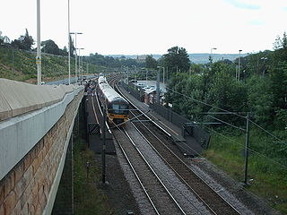
The Airedale line is one of the rail services in the West Yorkshire Metro area centred on West Yorkshire in northern England. The service is operated by Northern, on the route connecting Leeds and Bradford with Skipton. Some services along the line continue to Morecambe or Carlisle. The route covered by the service was historically part of the Midland Railway.

Wakefield Westgate railway station is a mainline railway station in Wakefield, West Yorkshire, England. It is 10 miles (16 km) south of Leeds to the west of the city centre, on the Wakefield Line and Leeds branch of the East Coast Main Line.
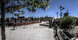
The Reading Viaduct, also called The Rail Park, is a disused elevated rail line in the Callowhill district of Philadelphia, Pennsylvania, United States that has been partly transformed into a rail trail.

The Coulée verte René-Dumont or Promenade plantée René-Dumont is a 4.7 km (2.9 mi) elevated linear park built on top of obsolete railway infrastructure in the 12th arrondissement of Paris, France. It was inaugurated in 1993.
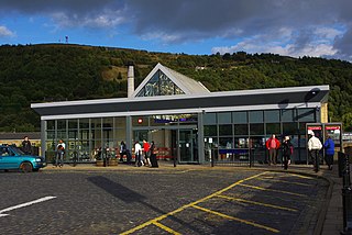
Halifax railway station serves the town of Halifax in West Yorkshire, England. It lies on the Calder Valley line and is 17 miles (27 km) west from Leeds.
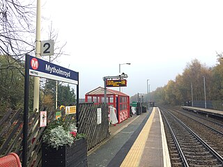
Mytholmroyd railway station serves the communities of Mytholmroyd, Luddendenfoot, Midgley, Cragg Vale, and surrounding areas in West Yorkshire, England. It has disabled access via ramps instead of steps on both platforms, unusually as the station is built on a viaduct. It lies on the Calder Valley Line operated by Northern and is situated 7.5 miles (12 km) west of Halifax and 25 miles (40 km) west of Leeds.
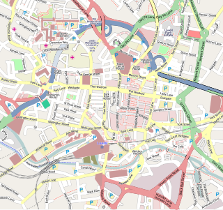
Leeds city centre is the central business district of Leeds, West Yorkshire, England. It is roughly bounded by the Inner Ring Road to the north and the River Aire to the south and can be divided into several quarters.

Holbeck is an inner city area of Leeds, West Yorkshire, England. It begins on the southern edge of Leeds city centre and mainly lies in the LS11 postcode district. The M1 and M621 motorways used to end/begin in Holbeck. Now the M621 is the only motorway that passes through the area since the end of the M1 moved to Hook Moor near Aberford. Since large parts of Holbeck have been vacated in preparation for the regeneration of the area, the district has in large parts suffered from a population exodus. Holbeck had a population of 5,505 in 2011. The district currently falls within the Beeston and Holbeck ward of Leeds City Council.

Holbeck railway station was a railway station that served the district of Holbeck, in Leeds, West Yorkshire, England.

The Leeds–Northallerton railway is a partly disused railway line between West and North Yorkshire, in northern England.

The Pickle Bridge line is a disused railway route in Northern England that ran between Huddersfield and Bradford.

The Harrogate–Church Fenton line was a railway line in North Yorkshire, opened by the York and North Midland Railway between 1847 and 1848, linking Harrogate and Church Fenton.
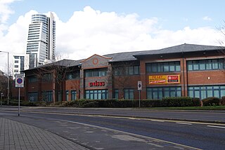
Leeds New Lane was a proposed new railway station to accommodate High Speed Two rail services in West Yorkshire, England. It was planned to be constructed on a viaduct on New Lane south of Leeds city centre, the River Aire and Leeds City station to which it would be connected by an elevated walkway. The site is occupied by Central Park, a small low-rise office park built in the 1990s and other small office buildings.

The Holbeck Viaduct Project is a community project that proposes bringing the Holbeck Viaduct in Leeds, England back into public use. The project is supported by a community group of the same name.
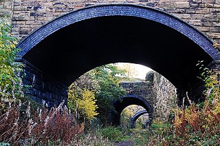
Heckmondwike Spen was a railway station opened by the London & North Western Railway (LNWR) in Heckmondwike, West Yorkshire, England. The station was one of two in the town of Heckmondwike, the other being Heckmondwike railway station which was opened by the Lancashire & Yorkshire Railway (L&Y). Both stations have been closed and the lines they served have closed too although the formations that they occupied have both been converted into greenways.

Knaresborough Viaduct is a viaduct in the North Yorkshire town of Knaresborough, England. The viaduct carries the Harrogate line over the River Nidd in the town. The viaduct was supposed to have opened in 1848, but the first construction collapsed into the river very near to completion, which necessitated a new viaduct and delayed the opening of the line through Knaresborough by three years.
The Historical Railways Estate (HRE) is a forms of over 3,100 structures—predominantly bridges, viaducts, tunnels and other works—associated with former railways in the United Kingdom. The structures are owned by the Department for Transport (DfT) and managed by National Highways (NH). NH has been criticised for its historical infill work on several bridges.


