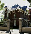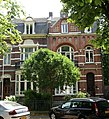
Ghent is a city and a municipality in the Flemish Region of Belgium. It is the capital and largest city of the East Flanders province, and the third largest in the country, after Brussels and Antwerp. It is a port and university city.
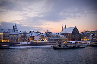
Maastricht is a city and a municipality in the southeastern Netherlands. It is the capital and largest city of the province of Limburg. Maastricht is located on both sides of the Meuse, at the point where the river is joined by the Jeker. Mount Saint Peter (Sint-Pietersberg) is largely situated within the city's municipal borders. Maastricht is adjacent to the border with Belgium and is part of the Meuse-Rhine Euroregion, an international metropolis with a population of about 3.9 million, which includes the nearby German and Belgian cities of Aachen, Liège, and Hasselt.

Hulst is a municipality and city in southwestern Netherlands in the east of Zeelandic Flanders.
The Pajottenland is a distinct region within the Flemish Brabant province and the south-western part of the Brussels Region of Belgium. The region is located west-southwest of Brussels. The Pajottenland is predominantly farmland, with occasional gently rolling hills, and lies mostly between the rivers Dender and Zenne / Senne. The area has historically provided food and drink for the citizens of Brussels, especially Lambic beers, which are only produced here and in the Zenne valley where Brussels is.

Sint-Stevens-Woluwe is a town in the Belgian province of Flemish Brabant and is part of Zaventem municipality. The town is located near the Brussels-Capital Region.

The Sint-Pieters-Leeuw Tower, sometimes called the VRT-toren, although there are several by that name, is a 302-metre-tall (991 ft) free standing tower at Sint-Pieters-Leeuw, on the outskirts of Brussels, Belgium, built between 1991 and 1994. It is the tallest free standing structure in Belgium. The tower's location, south-west of Brussels, was chosen for its central location in Belgium and to minimize hindrance to Brussels Airport beyond the opposite end of the city. The tower is owned by Norkring België.
Vissenaken is a village in Belgium. It is part (deelgemeente) of the municipality Tienen.

Heer is a neighbourhood of Maastricht, in the Dutch province of Limburg. Heer is a former municipality and village, incorporated into Maastricht in 1970 and, until 1828, this municipality was called "Heer en Keer". The municipality covered the former villages of Heer and Scharn. It is located on the right bank of the river Meuse.
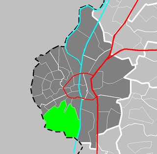
Sint Pieter is a neighbourhood in the city of Maastricht, in the Dutch province of Limburg. It is located on the western bank of the river Meuse, in the south of the city, and borders Belgium. It is a relatively affluent neighbourhood.
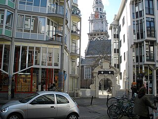
The Sint Antoniesbreestraat is a street in the centre of Amsterdam in the Netherlands. The street runs south from Nieuwmarkt square to the Sint Antoniesluis sluice gates, where it continues as the Jodenbreestraat. The Sint Antoniesbreestraat is primarily a shopping street with a variety of specialty shops. At the corner of Sint Antoniesbreestraat and Hoogstraat is an entry to the Nieuwmarkt stop of the Amsterdam Metro system.

Ruisbroek is a village in the municipality of Sint-Pieters-Leeuw, in the Belgian province of Flemish Brabant. Previously a separate municipality, it became a deelgemeente of Sint-Pieters-Leeuw in 1977. Due to its proximity to the Brussels Capital Region, the Brussels-Charleroi Canal, the Zenne river, the railway Brussels—Mons—Quévy and the Brussels outer ring (R0), the ward is heavily urbanised.

The Château de Duras in Duras, a half hour walk to the north of Sint-Truiden in Belgium, is built in the Classical style.

The Jekerkwartier is a neighbourhood in the old city centre of Maastricht, Limburg, Netherlands. It is named after the Jeker river that flows through the neighbourhood into the Meuse.
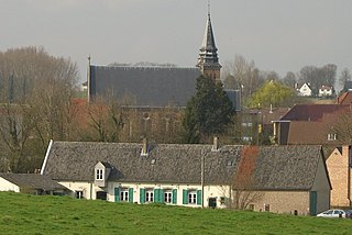
Itterbeek is a historical village in the province of Flemish Brabant, Belgium, and since 1977 a submunicipality of Dilbeek.
The watermill at Sint-Gertrudis-Pede (Pedemolen) in the municipality of Dilbeek is the only working watermill in the Pajottenland, and is protected as a monument since 1975
Sint-Anna-Pede is a village in Itterbeek, Belgium, which is a deelgemeente of Dilbeek. It gets its name from the Pedebeek, the stream that flows through the village.

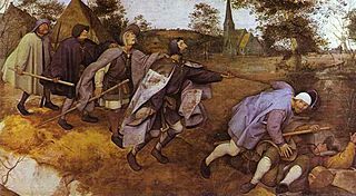
Saint Anna's Church is a Roman Catholic church in Sint-Anna-Pede, in the municipality of Dilbeek, Belgium, built around 1250. It is depicted in the painting The Blind Leading the Blind by Pieter Breughel the Elder.

Binnenstad is a neighbourhood in Maastricht, Netherlands. Until 2007, it was officially named City. As its name suggests, it is the most centrally located area of Maastricht.

Jan van Steffeswert or alternatively Jan van Steffenswert or Jan van Stevensweert was an Early Netherlandish sculptor and wood carver based in Maastricht. Contrary to the customs of the time, he signed at least some of the works he produced, using variously Jan Bieldesnider, Jan van Weerd or Jan van Steffeswert. To date, fourteen works have been positively identified as his.

Château St. Gerlach, formerly St. Gerlach Monastery or Sint-Gerlachusstift, is located in the church village of Houthem in Valkenburg aan de Geul in the valley of the Geul river, in the province of Limburg, Netherlands. It was originally built in the twelfth century as a monastery of canons and functioned from the fourteenth century as noble ladies convent. In the nineteenth century, the monastery was converted into a castle-like country house. It includes a rectangular main building, a coach house and a castle farm. Since 1997, the complex at Joseph Corneli Allee has been a luxurious hotel, restaurant and conference center established. The building complex, including the Sint-Gerlachus Church and the surrounding gardens, includes several national monuments and is part of the Buitengoed Geul & Maas.

