
Charleroi is a city and a municipality of Wallonia, located in the province of Hainaut, Belgium. The city is situated in the valley of the Sambre, in the south-west of Belgium, not far from the border with France. By 1 January 2008, the total population of Charleroi was 201,593. The metropolitan area, including the outer commuter zone, covers an area of 1,462 square kilometres (564 sq mi) with a total population of 522,522 by 1 January 2008, ranking it as the 5th most populous in Belgium after Brussels, Antwerp, Liège, and Ghent. The inhabitants are called Carolorégiens or simply Carolos.

Belleville is a station on Paris Métro Line 2 and Line 11. The station is in the district of Belleville at the corner of the 10th, 11th, 19th and 20th arrondissements.

Porte de Pantin is a station of the Paris Métro, serving line 5. It is named after the nearby avenue de la Porte de Pantin, on the edge of Paris leading to the town of Pantin. It was in turn named after the nearby Porte de Pantin, one of the former gates of Paris. The station's name has been subtitled Parc de la Villette since the creation of the eponymous park in 1987 on the site of the former slaughterhouses of La Villette to the north of the station which closed in 1974.

Ourcq is a station in the 19th arrondissement of Paris, served by line 5 of the Paris Métro. It is named after the nearby rue de l'Ourcq, which in turn was named after the river Ourcq, a tributary of the Marne (river). It rises in Aisne and flows into Île-de-France. It is connected to the Seine via the Canal de l'Ourcq.
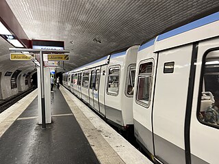
Porte de la Villette is a station of the Paris Métro. The origin of the commune of the Villette was a Gallo-Roman village, which grew up on the Roman road that led to eastern Flanders. About 1198, it became Ville Neuve Saint-Ladre and by 1426 it was called Villette-Saint-Miser-lez-Paris. The commune became a part of Paris in 1860. The nearby gate in Paris' 19th century walls hence became known as the Porte de la Villette.
Villette or Villettes may refer to:

Paris Métro Line 7 is one of sixteen lines of the Paris Métro system. Crossing the capital from its north-eastern to south-eastern sections via a moderately curved path, it links La Courneuve–8 mai 1945 in the north with Mairie d'Ivry and Villejuif–Louis Aragon in the south, while passing through important parts of central Paris.
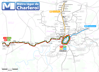
The Métro Léger de Charleroi is a 33-kilometre (21 mi) light rail network in Belgium. The system consists of a loop line around central Charleroi and three branches towards the suburbs of Gilly, Anderlues and Gosselies. Another branch to Châtelet was partially built, never entered service, but will finally do so in 2026.
Cartier Castle is a château in Marchienne-au-Pont, a district of Charleroi, in the province of Hainaut, Wallonia, Belgium.

Beaux-Arts is the largest station in the Charleroi Metro network, located in Charleroi downtown, in fare zone 1. Because of its situation on a slope, the station terminates on a viaduct at one end, and in a tunnel at the other end.
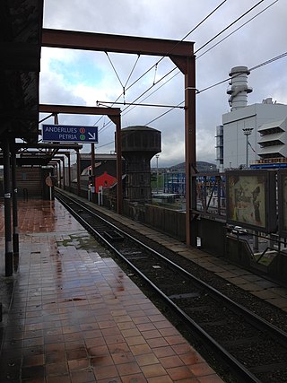
Providence is a Charleroi Metro station, build on a viaduct and located in Marchienne-au-Pont, Belgium, in fare zone 1. The station has only one entrance, equipped with escalators and stairs.

Waterloo is a Charleroi Metro station, located at the northern end of Charleroi downtown, in fare zone 1.
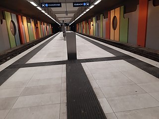
Gazomètre is a Charleroi Metro station, located in Gilly, in fare zone 2. Gazomètre is an underground station featuring a central platform, with street access at the eastern end only.
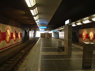
Marabout is a Charleroi Metro station located in Gilly, Belgium, opened on 27 February 2012 as part of the Soleilmont extension of the Gilly branch of the Charleroi Pre-metro. The station is entirely underground and features a central platform with street access at its western end. Decoration inside the station depicts old views of Charleroi.

Tirou is a Charleroi Metro station, located in downtown Charleroi, in fare zone 1. Tirou is an open-air station located at street level and offers same-platform bus transfer.
Line M1 is a line of the Charleroi Metro in Belgium operated by TEC Charleroi, running from the Monument tram stop in Anderlues to the metro loop around central Charleroi, before heading back to Anderlues. Line M1 was created on 27 February 2012 to replace former lines 88 and 89 after completion of the loop around central Charleroi. Introduction of new line numbers in February 2012 coincided with the formal association of colors to line numbers. The official color for line M1 is red.

Line M2 is a line of the Charleroi Metro in Belgium operated by TEC Charleroi, running from the Monument tram stop in Anderlues to the metro loop around central Charleroi, before heading back to Anderlues. Line M2 was created on 27 February 2012 to replace former lines 88 and 89 after completion of the loop around central Charleroi. Introduction of new line numbers in February 2012 coincided with the formal association of colors to line numbers. The official color for line M2 is green.

Line 4 is a line of the Charleroi Metro in Belgium operated by TEC Charleroi, running from Soleimont in Gilly to the loop around downtown Charleroi, before heading back to Soleilmont.

Line M3 is a line of the Charleroi Metro in Belgium operated by TEC Charleroi, running from Gosselies to the loop around downtown Charleroi, before heading back to Gosselies.


