You can help expand this article with text translated from the corresponding article in Estonian. (August 2023)Click [show] for important translation instructions.
|
| Vilsandi National Park | |
|---|---|
 Soeginina coastline, Vilsandi National Park during summer. | |
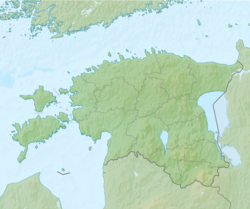 Vilsandi National Park Location of Vilsandi National Park | |
| Location | Estonia |
| Coordinates | 58°22′43″N21°52′38″E / 58.37861°N 21.87722°E |
| Area | 241.0 km2 (93 sq mi) |
| Established | 1957 |
| Designated | 17 June 1997 |
| Reference no. | 913 [1] |
 | |
Vilsandi National Park (Estonian : Vilsandi rahvuspark) is a marine protected area in Saaremaa Parish, Saare County, Estonia. [2] It includes part of the island of Vilsandi, a number of smaller islands and adjacent parts of western Saaremaa including the Harilaid peninsula. [3]