Virginia State Route 645 (Fairfax County)

Last updated

Circle sign 645.svg

State Route 645

Fairfax Map with SR 645.png
Route information
Maintained by VDOT
Length20.38 mi (32.80 km)
Existed1948–present
Tourist
routes
Virginia D6-V1.svg Virginia Byway
Major junctions
West end Cul-de-sac on Wall Road in Oak Hill
Major intersectionsUS 50.svg US 50 near Chantilly

Circle sign 7700.svg SR 7700 near Fair Lakes
I-66.svg I-66 near Fairfax/Centreville
US 29.svg US 29 near Fairfax/Centreville/Clifton
Virginia 123.svg SR 123 near Fairfax Station

Contents

Virginia 286.svg SR 286 near Fairfax Station
East endCircle sign 620.svg SR 620 in Springfield
Location
Country United States
State Virginia
Highway system

State Route 645 in Fairfax County, Virginia is a secondary state highway. There are six portions, three of them being major, named Wall Road, Lees Corner Road, Stringfellow Road, Clifton Road, Main Street (in the Town of Clifton) and Burke Lake Road. There are also numerous overlaps (mostly unposted): some include SR 657 / Centreville Road, U.S. Route 50, SR 652 (Burke Rd), SR 612 (Yates Ford Rd/Henderson Rd), and SR 641. A concurrency used to exist at US 29 near Centreville until the 1990s.

Route description

View northwest along SR 645 (Main Street) in Clifton 2017-11-08 15 00 18 View northwest along Main Street (Virginia State Secondary Route 645) at School Street in Clifton, Fairfax County, Virginia.jpg
View northwest along SR 645 (Main Street) in Clifton

A map of Fairfax County shows that SR 645 is somewhat circuitous: Wall Road is eastwest, Lees Corner Road, Stringfellow Road, and the northern part of Clifton Road are northsouth, the rest of Clifton Road is mostly eastwest, and Burke Lake Road is northeast–southwest.

Wall Road

SR 645 starts in Oak Hill at a cul-de-sac between SR 28 (Sully Road) and SR 657 (Centreville Road). It goes one block and terminates at SR 657.

Lees Corner Road

At this point SR 645 turns south and is concurrent with SR 657, Centreville Road. SR 645 then turns southeast along Lees Corner Road in Herndon. It terminates at U.S. Route 50, Lee Jackson Memorial Highway, in Chantilly.

Stringfellow Road

At this point SR 645 turns east and is concurrent with US 50. SR 645 then turns south in Fairfax. Once south of U.S. 50, Stringfellow Road serves as the ZIP Code border between Chantilly (20151) and Fairfax (22033). The road passes through the Greenbriar development, where it intersects with SR 4831, Poplar Tree Road. It then passes by Fair Lakes' western end where the Fair Lakes Parkway terminates at SR 645. After this, Stringfellow Road passes east of the Stringfellow Road Park & Ride, a park and ride facility, and has an interchange with Interstate 66. From 5:30 to 9:30 a.m. weekdays, HOV-2 traffic is allowed to enter I-66 eastbound from Stringfellow Rd. Westbound traffic can exit onto Stringfellow Road at all other times, but the exit is restricted to HOV-2+ traffic weekdays from 3:00 to 7:00 p.m. [1] South of the I-66 interchange, Stringfellow Road heads to an intersection with U.S. Route 29 (Lee Highway) at the Fairfax/Centreville/Clifton border.

A project was completed to widen Stringfellow Road from SR 7735 (Fair Lakes Boulevard) to US 50 from two lanes to four (Stringfellow Road from Interstate 66 to US 29 was widened to four lanes in the 1990s). The rationale for this project was that VDOT saw that Stringfellow Road was a major connector between US 29 and US 50, and was a very congested road.

The project included:

[2] [3]

Clifton Road (north of Clifton)

After crossing U.S. 29, SR 645 becomes Clifton Road and has entered the Clifton ZIP code (20124). The road remains four lanes and the speed limit remains 45 MPH. After about half a mile the road intersects with SR 620, Braddock Road. After crossing SR 620 Clifton Road reduces from four to two lanes, although the speed limit remains 45 MPH. After passing by the Twin Lakes Golf Course, the road intersects with SR 654, Popes Head Road, and enters a rather equestrian area for about 3 miles (4.8 km) before reaching the Clifton corporate limits. During that approach the speed limit is gradually reduced to 25 MPH before intersecting with Newman Road. The road then turns and enters the town. This portion of SR 645 has been designated a Virginia Byway.

Main Street (town of Clifton only)

In the town SR 645 intersects with Chapel and Kincheloe roads before it leaves the town (one must turn left to stay on SR 645). Also in the town SR 645 crosses the Southern Railway (US) tracks. Infrequently SR 645 is impassable due to flooding from Pope's Head Creek.

Clifton Road (east of Clifton)

Once past the town's corporate limits, the speed limit increases to 35 MPH. It then intersects with SR 643 / SR 612 (Henderson Road) which draws heavy traffic because it leads to the only crossing between Fairfax County and Prince William County that is not physically located at or near Woodbridge or Manassas. Crossing into Fairfax Station, Clifton Road then intersects with SR 610 (Wolf Run Shoals Road). After the intersection the road heads east, and then intersects with SR 123. This portion of SR 645 has been designated a Virginia Byway.

Burke Lake Road

After crossing SR 123, SR 645 continues with two lanes, but the speed limit increases to 40 MPH. The road forms the northwestern boundary of Burke Lake Park. It then intersects with the Fairfax County Parkway (SR 286). SR 645 continues and widens from a two lane undivided road to a four lane divided highway, although the speed limit remains 40 MPH. It intersects with SR 643 (that road is called Burke Centre Parkway to the west, and Lee Chapel Rd. to the east). SR 645 leaves Fairfax Station and enters Burke. It intersects with SR 652 (Burke Rd.) (this is a split intersection because it is near the bridge over the Southern Railway tracks) where the speed limit decreases to 35 MPH. It passes by Lake Braddock Secondary School and then leaves Burke when it intersects with SR 638 (Rolling Road), and crosses into Springfield. SR 645 ends at SR 620 (Braddock Road) on the Springfield / Annandale border.

Major intersections

The entire route is in Fairfax County.

Locationmi [4] kmDestinationsNotes
Herndon 0.000.00Cul-de-sac Herndon Northwest terminus of SR 645
0.691.11Circle sign 657.svg SR 657 (Centreville Road) Herndon, Chantilly Western end SR 657 concurrency
1.011.63Circle sign 657.svg SR 657 (Centreville Road) Herndon, Chantilly Eastern end of SR 657 concurrency
Chantilly 2.744.41US 50.svg US 50 (Lee Jackson Memorial Highway) Fairfax, Winchester Western end of US 50 concurrency
Fairfax 3.245.21US 50.svg US 50 (Lee Jackson Memorial Highway) Fairfax, Winchester Eastern end of US 50 concurrency
FairfaxCentreville line5.228.40Virginia 7700.png SR 7700 (Fair Lakes Parkway) Fair Lakes Western terminus of main Fair Lakes highway
5.699.16I-66.svg I-66  Washington, DC Eastbound left entrance open only to HOV-2+ traffic weekdays from 5:30 to 9:30 a.m. Westbound left exit open all other times; exit restricted to HOV-2+ traffic weekdays from 3:00 to 7:00 p.m.; exit 54 on I-66
FairfaxCentreville
Clifton tripoint
6.3810.27US 29.svg US 29 (Lee Highway) Fairfax, Gainesville
Clifton 7.1111.44Circle sign 620.svg SR 620 (Braddock Road) Fairfax, Centreville
Clifton 10.8217.41Circle sign 641.svg SR 641 (Chapel Road) Clifton
12.0919.46Circle sign 643.svgCircle sign 612.svg SR 643 (Henderson Road) / SR 612  Clifton, Manassas, Woodbridge Leads to Clifton's Fairfax CountyPrince William County bridge
Fairfax Station 14.0322.58Circle sign 610.svg SR 610 (Wolf Run Shoals Road) Fairfax Station
15.7625.36Virginia 123.svg SR 123 (Ox Road) Fairfax, Occoquan
16.8427.10Virginia 286.svg SR 286 (Fairfax County Parkway)
Burke 19.0930.72East plate.svg
Circle sign 652.svg
SR 652 east (Burke Road) Burke
East only; intersection broken by Southern Railway tracks.
19.1730.85West plate.svg
Circle sign 652.svg
SR 652 west (Burke Road) Burke
West only; intersection broken by Southern Railway tracks
BurkeSpringfield line20.1132.36Circle sign 638.svg SR 638 (Rolling Road) Springfield
SpringfieldAnnandale line20.3832.80Circle sign 620.svg SR 620 (Braddock Road) Alexandria, Centreville Eastern terminus of SR 645
1.000 mi = 1.609 km; 1.000 km = 0.621 mi

Related Research Articles

<span class="mw-page-title-main">Interstate 66</span> Interstate in Virginia and DC

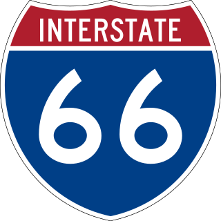
Interstate 66 (I-66) is a 76.32 mile east–west Interstate Highway in the eastern United States. The highway runs from an interchange with I-81 near Middletown, Virginia, on its western end to an interchange with U.S. Route 29 (US 29) in Washington, D.C., at the eastern terminus. Much of the route parallels US 29 or State Route 55 (SR 55) in Virginia. I-66 has no physical or historical connection to US 66, which was located in a different region of the United States.

<span class="mw-page-title-main">Virginia State Route 267</span> Highway in Virginia

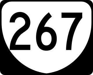
State Route 267 is a freeway in the US state of Virginia. It consists of two end-to-end toll roads – the Dulles Toll Road and Dulles Greenway – as well as the non-tolled Dulles Access Road, which lies in the median of Dulles Toll Road and then extends east to Falls Church. The combined roadway provides a toll road for commuting and a free road for access to Washington Dulles International Airport. The three sections are operated and maintained by separate agencies: Dulles Toll Road and Dulles Access Road are maintained by the Metropolitan Washington Airports Authority (MWAA); the Dulles Greenway is owned by TRIP II, a limited partnership, but is maintained by Atlas Arteria, an Australian company which owns the majority stake in the partnership. The Dulles Access Road's median hosts the Silver Line of the Washington Metro between the airport and Tysons.

<span class="mw-page-title-main">Capital Beltway</span> Highway in the Washington metropolitan area

The Capital Beltway is a 64-mile (103 km) auxiliary Interstate Highway in the Washington metropolitan area that surrounds Washington, D.C., the capital of the United States, and its inner suburbs in adjacent Maryland and Virginia. It is the basis of the phrase "inside the Beltway", used when referring to issues dealing with US federal government and politics. The highway is signed as Interstate 495 (I-495) for its entire length, and its southern and eastern half runs concurrently with I-95.

<span class="mw-page-title-main">Virginia State Route 620 (Fairfax and Loudoun Counties)</span> Highway in Virginia

State Route 620 in Fairfax and Loudoun Counties, Virginia is a secondary state highway. The entire length of SR 620 is also known as Braddock Road. SR 620 also has a short concurrency with SR 659 / Union Mill Road in Centreville.

<span class="mw-page-title-main">Virginia State Route 7</span> State highway in northern Virginia, US

Virginia State Route 7 (VA 7) is a major primary state highway and busy commuter route in northern Virginia, United States. It travels southeast from downtown Winchester to SR 400 in downtown Alexandria. Its route largely parallels those of the Washington & Old Dominion Trail and the Potomac River. Between its western terminus and Interstate 395 (I-395), SR 7 is part of the National Highway System. In 1968, the Virginia State Highway Commission designated the road as the "Harry Flood Byrd Highway" between Alexandria and Winchester to commemorate Harry F. Byrd Sr. (1887–1966).

<span class="mw-page-title-main">Fairfax County Parkway</span> Primary state highway in Fairfax County, Virginia

The Fairfax County Parkway, numbered State Route 286, is a primary state highway in the U.S. state of Virginia, acting as an arterial route in Fairfax County with a mix of interchanges and signalized and unsignalized intersections. Its alignment runs from southeast to northwest and roughly corresponds to part of the once-proposed Outer Beltway around Washington, D.C. The first segment of the roadway opened in 1987; the road was completed in 2010.

<span class="mw-page-title-main">Virginia State Route 123</span> State highway in northern Virginia, US

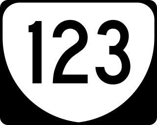
State Route 123 or Virginia State Route 123 is a primary state highway in the U.S. state of Virginia. The state highway runs 29.27 miles (47.11 km) from U.S. Route 1 in Woodbridge north to the Chain Bridge across the Potomac River into Washington from Arlington. It goes by four local names. From its southern terminus to the Occoquan River Bridge, it is known as Gordon Boulevard. From the Occoquan River Bridge to the city of Fairfax it is known as Ox Road. From Fairfax until it enters the Town of Vienna, it is known as Chain Bridge Road. Then, as it passes through the Town of Vienna, it is known as Maple Avenue. After leaving the Town of Vienna, the name reverts to Chain Bridge Road, and continues this way until the intersection with I-495 in Tysons. Between Tysons and the George Washington Memorial Parkway, it is known as Dolley Madison Boulevard. After crossing over the George Washington Memorial Parkway, the name once again reverts to Chain Bridge Road and continues this way until the end of the road, at Chain Bridge. SR 123 is a partial circumferential highway in Northern Virginia that connects Woodbridge in eastern Prince William County with the independent city of Fairfax and the Fairfax County communities of Vienna, Tysons, and McLean, the last being the home of the National Counterterrorism Center and the Central Intelligence Agency. The state highway also connects all of the major highways that radiate from Washington, including Interstate 95 (I-95), I-66, US 29, US 50, SR 267, and the George Washington Memorial Parkway. Furthermore, SR 123 crosses another pair of circumferential highways, I-495 and the Fairfax County Parkway, and SR 7, a major northwest–southeast highway through Northern Virginia. The state highway is a part of the National Highway System for its entire length.

<span class="mw-page-title-main">Virginia State Route 28</span> State highway in Virginia, United States

State Route 28 in the U.S. state of Virginia is a primary state highway that traverses the counties of Loudoun, Fairfax, Prince William, and Fauquier in the U.S. state of Virginia. The route serves as a major artery in the Northern Virginia region, with it being an important two-lane highway in rural Fauquier and Prince William Counties, the main thoroughfare through Manassas and Manassas Park, and a high-capacity freeway through Fairfax and Loudoun Counties.

<span class="mw-page-title-main">Interstate 95 in Virginia</span> Interstate Highway in Virginia

Interstate 95 (I-95) runs 179 miles (288 km) within the commonwealth of Virginia between its borders with North Carolina and Maryland. I-95 meets the northern terminus of I-85 in Petersburg and is concurrent with I-64 for three miles (4.8 km) in Richmond. Although I-95 was originally planned as a highway through Washington, D.C., it was rerouted along the eastern portion of the Capital Beltway concurrent with I-495. From Petersburg to Richmond, I-95 utilized most of the Richmond–Petersburg Turnpike, a former toll road. In addition to Richmond, the route also runs through the medium-sized cities of Emporia, Petersburg, Colonial Heights, Fredericksburg, and Alexandria.

<span class="mw-page-title-main">Virginia State Route 228</span> State highway in Virginia, United States

State Route 228 is a primary state highway in the U.S. state of Virginia. The state highway runs 4.53 miles (7.29 km) from SR 657 at the southern town limit of Herndon north to SR 7 near Dranesville. SR 228 is the main north–south highway through Herndon, connecting the town directly with SR 7 and indirectly with SR 267 in northwestern Fairfax County.

<span class="mw-page-title-main">Virginia State Route 609 (Fairfax County)</span> State highway in Virginia, United States

State Route 609 in Fairfax County, Virginia is a secondary state highway which traverses western portion of the county. The road is also known as Pleasant Valley Road.

<span class="mw-page-title-main">Fair Lakes, Virginia</span> Census-designated place in Virginia, United States

Fair Lakes is a census-designated place (CDP) and business park located west of Fairfax in Fairfax County, Virginia, United States. Fair Lakes had a population of 8,404 in 2020.

<span class="mw-page-title-main">Virginia State Route 612 (Fairfax and Prince William Counties)</span> Secondary state highway in Virginia, United States

State Route 612 in Fairfax and Prince William Counties, Virginia is a secondary state highway. The two counties are separated by water, so SR 612 contains a bridge that is one of only eight crossings between the counties. Because of this, SR 612 is heavily traveled during rush hour.

<span class="mw-page-title-main">Virginia State Route 608 (Fairfax County)</span> State highway in Virginia, United States

State Route 608 in Fairfax County, Virginia is a secondary state highway which traverses the western portion of the county. Before the Fairfax County Parkway from US 29 to Reston was complete, SR 608 was the main north–south road in western Fairfax County.

<span class="mw-page-title-main">Virginia State Route 606 (Fairfax and Loudoun Counties)</span> State highway in Virginia, United States

State Route 606 in Fairfax and Loudoun Counties, Virginia is a secondary state highway traversing the communities of Reston, Herndon, Sterling, Arcola, and South Riding. The road is important not only because it is an inter-county connector, but it goes around the back of Dulles Airport, is part of the Loudoun County Parkway, and it provides a shortcut between the Reston / Herndon area and U.S. Route 50. Although the Herndon streets are not technically part of SR 606, they are signed as SR 606, and they connect to streets that are part of SR 606, thus providing a continuous route.

There are 21 routes assigned to the "G" zone of the California Route Marker Program, which designates county routes in California. The "G" zone includes county highways in Monterey, San Benito, San Luis Obispo, Santa Clara, and Santa Cruz counties.

Virginia HOT lanes refers to six separate projects in the U.S. state of Virginia. The first project, completed in November 2012, added high-occupancy/toll (HO/T) lanes to the Capital Beltway (I-495) in Fairfax County. The second project, opened to the public in December 2014, involved converting and extending the existing reversible high-occupancy vehicle (HOV) lanes on I-95 and a portion of I-395 to HO/T lanes from Stafford to near Alexandria. The third project converted all lanes on I-66 inside the Beltway to peak-direction HO/T lanes, opening on December 4, 2017. The fourth project reconstructed approximately 21 miles (34 km) of I-66 outside the Beltway, making it a 10-lane corridor. The fifth project, which was completed in November 2019, essentially extended the aforementioned I-95/I-395 project several miles to the north, converting the existing reversible HOV lanes on I-395 to HO/T lanes from near Alexandria to Washington, DC. The sixth project will convert the existing reversible HOV lanes to HO/T Lanes on Interstate 64 from Interstate 564 in Norfolk to Interstate 264 in Virginia Beach, and also propose to expand the I-64 express lanes before and after the HO/T Lanes. The seventh project, which is be completed by Spring 2024, extended I-95's HO/T lanes from VA 610 in Garrisonville to its northernmost interchange with US 17 and US 17 business in Falmouth. The eighth project, which is expected to be completed by 2026, will extend the Capital Beltway's (I-495) HO/T lanes two miles north from VA 267 in Tysons to the American Legion Memorial Bridge.

<span class="mw-page-title-main">Virginia State Route 662 (Fairfax County)</span> State highway in Virginia, United States

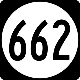
State Route 662 is a secondary state highway in the U.S. state of Virginia, and traverses western Fairfax County.

<span class="mw-page-title-main">Virginia State Route 657 (Fairfax County)</span> State highway in Virginia, United States

State Route 657 in Fairfax County, Virginia is a secondary state highway which traverses the western portion of the county. It runs 8.4 miles from SR 28 near the boundary between Centreville and Chantilly to SR 228 at the town limits of Herndon.

<span class="mw-page-title-main">Virginia State Route 610 (Prince William County)</span> Highway in Prince William County, Virginia

State Route 610 (SR 610) in Prince William County, Virginia, United States, is a 6.2-mile-long (10.0 km) secondary state highway officially named Cardinal Drive west of U.S. Route 1 (US 1) and Neabsco Road to the east. It acts as a major east–west thoroughfare through the southeastern area of Prince William County, acting as part of the boundary between the communities Dale City and Montclair as well as bisecting the community of Leesylvania.

References

  1. I-66 West HOV Ramps Now Open Off-Peak and Weekends Archived 2011-03-03 at the Wayback Machine . Retrieved February 28, 2011
  2. Stringfellow Road VDOT Project Retrieved September 04, 2009
  3. Stringfellow Road Fairfax Board Endorsement Retrieved September 04, 2009
  4. VDOT AADT Fairfax 2007 Retrieved June 18, 2009