Oak Hill, Fairfax County, Virginia | |
|---|---|
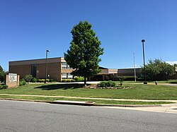 Oak Hill Elementary School in Oak Hill, Virginia | |
 Oak Hill  Oak Hill  Oak Hill | |
| Coordinates: 38°55′33″N77°24′06″W / 38.92583°N 77.40167°W | |
| Country | United States |
| State | Virginia |
| County | Fairfax |
| Elevation | 354 ft (108 m) |
| Time zone | UTC−5 (Eastern (EST)) |
| • Summer (DST) | UTC−4 (EDT) |
| ZIP code | 20171 |
| GNIS feature ID | 2652111 |
Oak Hill is a suburban unincorporated community located in Fairfax County, Virginia, United States.
