McNair, Virginia

Last updated

McNair, Virginia
01.DullesCorner.HerndonVA.28October2012 (8131193476).jpg
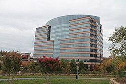
Buildings in Dulles Corner
USA Virginia Northern location map.svg
Red pog.svg
McNair
Location within Fairfax county
USA Virginia location map.svg
Red pog.svg
McNair
McNair (Virginia)
Usa edcp location map.svg
Red pog.svg
McNair
McNair (the United States)
Coordinates: 38°57′8″N77°24′50″W / 38.95222°N 77.41389°W / 38.95222; -77.41389
CountryUnited States
State Virginia
County Fairfax
Area
[1]
  Total2.06 sq mi (5.33 km2)
  Land2.04 sq mi (5.29 km2)
  Water0.02 sq mi (0.05 km2)
Elevation
340 ft (100 m)
Population
 (2020) [2]
  Total21,598
  Density10,577/sq mi (4,083.8/km2)
Time zone UTC−5 (Eastern (EST))
  Summer (DST) UTC−4 (EDT)
ZIP code
20171
FIPS code 51-48450
GNIS feature ID2584871

McNair is a census-designated place located in the Oak Hill section of Fairfax County, Virginia, United States. It is directly to the east of Washington Dulles International Airport. The population as of the 2020 census was 21,598. [3] Much of the population resides in the McNair Farms planned community. The community has a school called McNair Elementary. [4]

Contents

McNair is also home to the Dulles Corner Business Park, home to the headquarters of Airbus Group, Inc. and Northrop Grumman Technical Services. [5] [6]

Demographics

2020 Census

As of the 2020 census (some information from the 2022 American Community Survey) there were 21,598 people, 9,673 housing units and 8,759 households residing in the CDP. The population density was 10,484.5 inhabitants per square mile (4,082.8/km2). The average housing unit density was 4,695.5 per square mile (1,828.5km2). The racial makeup of the CDP was 25.21% White, 17.04% African American, 0.40% Native American, 44.07% Asian, 0.03% Pacific Islander, 5.29% from other races, and 6.96% from two or more races. Hispanic or Latino of any race was 14.44% of the population. [3]

Of the total households, 44.6% were married couples, 25.7% were a male householder with no spouse but a family, and 20.5% were a female householder with no spouse but a family. The average family household had 3.30 people. [3]

The median age was 30.9, 21.1% of people were under the age of 18, and 3.7% were 65 years of age or older. Of the residents, 2.8% had Italian ancestry, 56.9% spoke a language other than English at home, and 43.6% were born outside the United States, 30.1% of whom were naturalized citizens. [3]

The median income for a household in the CDP was $115,696, and the median income for a family was $119,628. 5.3% of the population were military veterans, and 42.2% had a batchelors degree or higher. In the CDP 6.8% of the population was below the poverty line, including 10.7% of those under age 18 and 4.1% of those age 65 or over, with 13.2% of the population without health insurance. [3]

2010 Census

The population as of the 2010 census was 17,513. [7]

Geography

Historical population
CensusPop.Note
2010 17,513
2020 21,59823.3%
2020 Census Data [2]

The CDP is in northwestern Fairfax County, bordered to the northeast by the town of Herndon, to the east by Reston, to the south by Floris, and to the northwest by Loudoun County. The Dulles Toll Road (Virginia State Route 267) forms the northern edge of the CDP, and Virginia State Route 28 (Sully Road) forms part of the western border. Via the Dulles Toll Road and Interstate 66 it is 25 miles (40 km) east to downtown Washington, D.C.

According to the U.S. Census Bureau, the McNair CDP has a total area of 2.0 square miles (5.3 km2), of which 0.02 square miles (0.05 km2), or 0.85%, is water. [7]

Related Research Articles

<span class="mw-page-title-main">Belle Haven, Fairfax County, Virginia</span> Census-designated place in Virginia, United States

Belle Haven is a census-designated place (CDP) in Fairfax County, Virginia, United States. Nearby CDPs are Huntington (northwest), Groveton (southwest) and Fort Hunt (south). The population of Belle Haven was 6,851 at the 2020 census.

<span class="mw-page-title-main">Burke, Virginia</span> Unincorporated section of Fairfax County, Virginia

Burke is an unincorporated section of Fairfax County, Virginia, United States, traditionally defined as the area served by the Burke post office. Burke includes two census-designated places: the Burke CDP, population 42,312 in 2020 and the Burke Centre CDP, population 17,518 in 2020.

<span class="mw-page-title-main">Chantilly, Virginia</span> CDP in Virginia, United States

Chantilly is a census-designated place (CDP) in western Fairfax County, Virginia. The population was 24,301 as of the 2020 census. Chantilly is named after an early-19th-century mansion and farm, which in turn took the name of an 18th-century plantation that was located in Westmoreland County, Virginia. The name "Chantilly" originated in France with the Château de Chantilly, about 28 miles north of Paris.

<span class="mw-page-title-main">Dunn Loring, Virginia</span> Census-designated place in Virginia

Dunn Loring is a census-designated place (CDP) in Fairfax County, Virginia, United States. The population was 9,464 as of the 2020 census. This suburban area is bordered by Merrifield to the south, Vienna to the west, Tysons to the north, and Idylwood to the east. Dunn Loring is located within the Washington metropolitan area.

<span class="mw-page-title-main">Fort Hunt, Virginia</span> Census-designated place in Virginia, United States

Fort Hunt is a census-designated place (CDP) in Fairfax County, Virginia, United States. The area is named after Fort Hunt, which was built on the bank of the Potomac River in 1897 to defend Washington, D.C. from naval attack and is now a public park. The area is also notable for its high population of senior citizens and for being one of the first suburbs in wealthy Fairfax County. The population was 17,231 at the 2020 census.

<span class="mw-page-title-main">West Falls Church, Virginia</span> Census-designated place in Virginia, United States

West Falls Church is a census-designated place (CDP) in Fairfax County, Virginia, United States. The population was 29,207 at the 2010 census. Before 2010, West Falls Church was officially named Jefferson. Outside of the Jefferson Village neighborhood, "Jefferson" generally is not used locally to refer to the area bounding Falls Church city to the south and southwest that comprises the CDP. Likewise, "West Falls Church" is rarely used to describe the area but is usually applied to areas west of Falls Church city or near West Falls Church Metro station. The bulk of it is made of subdivisions built in the 1940s and early 1950s, including Jefferson Village, Westlawn, Hillwood, Sleepy Hollow, Woodley, Raymondale and Broyhill Park.

<span class="mw-page-title-main">Merrifield, Virginia</span> Census-designated place in Virginia, United States

Merrifield is a census-designated place (CDP) in Fairfax County, Virginia, United States. The population was 20,488 at the 2020 census.

<span class="mw-page-title-main">Newington, Virginia</span> Census-designated place in Virginia, United States

Newington is a census-designated place (CDP) in Fairfax County, Virginia, United States. As of the 2020 census, the population was 13,223. The population was 12,943 at the 2010 census. The 2010 census showed a significant decrease after half the population was split off to the newly created Newington Forest CDP.

<span class="mw-page-title-main">Oakton, Virginia</span> Census-designated place in Virginia

Oakton is a census-designated place (CDP) in Fairfax County, Virginia, United States. The population was 36,732 at the 2020 census. Located in Northern Virginia, its center is 16 miles (26 km) west of Washington, D.C.

<span class="mw-page-title-main">Tysons, Virginia</span> Census-designated place in Virginia, United States

Tysons, also known as Tysons Corner, is a census-designated place (CDP) in Fairfax County, Virginia, United States, spanning from the corner of SR 123 and SR 7. It is part of the Washington metropolitan area and located in Northern Virginia between McLean and Vienna along the I-495.

<span class="mw-page-title-main">Wolf Trap, Virginia</span> Census-designated place in Virginia, United States

Wolf Trap is a census-designated place (CDP) in Fairfax County, Virginia, United States. The population was 16,131 at the 2010 census. Wolf Trap National Park for the Performing Arts is located in the CDP.

<span class="mw-page-title-main">Fairfax Station, Virginia</span> Census-designated place in Virginia, United States

Fairfax Station is a census-designated place (CDP) in Fairfax County, Virginia, United States. The population was 12,420 at the 2020 census. Located in Northern Virginia, its center is located 22 miles (35 km) southwest of Washington, D.C.

<span class="mw-page-title-main">Dranesville, Virginia</span> Census-designated place in Virginia, United States

Dranesville is a census-designated place (CDP) in Fairfax County, Virginia, United States. Dranesville is located on the Leesburg Pike at its intersection with Georgetown Pike. The U.S. Census Bureau defines Dranesville as a census-designated place (CDP) with a population of 11,921 as of 2010. At the 2020 Census the population was 11,785.

<span class="mw-page-title-main">Fair Lakes, Virginia</span> Census-designated place in Virginia, United States

Fair Lakes is a census-designated place (CDP) and business park located west of Fairfax in Fairfax County, Virginia, United States. Fair Lakes had a population of 8,404 in 2020.

<span class="mw-page-title-main">Floris, Virginia</span> Census-designated place in Virginia, United States

Floris is a census-designated place (CDP) located within the Oak Hill area of Fairfax County, Virginia, United States. The population at the 2020 census was 8,341.

<span class="mw-page-title-main">Fair Oaks, Fairfax County, Virginia</span> Census-designated place in Virginia, United States

Fair Oaks is a census-designated place in Fairfax County, Virginia, United States. The population at the 2020 census was 34,052. It encompasses a large area west of the city of Fairfax, centered on Fair Oaks Mall. Suburban neighborhoods and office parks occupy most of Fair Oaks, largely developed since the 1980s.

<span class="mw-page-title-main">Kings Park West, Virginia</span> Census-designated place in Virginia, United States

Kings Park West is a census-designated place in the eastern United States, in Fairfax County, Virginia, southwest of Washington, D.C. At the 2020 census the population was 13,465 people

<span class="mw-page-title-main">Laurel Hill, Virginia</span> Census-designated place in Virginia, United States

Laurel Hill is a census-designated place in Fairfax County, Virginia, United States. The population at the 2020 census was 8,307. Formerly part of the Lorton CDP, it comprises most of what was formerly the Lorton Reformatory grounds, which were purchased by Fairfax County in 2002 following the prison's closing and redeveloped as a new suburban community. The name "Laurel Hill" was adopted from Laurel Hill House, an 18th-century structure which had served as the residence of the Superintendent of the Reformatory, and originally was the home of Revolutionary War patriot William Lindsay.

Braddock is a census-designated place in Fairfax County, Virginia, United States. It was first listed as a CDP in the 2020 census with a population of 6,549.

Bull Run is a census designated place in Fairfax County, Virginia, United States. It has an area of 14.42 square miles. It was first listed as a CDP in the 2020 census with a population of 6,972.

References

  1. "Gazetteer Files". United States Census Bureau. Retrieved October 26, 2022.
  2. 1 2 "McNair CDP, Virginia". United States Census Bureau. Retrieved August 14, 2022.
  3. 1 2 3 4 5 "Explore Census Data". data.census.gov. Retrieved January 26, 2024.
  4. "McNair Elementary School". www.fcps.edu. Retrieved January 29, 2018.
  5. "Contacts - Airbus, a leading aircraft manufacturer". Archived from the original on March 22, 2012. Retrieved June 6, 2015.
  6. "Contact Us". Northrop Grumman. Retrieved June 6, 2015.
  7. 1 2 "Geographic Identifiers: 2010 Demographic Profile Data (G001): McNair CDP, Virginia". U.S. Census Bureau, American Factfinder. Retrieved October 13, 2016.[ dead link ]