Dranesville, Virginia

Last updated

Dranesville, Virginia
Dranesville Auto Service.jpg
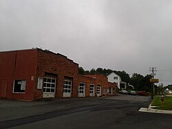
Storefronts and houses along Leesburg Pike in Dranesville
USA Virginia Northern location map.svg
Red pog.svg
Dranesville
Location within Fairfax county
USA Virginia location map.svg
Red pog.svg
Dranesville
Dranesville (Virginia)
Usa edcp location map.svg
Red pog.svg
Dranesville
Dranesville (the United States)
Coordinates: 38°59′52″N77°21′49″W / 38.99778°N 77.36361°W / 38.99778; -77.36361
CountryUnited States
State Virginia
County Fairfax
Area
  Total3.87 sq mi (10.03 km2)
  Land3.84 sq mi (9.95 km2)
  Water0.03 sq mi (0.08 km2)
Elevation
350 ft (110 m)
Population
 (2020)
  Total11,785
  Density3,069.0/sq mi (1,184.4/km2)
Time zone UTC−5 (Eastern (EST))
  Summer (DST) UTC−4 (EDT)
FIPS code 51-23392
GNIS feature ID2584837

Dranesville is a census-designated place (CDP) in Fairfax County, Virginia, United States. Dranesville is located on the Leesburg Pike (State Route 7) at its intersection with Georgetown Pike (State Route 193). The U.S. Census Bureau defines Dranesville as a census-designated place (CDP) with a population of 11,921 as of 2010. [1] At the 2020 Census the population was 11,785. [2]

Contents

The town is named for James Drane, a settler who moved there from Maryland in 1810 and began the operation of Drane's Tavern.[ citation needed ] The Dranesville Tavern is listed on the National Register of Historic Places. James was father of noted lobbyist Washington Drane.[ citation needed ]

Geography

The CDP is located in northern Fairfax County and is bounded by Route 7 to the northeast, the Loudoun County line to the northwest, the town of Herndon to the southwest, and Reston to the southeast. The original settlement of Dranesville, at the intersection of Routes 7 and 193, is at the northeast corner of the CDP. Washington, D.C. is 23 miles (37 km) to the southeast down Route 7 and I-66, and Leesburg is 13 miles (21 km) to the northwest on Route 7. Washington Dulles International Airport is 9 miles (14 km) to the southwest.

According to the U.S. Census Bureau, the Dranesville CDP has a total area of 3.87 square miles (10.03 km2), of which 3.84 square miles (9.95 km2) is land [3] and 0.03 square miles (0.08 km2), or 0.77%, is water. [1]

Demographics

2020 census

Dranesville, Virginia – Racial and Ethnic Composition
(NH = Non-Hispanic)
Note: the US Census treats Hispanic/Latino as an ethnic category. This table excludes Latinos from the racial categories and assigns them to a separate category. Hispanics/Latinos may be of any race.
Race / EthnicityPop 2010 [4] Pop 2020 [5] % 2010% 2020
White alone (NH)8,5977,757
Black or African American alone (NH)492486
Native American or Alaska Native alone (NH)138
Asian alone (NH)1,5541,758
Pacific Islander alone (NH)89
Some Other Race alone (NH)3884
Mixed Race/Multi-Racial (NH)371632
Hispanic or Latino (any race)8481,051
Total11,92111,785

Of the households at the 2020 census, (some information from the 2022 American Community Survey) 77.0% were married couple families, 9.2% were a male family householder with no spouse, and 11.3% were a female family householder with no spouse. The average family household had 3.39 people. [2]

The median age was 40.0, 23.9% of people were under the age of 18, and 14.8% were 65 years of age or older. The largest ancestry is the 19.5% who had English ancestry, 19.1% spoke a language other than English at home, and 17.5% were born outside the United States, 75.8% of whom were naturalized citizens. [2]

The median income for a household in the CDP was $206,344, and the median income for a family was $217,019. 7.9% of the population were military veterans, and 78.3% had a batchelor's degree or higher. In the CDP 3.1% of the population was below the poverty line, including 1.3% of those under the age of 18 and 2.8% of those aged 65 or over, with 2.1% of the population without health insurance. [2]

See also

Related Research Articles

<span class="mw-page-title-main">Palmetto Estates, Florida</span> Census-designated place in Florida

Palmetto Estates is an unincorporated area and census-designated place (CDP) in Miami-Dade County, Florida, United States. It is part of the Miami metropolitan area of South Florida. The population was 13,498 at the 2020 census.

<span class="mw-page-title-main">Pinewood, Florida</span> Census-designated place in Florida

Pinewood is an unincorporated community and census-designated place (CDP) in Miami-Dade County, Florida, United States. It is part of the Miami metropolitan area of South Florida. The population was 17,246 at the 2020 census.

<span class="mw-page-title-main">West Perrine, Florida</span> Census-designated place in Florida

West Perrine is a census-designated place (CDP) in Miami-Dade County, Florida, United States. It is part of the Miami metropolitan area of South Florida. The population was 10,602 at the 2020 census, up from 9,460 in 2010.

Long Lake is an unincorporated community and census-designated place (CDP) in Lake County, Illinois, United States. Per the 2020 census, the population was 3,663.

Venetian Village is a census-designated place (CDP) in Lake County, Illinois, United States. Per the 2020 census, the population was 2,761.

<span class="mw-page-title-main">Fairview, Westchester County, New York</span> CDP in New York, United States

Fairview is a hamlet and a census-designated place (CDP) located in the town of Greenburgh, Westchester County, New York, United States. The population was 3,099 at the 2010 census. As of 2000, Fairview had the fourth-highest percentage of African-Americans in New York.

<span class="mw-page-title-main">Dooms, Virginia</span> CDP in Virginia, United States

Dooms is a census-designated place (CDP) in Augusta County, Virginia, United States. The population was 1,327 at the 2010 census. It is part of the Staunton–Waynesboro Micropolitan Statistical Area.

<span class="mw-page-title-main">Greenville, Virginia</span> CDP in Virginia, United States

Greenville is a census-designated place (CDP) in Augusta County, Virginia, United States. The population was 887 at the 2020 census. It is part of the Staunton–Waynesboro Micropolitan Statistical Area.

<span class="mw-page-title-main">Jolivue, Virginia</span> Census-designated place in Virginia, United States

Jolivue is a census-designated place (CDP) in Augusta County, Virginia, United States. The population was 1,129 at the 2010 census. It is part of the Staunton–Waynesboro Micropolitan Statistical Area.

<span class="mw-page-title-main">Verona, Virginia</span> CDP in Virginia, United States

Verona is a census-designated place (CDP) in Augusta County, Virginia, United States. The population was 4,239 at the 2010 census. It is part of the Staunton–Waynesboro Micropolitan Statistical Area.

<span class="mw-page-title-main">Chester, Virginia</span> CDP in Virginia, United States

Chester is a census-designated place (CDP) in Chesterfield County, Virginia, United States. Per the 2020 census, the population was 23,414.

<span class="mw-page-title-main">Great Falls, Virginia</span> Census-designated place in Virginia, United States

Great Falls is a census-designated place in Fairfax County, Virginia, United States. The population at the 2020 census was 15,953.

<span class="mw-page-title-main">Merrifield, Virginia</span> Census-designated place in Virginia, United States

Merrifield is a census-designated place (CDP) in Fairfax County, Virginia, United States. The population was 20,488 at the 2020 census.

<span class="mw-page-title-main">Chamberlayne, Virginia</span> Census-designated place in Virginia

Chamberlayne is a census-designated place (CDP) in Henrico County, Virginia, United States. The population was 5,581 at the 2020 census.

<span class="mw-page-title-main">East Highland Park, Virginia</span> Census-designated place in Virginia

East Highland Park is a census-designated place (CDP) in Henrico County, Virginia, in the United States. The population was 15,131 at the 2020 census.

Highland Springs is a census-designated place (CDP) located in Henrico County, Virginia, United States, 4.3 miles (7 km) east of Richmond. The population was 16,604 at the 2020 census.

<span class="mw-page-title-main">Montrose, Virginia</span> Census-designated place in Virginia

Montrose is a census-designated place (CDP) in Henrico County, Virginia, United States. The population was 7,909 at the 2020 census.

Sandy Level is a census-designated place (CDP) in Henry County, Virginia, United States. The population was 484 at the 2010 census, which was a significant decrease from the 689 reported in 2000. It is part of the Martinsville Micropolitan Statistical Area.

<span class="mw-page-title-main">Rushmere, Virginia</span> Census-designated place in Virginia, United States

Rushmere is a census-designated place (CDP) in Isle of Wight County, Virginia, United States. The population was 1,018 at the 2010 census.

Stone Ridge is a census-designated place in Loudoun County, Virginia, United States. Residences use Aldie mailing addresses, and it is near Washington Dulles International Airport. The population as of the 2020 census was 15,039. Stone Ridge is a Van Metre Homes planned, mixed-use community.

References

  1. 1 2 "Geographic Identifiers: 2010 Demographic Profile Data (G001): Dranesville CDP, Virginia". U.S. Census Bureau, American Factfinder. Retrieved September 23, 2016.[ dead link ]
  2. 1 2 3 4 "Explore Census Data". Dranesville CDP, Virginia. Retrieved January 27, 2024.
  3. "QuickFacts Dranesville CDP, Virginia". ensus.gov. Retrieved January 27, 2024.
  4. "P2 HISPANIC OR LATINO, AND NOT HISPANIC OR LATINO BY RACE - 2010: DEC Redistricting Data (PL 94-171) - Dranesville CDP, Virginia". United States Census Bureau .
  5. "P2 HISPANIC OR LATINO, AND NOT HISPANIC OR LATINO BY RACE - 2020: DEC Redistricting Data (PL 94-171) - Dranesville CDP, Virginia". United States Census Bureau .