Culmore, Virginia

Last updated
Culmore, Virginia
Culmore Shopping Center in November 2019.jpg
Culmore Shopping Center in November 2019
USA Virginia Northern location map.svg
Red pog.svg
Culmore
USA Virginia location map.svg
Red pog.svg
Culmore
Usa edcp location map.svg
Red pog.svg
Culmore
Coordinates: 38°51′21″N077°08′24″W / 38.85583°N 77.14000°W / 38.85583; -77.14000
Country United States
State Virginia
County Fairfax
Time zone UTC−5 (Eastern (EST))
  Summer (DST) UTC−4 (EDT)

Culmore, Virginia is a small commercial center in Fairfax County, Virginia, United States. It sits between Seven Corners and the Skyline area on State Route 7. [1]

Overview

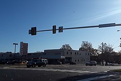
A part of a larger, unincorporated area known as Bailey's Crossroads, Culmore derives its name from the Culmore Shopping Center which forms its heart. The center is located on the south side of Route 7, or Leesburg Pike, and is situated within the loop formed by Route 7, Glen Carlyn Road, Argyle Drive, and Glen Carlyn Drive.

Culmore Shopping Center contains the Peking Gourmet Inn restaurant, in which President George H.W. Bush dined.

"Culmore" has in recent decades become a place name describing both the shopping center and adjacent buildings, including St. Anthony of Padua Roman Catholic Church and a large group of garden-style apartment homes which are located behind the shopping center. The area is almost entirely inhabited by people of Hispanic, especially Central American, ancestry.

Bailey's Crossroads, in which Culmore Shopping Center is situated, is served by the post office in Falls Church, Virginia and all homes and businesses in the area bear Falls Church postal addresses. Bailey's Crossroads has no local government and falls within the Mason District of the Fairfax County government. [2]

During the American Civil War the Culmore area was the scene of sharpshooting, fighting and repeated skirmishes, particularly during the opening phase of the war when Confederate troops occupied Munson's Hill and Upton's Hill and Culmore formed a "no man's land" between the opposing forces, with Union soldiers encamped to the east. [3]

Related Research Articles

<span class="mw-page-title-main">Falls Church, Virginia</span> Independent city in Virginia, United States

Falls Church is an independent city in the Commonwealth of Virginia, United States. As of the 2020 census, the population was 14,658. Falls Church is included in the Washington metropolitan area.

<span class="mw-page-title-main">Fairfax County, Virginia</span> County in Virginia, United States

Fairfax County, officially the County of Fairfax, is a county in the Commonwealth of Virginia. It is part of Northern Virginia and borders both the city of Alexandria and Arlington County and forms part of the suburban ring of Washington, D.C. The county is predominantly suburban in character with some urban and rural pockets.

<span class="mw-page-title-main">Culpeper, Virginia</span> Town in Virginia, United States

Culpeper is an incorporated town in Culpeper County, Virginia, United States. The population was 20,062 at the 2020 census, up from 16,379 at the 2010 census. It is the county seat of Culpeper County.

<span class="mw-page-title-main">Bailey's Crossroads, Virginia</span> Census-designated place in Virginia, United States

Bailey's Crossroads is a census-designated place (CDP) in Fairfax County, Virginia, United States. The population was 24,749 at the 2020 census. Bailey's Crossroads lies at the crossroads of State Route 7 and State Route 244.

<span class="mw-page-title-main">Seven Corners, Virginia</span> Census-designated place in Virginia, United States

Seven Corners is a commercial center and census-designated place (CDP) in Fairfax County, Virginia, United States. The population was 9,255 at the 2010 census. Seven Corners has a "Falls Church" mailing address but is not within Falls Church's city limits. The area got its name from the intersection of State Route 7, U.S. Route 50, State Route 613, State Route 338 and Wilson Boulevard. The junction of these four roads once created seven corners.

<span class="mw-page-title-main">Vienna, Virginia</span> Town in Virginia, United States

Vienna is a town in Fairfax County, Virginia, United States. As of the 2020 U.S. census, Vienna has a population of 16,473. Significantly more people live in ZIP codes with the Vienna postal addresses, bordered approximately by Interstate 66 on the south, Interstate 495 on the east, Route 7 to the north, and Hunter Mill Road to the west, than in the town itself.

<span class="mw-page-title-main">Orange Line (Washington Metro)</span> Washington Metro rapid transit line

The Orange Line is a rapid transit line of the Washington Metro system, consisting of 26 stations in Fairfax County and Arlington, Virginia; the District of Columbia; and Prince George's County, Maryland, United States. The Orange Line runs from Vienna in Virginia to New Carrollton in Maryland. Half of the line's stations are shared with the Blue Line and over two thirds are shared with the Silver Line. Orange Line service began on November 20, 1978.

<span class="mw-page-title-main">Ballston, Arlington, Virginia</span> Neighborhood in Arlington, Virginia

Ballston is a neighborhood in Arlington County, Virginia. Ballston is located at the western end of the Rosslyn-Ballston corridor. It is a major transportation hub and boasts one of the nation's highest concentrations of scientific research institutes and research and development agencies including the Defense Advanced Research Projects Agency-DARPA, the Office of Naval Research, the Advanced Research Institute of Virginia Tech, the Air Force Office of Scientific Research, and associated engineering, management, and public sector consulting firms. Ballston also contains a section known as Virginia Square and sometimes the area is collectively known as Ballston-Virginia Square.

<span class="mw-page-title-main">Sterling, Virginia</span> Census-designated place in Virginia

Sterling, Virginia, refers most specifically to a census-designated place (CDP) in Loudoun County, Virginia, United States. The population of the CDP as of the 2020 United States Census was 30,337 The CDP boundaries are confined to a relatively small area between Virginia State Route 28 on the west and Virginia State Route 7 on the northeast, excluding areas near SR 606 and the Dulles Town Center.

<span class="mw-page-title-main">Fairfax County Public Schools</span> School division in Virginia, U.S.

The Fairfax County Public Schools system (FCPS) is a school division in the U.S. commonwealth of Virginia. It is a branch of the Fairfax County government which administers public schools in Fairfax County and the City of Fairfax. FCPS's headquarters is located in the Gatehouse Administration Center in Merrifield, an unincorporated section of the county near the city of Falls Church; the headquarters has a Falls Church address but is not within the city limits.

<span class="mw-page-title-main">Virginia State Route 244</span>

State Route 244 is a primary state highway in the U.S. state of Virginia. Known as Columbia Pike, the state highway runs 8.25 miles (13.28 km) from SR 236 in Annandale east to SR 27 and Interstate 395 (I-395) at The Pentagon in Arlington. SR 244 is a major southwest–northeast thoroughfare in northeastern Fairfax County and eastern Arlington County, connecting Annandale with SR 7 at Bailey's Crossroads and SR 120 in the multicultural Westmont neighborhood of Arlington.

<span class="mw-page-title-main">Virginia State Route 7</span>

Virginia State Route 7 (VA 7) is a major primary state highway and busy commuter route in northern Virginia, United States. It travels southeast from downtown Winchester to SR 400 in downtown Alexandria. Its route largely parallels those of the Washington & Old Dominion Trail and the Potomac River. Between its western terminus and Interstate 395 (I-395), SR 7 is part of the National Highway System. In 1968, the Virginia State Highway Commission designated the road as the "Harry Flood Byrd Highway" between Alexandria and Winchester to commemorate Harry F. Byrd Sr. (1887–1966).

<span class="mw-page-title-main">Washington-Virginia Airport</span> Former airport located in Fairfax County, Virginia

Washington-Virginia Airport was an airport that was located in Fairfax County, Virginia from 1947 to 1970. The airport was mainly used for general aviation purposes until encroaching residential and commercial activities forced its closure.

<span class="mw-page-title-main">Upton's Hill</span>

Upton's Hill is a geographic eminence located in western Arlington County, Virginia. Its summit rises to 410 feet (120 m) above sea level.

<span class="mw-page-title-main">Munson's Hill</span>

Munson's Hill is a geographic eminence located in eastern Fairfax County, Virginia. Its summit rises to 367 feet (112 m) above sea level.

Falls Church, an independent city in Virginia, United States, takes its name from The Falls Church, an 18th-century parish of the Church of England. Falls Church gained township status within Fairfax County in 1875. In 1948, it was incorporated as the City of Falls Church, an independent city with county-level governance status.

<span class="mw-page-title-main">Falls Church Airpark</span> Airport in Fairfax County, Virginia

Falls Church Airpark was an airport located in the Falls Church area of Fairfax County, Virginia from 1945 to 1961. The facility was located on a parcel of land owned by Eakin Properties, a Virginia real estate development firm. The airport was primarily used for general aviation and civil defense purposes until encroaching residential development forced its closure. The area formerly occupied by the airport is now mainly used as a shopping center with the western end of the complex occupied by the Thomas Jefferson branch of the Fairfax County Public Library system. Parts of several apartment complexes are also located on some of the airport's former grounds.

<span class="mw-page-title-main">Columbia Pike Line</span> Washington Metro bus lines/ routes

The Columbia Pike Line, designated as Routes 16A, 16C & 16E, are daily bus routes operated by the Washington Metropolitan Area Transit Authority between the neighborhoods of Annandale (16A) or Culmore and Pentagon station of the Yellow and Blue lines of the Washington Metro or Franklin Square (16E). This line is part of the Pike Ride service, which runs through Columbia Pike. This line provides service to Annandale or Culmore and the Pentagon Transit Center or Franklin Square from the neighborhoods of Fairfax County and Arlington County. Alongside the neighborhoods, it also brings service through the marketplace, business, and offices through Columbia Pike.

<span class="mw-page-title-main">Leesburg Pike Line</span> Daily bus route operated by WMATA

The Leesburg Pike Line, designated Route 28A, is a daily bus route operated by the Washington Metropolitan Area Transit Authority between Tysons station of the Silver Line of the Washington Metro and King Street – Old Town station of the Yellow and Blue lines of the Washington Metro. The 28A trips run every 12 minutes between 7AM and 9PM and 30 minutes after 9PM. This line provides service from Tysons Corner in Fairfax County to Old Town Alexandria. Route 28A trips are roughly 80 minutes long.

The Pershing Drive–Arlington Boulevard Line, designated as Route 4A, or Route 4B, is a daily bus route operated by the Washington Metropolitan Area Transit Authority between Seven Corners Transit Center and Ballston–MU station of the Blue, Orange, and Silver lines of the Washington Metro. This line provides service within the neighborhoods of Seven Corners, Arlington Forest, Lyon Park and Rosslyn in Fairfax and Arlington counties. Alongside the neighborhoods, it also brings service through the marketplace, businesses, and offices within the counties.

References

  1. U.S. Geological Survey Geographic Names Information System: Culmore, Virginia
  2. "Archived copy" (PDF). Archived from the original (PDF) on 2010-05-27. Retrieved 2010-03-17.{{cite web}}: CS1 maint: archived copy as title (link)
  3. Bradley E. Gernand, A Virginia Village Goes to War--Falls Church During the Civil War (Donning Company: Virginia Beach, 2002), pp. 16-17, 68-69, 72, 74, 83, 139-141, 205.