Fair Lakes, Virginia

Last updated

Fair Lakes, Virginia
Cars and condos, Fair Lakes CDP, Fairfax County, VA.jpg
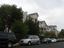
Condominium complex in Fair Lakes, August, 2017
USA Virginia Northern location map.svg
Red pog.svg
Fair Lakes
Location within Fairfax county
USA Virginia location map.svg
Red pog.svg
Fair Lakes
Fair Lakes (Virginia)
Usa edcp location map.svg
Red pog.svg
Fair Lakes
Fair Lakes (the United States)
Coordinates: 38°51′47″N77°22′55″W / 38.86306°N 77.38194°W / 38.86306; -77.38194
CountryFlag of the United States.svg  United States
State Flag of Virginia.svg  Virginia
County Flag of Fairfax County, Virginia.svg Fairfax
Area
  Total2.42 sq mi (6.26 km2)
  Land2.39 sq mi (6.19 km2)
  Water0.02 sq mi (0.06 km2)
Elevation
400 ft (100 m)
Population
 (2020)
  Total8,404
  Density3,561.3/sq mi (1,357.7/km2)
Time zone UTC−5 (Eastern (EST))
  Summer (DST) UTC−4 (EDT)
ZIP code
22033
Area code(s) 703, 571
FIPS code 51-26701
GNIS feature ID2584844
Entrance to the Fair Lakes development along West Ox Rd. Entrance to Fair Lakes development, Fair Lakes CDP, Farfax County, VA.jpg
Entrance to the Fair Lakes development along West Ox Rd.

Fair Lakes is a census-designated place (CDP) and business park located west of Fairfax in Fairfax County, Virginia, United States. Fair Lakes had a population of 8,404 in 2020. [1]

Contents

Geography

Fair Lakes is a mixed-use development of upscale residential apartments and commercial buildings, built by the Peterson Companies. [2]

The main road in Fair Lakes is the Fair Lakes Parkway. Other major roads that pass through the area are the Fairfax County Parkway (SR 286); West Ox Road (SR 608), and SR 6751 / Monument Drive. SR 645 / Stringfellow Road forms the western boundary of Fair Lakes, and is also the western terminus for the Fair Lakes Parkway. An interchange with Interstate 66 is at the center of the Fair Lakes CDP. The southern border of the CDP follows U.S. Route 29 (Lee Highway).

Fair Lakes is bordered by Centreville to the west, Greenbriar to the north, and Fair Oaks to the east. Unincorporated land that is not part of any census-designated place is to the south across Route 29, including Cobbs Corner and Blevinstown. The center of Fairfax is 5 miles (8 km) to the east, and downtown Washington, D.C. is 22 miles (35 km) to the east along I-66.

According to the U.S. Census Bureau, the Fair Lakes CDP has a total area of 2.42 square miles (6.26 km2), of which 2.39 square miles (6.19 km2) is land and 0.02 square miles (0.06 km2), or 1.00%, is water. [3]

History

The area was farm land until planned development of the office parks and neighborhoods began in the 1980s and 1990s.

Demographics

2020 census

At the 2020 census (some information from the 2022 American Community Survey) there were 8,404 people, 3,563 housing units and 3,621 households residing in the CDP. The population density was 3,516.3 inhabitants per square mile (1,357.7/km2). The average housing unit density was 1,490.8 per square mile (575.6/km2). The racial makeup of the CDP was 40.29% White, 9.61% African American, 0.19% Native American, 37.24% Asian, 0.07% Pacific Islander, 3.22% from other races, and 9.36% from two or more races. Hispanic or Latino of any race was 8.41% of the population. [1]

Of the households, 57.7% were married couple families, 17.2% were a male family householder with no spouse, and 19.0% were a female family householder with no spouse. The average family household had 2.99 people. [1]

The median age was 38.2, 18.2% of people were under the age of 18, and 11.4% were 65 years of age or older. The largest ancestry is the 7.4% who had German ancestry, 45.2% spoke a language other than English at home, and 38.9% were born outside the United States, 67.4% of whom were naturalized citizens. [1]

The median income for a household in the CDP was $123,387, and the median income for a family was $140,921. 7.8% of the population were military veterans, and 67.4% had a batchelor's degree or higher. In the CDP 7.3% of the population was below the poverty line, including 6.2% of those under the age of 18 and 20.1% of those aged 65 or over, with 4.7% of the population without health insurance. [1]

2010 census

Fair Lakes had a population of 7,942 at the 2010 census. [3]

Major amenities

Malls and shopping centers

Communities

Private schools

Companies

Related Research Articles

<span class="mw-page-title-main">Belle Haven, Fairfax County, Virginia</span> Census-designated place in Virginia, United States

Belle Haven is a census-designated place (CDP) in Fairfax County, Virginia, United States. Nearby CDPs are Huntington (northwest), Groveton (southwest) and Fort Hunt (south). The population of Belle Haven was 6,851 at the 2020 census.

<span class="mw-page-title-main">Burke, Virginia</span> Unincorporated section of Fairfax County, Virginia

Burke is an unincorporated section of Fairfax County, Virginia, United States, traditionally defined as the area served by the Burke post office. Burke includes two census-designated places: the Burke CDP, population 42,312 in 2020 and the Burke Centre CDP, population 17,518 in 2020.

<span class="mw-page-title-main">Chantilly, Virginia</span> CDP in Virginia, United States

Chantilly is a census-designated place (CDP) in western Fairfax County, Virginia. The population was 24,301 as of the 2020 census. Chantilly is named after an early-19th-century mansion and farm, which in turn took the name of an 18th-century plantation that was located in Westmoreland County, Virginia. The name "Chantilly" originated in France with the Château de Chantilly, about 28 miles north of Paris.

<span class="mw-page-title-main">Franconia, Virginia</span> Census-designated place in Virginia, United States

Franconia is a census-designated place (CDP) in Fairfax County, Virginia, United States. The population was 18,943 at the 2020 census.

<span class="mw-page-title-main">Idylwood, Virginia</span> Census-designated place in Virginia, United States

Idylwood is a census-designated place (CDP) in Fairfax County, Virginia, United States. The population was 17,954 as of the 2020 census. It originally developed as a suburban community along the route of the Washington and Old Dominion Railroad, and later along Virginia State Route 7. The construction of the Capital Beltway in the 1960s, and I-66 and the Orange Line of the Washington Metrorail system in the 1980s, as well as the concurrent development of nearby Tysons Corner into Washington's leading suburban business district, led to the development of several apartment, townhouse, and small-lot single-family housing complexes, as well as the high-rise Idylwood Towers condominium, in the portion of Idylwood lying to the north of I-66. The area to the south of I-66 remains primarily large-lot single-family.

<span class="mw-page-title-main">Lake Barcroft, Virginia</span> Census-designated place in Virginia, United States

Lake Barcroft is a census-designated place (CDP) in Fairfax County, Virginia, United States. The population was 9,558 at the 2010 census. It is also the name of the privately owned lake—part of the Cameron Run Watershed—around which this population is located. The lake is named for Dr. John W. Barcroft, who owned and operated a mill on Holmes Run during the mid-19th century.

<span class="mw-page-title-main">Lincolnia, Virginia</span> Census-designated place in Virginia, United States

Lincolnia is a census-designated place (CDP) in Fairfax County, Virginia, United States. The population was 22,828 at the 2010 census, an increase of over 44% from 2000.

<span class="mw-page-title-main">Newington, Virginia</span> Census-designated place in Virginia, United States

Newington is a census-designated place (CDP) in Fairfax County, Virginia, United States. As of the 2020 census, the population was 13,223. The population was 12,943 at the 2010 census. The 2010 census showed a significant decrease after half the population was split off to the newly created Newington Forest CDP.

<span class="mw-page-title-main">Fairfax Station, Virginia</span> Census-designated place in Virginia, United States

Fairfax Station is a census-designated place (CDP) in Fairfax County, Virginia, United States. The population was 12,420 at the 2020 census. Located in Northern Virginia, its center is located 22 miles (35 km) southwest of Washington, D.C.

<span class="mw-page-title-main">Virginia State Route 645 (Fairfax County)</span>

State Route 645 in Fairfax County, Virginia is a secondary state highway. There are six portions, three of them being major, named Wall Road, Lees Corner Road, Stringfellow Road, Clifton Road, Main Street and Burke Lake Road. There are also numerous overlaps : some include SR 657 / Centreville Road, U.S. Route 50, SR 652, SR 612, and SR 641. A concurrency used to exist at US 29 near Centreville until the 1990s.

<span class="mw-page-title-main">Floris, Virginia</span> Census-designated place in Virginia, United States

Floris is a census-designated place (CDP) located within the Oak Hill area of Fairfax County, Virginia, United States. The population at the 2020 census was 8,341.

<span class="mw-page-title-main">Burke Centre, Virginia</span> Census-designated place in Virginia, United States

Burke Centre is a planned residential community located west of Burke in Fairfax County, Virginia, United States. Burke Centre is a planned community managed by the Burke Centre Conservancy homeowners' association (HOA).

<span class="mw-page-title-main">Crosspointe, Virginia</span> Census-designated place in Virginia, United States

Crosspointe is a census-designated place in Fairfax County, Virginia, United States. The population as of the 2020 census was 5,722.

<span class="mw-page-title-main">Fair Oaks, Fairfax County, Virginia</span> Census-designated place in Virginia, United States

Fair Oaks is a census-designated place in Fairfax County, Virginia, United States. The population at the 2020 census was 34,052. It encompasses a large area west of the city of Fairfax, centered on Fair Oaks Mall. Suburban neighborhoods and office parks occupy most of Fair Oaks, largely developed since the 1980s.

<span class="mw-page-title-main">Franklin Farm, Virginia</span> Census-designated place in Virginia, United States

Franklin Farm refers to both a census-designated place (CDP) and a planned community located within the Oak Hill section of Fairfax County, Virginia, United States. It is a suburb of Washington, D.C., located about 20 miles west of the White House. At the 2020 census it had a population of 19,189.

<span class="mw-page-title-main">Greenbriar, Virginia</span> Census-designated place in Virginia, United States

Greenbriar is a census-designated place in Fairfax County, Virginia, United States. The population at the 2020 census was 8,421. The community between Fairfax City and Chantilly dates from the late 1960s, when it was developed by Levitt & Sons. The community is famous for having only one road within its territory that does not start with an "M" or "P", which is Acorn Hill. A popular belief is that the roads were named after the architect's two children. One drawback for residents of the community is that with nearly identical sounding named roads in such close proximity to each other and house numbers being the same, the US Postal Service along with UPS and FedEx sometimes deliver items to the wrong house.

<span class="mw-page-title-main">Kings Park West, Virginia</span> Census-designated place in Virginia, United States

Kings Park West is a census-designated place in the eastern United States, in Fairfax County, Virginia, southwest of Washington, D.C. At the 2020 census the population was 13,465 people

<span class="mw-page-title-main">McNair, Virginia</span> Census-designated place in Virginia, United States

McNair is a census-designated place located in the Oak Hill section of Fairfax County, Virginia, United States. It is directly to the east of Washington Dulles International Airport. The population as of the 2020 census was 21,598. Much of the population resides in the McNair Farms planned community. The community has a school called McNair Elementary.

<span class="mw-page-title-main">George Mason, Virginia</span> Census-designated place in Virginia, United States

George Mason is a census-designated place (CDP) in Fairfax County, Virginia, United States. The population at the 2020 census was 11,162. It consists of George Mason University and some adjacent neighborhoods to the south and southwest of the city of Fairfax, and is named for American Founding Father George Mason.

<span class="mw-page-title-main">South Run, Virginia</span> Census-designated place in Virginia, United States

South Run is a census-designated place in Fairfax County, Virginia, United States. The population as of the 2010 census was 6,389.

References

  1. 1 2 3 4 5 "Fair Lakes CDP, Virginia". data.census.gov. Retrieved January 27, 2024.
  2. "Peterson". petersoncos.com. Retrieved October 12, 2015.
    - Organisation for Economic Co-operation and Development (2002), Road Travel Demand: Meeting the Challenge, OECD, p. 147, ISBN   92-64-19755-9
  3. 1 2 "Geographic Identifiers: 2010 Demographic Profile Data (G001): Fair Lakes CDP, Virginia". U.S. Census Bureau, American Factfinder. Retrieved September 23, 2016.[ dead link ]