Virginia State Route 620 (Fairfax and Loudoun Counties)

Last updated

Circle sign 620.svg

State Route 620

Fairfax & Loudoun Counties with SR 620.png
Route information
Maintained by VDOT
Length27.71 mi (44.59 km)
22.28 mi in Fairfax County
5.28 mi. in Loudoun County
Major junctions
East end Virginia 244.svg SR 244 in Lincolnia near Lake Barcroft
Major intersections I-495.svg I-495 in Annandale / Springfield

Virginia 123.svg SR 123 in Fairfax
Virginia 286.svg VA 286 / Fairfax County Parkway in Fairfax

Contents

Virginia 28.svg SR 28 in Centreville
West endCircle sign 705.svg SR 705 in Stone Ridge
Location
Country United States
State Virginia
Highway system

State Route 620 in Fairfax and Loudoun Counties, Virginia is a secondary state highway. The entire length of SR 620 is also known as Braddock Road (except for a small section in Centreville called Spindle Court). SR 620 also has a short concurrency with SR 659 / Union Mill Road in Centreville.

In Centreville and Eastern Loudoun County, SR 620 is a major commuter route, as it empties onto SR 28 (Sully Rd.), which in turn has a nearby interchange with Interstate 66. SR 620 also has major junctions with SR 123, Fairfax County Parkway, and Interstate 495 (Capital Beltway). It has a very large number of residential neighborhoods lining the road, so most of the remainder is also a major commuter artery. The length and positioning of the highway attract motorists that are traveling from one part of Fairfax County to another.

Route description

East and Central Fairfax County

Accotink Creek crossing at the tripoint of Annandale, West Springfield, and North Springfield Braddock Road Accotink Creek crossing 2020b.jpg
Accotink Creek crossing at the tripoint of Annandale, West Springfield, and North Springfield

SR 620 begins in Fairfax County at Columbia Pike (SR 244) near Lake Barcroft and runs southward, crossing the Little River Turnpike. It then intersects the Capital Beltway, Interstate 495. SR 620, heading westward at this point, then passes north of Burke and intersects SR 123 near George Mason University. It remains well south of Fairfax City and meets the freeway portion of Fairfax County Parkway. It then intersects SR 645 (Clifton Road) in Clifton, and next meets Union Mill Road. At this point, the road becomes New Braddock Road and SR 7783. [1] New Braddock Road continues to SR 28.

In Centreville

While New Braddock Road continues straight, SR 620 itself is concurrent with SR 659 / Union Mill Road for one block. A new segment of Braddock Road (which shortly matches the old alignment of Braddock Road) starts here and heads west into Centreville. However, SR 620 quickly turns off onto a side-street, Spindle Court, and unceremoniously dead-ends behind Mountain View Alternative High School, creating another gap. The road that was SR 620 continues ahead as Old Braddock Road, SR 7759. Old Braddock Road continues ahead to Old Centreville Road (SR 898). That road connects to the beginning of the third segment of Braddock Road, which is located at a four-way intersection with US 29. This third segment was originally connected with what is now Spindle Court, but when a shopping center was built, a dead end on Braddock Road was created, and was renamed Spindle Ct. This segment only lasts for 0.32 mile, before turning into Pickwick Road (SR 1021). [1]

Western Fairfax County

Braddock Road picks up again on the other side of I-66, at an intersection with SR 28. This fourth segment of SR 620 continues to the northwest, through several residential areas. It intersects with SR 609 (Pleasant Valley Road) and enters Loudoun County.

Loudoun County

Keeping the SR 620 designation, Braddock Road forms the southern border of South Riding where it intersects with and is the southern terminus of Loudoun County Parkway, SR 606. It then intersects with SR 659 (Gum Spring Road). It ends at the roundabout with SR 705 (Lightridge Farm Rd.) in Stone Ridge. Braddock Road, now designated SR 705, continues northwest to US 15 near Gilberts Corner.

Braddock Road where it forms the border of North Springfield Braddock Road at Ferndale Street in North Springfield.jpg
Braddock Road where it forms the border of North Springfield

Among the cities, towns and other landmarks traversed by SR 620 are:

Future construction

Many residents oppose the possible new construction of a shopping center at the southwestern corner of the intersection of SR 620 and SR 659 (Gum Springs Road), directly behind the Virginia Manor neighborhood, due to concerns of increased traffic. [2] Loudoun County supervisors will vote on a proposal in September 2019 for a different shopping center, located at the southeastern corner of the intersection. This proposal would include a new intersection being constructed for an entrance off SR 620 to the shopping center. [3]

Fairfax County is currently considering changes to SR 620 between Guinea Road and I-495. These include the improvement of pedestrian walkways and reconfiguration of certain intersections to decrease congestion in the area. [4] [5] The county's Department of Transportation has ruled out adding travel lanes to SR 620 or constructing a new park-and-ride and transit center due to the high costs. [6]

History

Historically, SR 620 was known as Braddock Road. The road has historical significance in the American Civil War, and portions of the road were established prior to British colonization of northern Virginia. Although the original Braddock Road was unified throughout its length, many portions of the original road have been transected, relocated or disjointed since the original path was defined (especially since the modern paved road system was constructed).

Establishment, including pre-colonization era

Braddock Road was originally composed of paths established by the Native American inhabitants of Northern Virginia. Later, British colonialists and Virginian governments developed and improved the paths into what became known as "Braddock's Road."

Colonial and revolutionary era

Price's Common, a market that operated during the colonial administration and was the site of the drafting of the Virginia Declaration of Rights signed by George Mason (and after which the Bill of Rights of the United States Constitution was modeled), was located by the intersection of Braddock Road and Backlick Road.

Braddock Rd is so named as it was believed to be the route of the English General Edward Braddock's force during the French and Indian War. At the outset of the Braddock Expedition, the force was split into two groups. Braddock led the first group across the Potomac near Rock Creek and up to Frederick and Sir Peter Halkett led a second group through Northern Virginia. Halkett's group marched past the Old Fairfax County courthouse (today Tysons Corner) and up to Coleman's Ordinary (today Northern Herndon, Virginia). It is unlikely that today's Braddock Road was the actual route taken by Halkett's group. Rather, they roughly followed the route of present-day Leesburg Pike (Route 7).

Civil War

During the American Civil War, both Union and Confederate troops traversed Braddock Road during various battles in Fairfax County and other parts of Northern Virginia.

One of Mosby's Raiders, Robert Spindle, was a native of Centreville. Later, the part of SR 620 that was formed when Braddock Road was cut at US 29 was named after him, Spindle Court. [7]

Modern era

With the advent of the modern road system, Braddock Road changed. In the 1930s after the Virginia Secondary Road system was created [8] Braddock Road in Fairfax and Loudoun Counties was given the designation SR 620.

In the 1960s I-66 was built coming through Centreville. [9] At this point the section of SR 620 between SR28 south of I-66 and a point north of the new I-66 was deleted, and a new SR 620 entrance was created intersecting with SR 28 north of I-66.

When SR 28 was widened from a 4-lane highway to a 6-lane one [9] SR 620 was changed again. SR 620 south of I-66 no longer intersected with SR 28; SR 620 ended where Willoughby Newton Drive is now.

In the 1980s a shopping center was built at the corner of U.S. 29 and Old Centreville Road. At that time the non-SR 620 section of Braddock Road was constructed linking SR 620 to Old Centreville Road. The intersection between SR 620 and U.S. 29 was cut, and this small portion of SR 620 was renamed Spindle Court. [9]

The Loudoun County Board of Supervisors undertook an effort in 1989 to give the county's roads names that were determined to be more historically accurate. The plan proposed to rename the county's portion of Braddock Road to Colchester Road, but this single change was removed immediately before adoption. [10]

In the 1990s New Braddock Road was constructed linking Union Mill Road to SR 28. This is when SR 620 was cut, so that, on the east side of Union Mill Road, the road is Braddock Road, and on the west side it is New Braddock Road. Braddock Road heading west now intersects with Union Mill Road one block to the north. [9]

The final change came in 2009. A barrier was erected on SR 28 that forced all traffic coming from SR 620 from the west to turn south on SR 28.

Fairfax County considered changing the intersection between SR 123 and SR 620 to a full interchange. The designs considered are diamond, a modified diamond interchange, an SPUI, and a tight SPUI. [11] Ultimately, one left turn lane in each direction of SR 123 was added at the intersection, the left turn lane on eastbound SR 620 was extended, and new traffic signals were installed. [12]

Major intersections

CountyLocationmi [13] [14] kmDestinationsNotes
Loudoun 0.000.00Circle sign 705.svg SR 705 (Braddock Road / Lightridge Farm Road)
2.233.59Circle sign 659.svg SR 659 (Gum Spring Road)
South Riding 3.595.78Circle sign 606.svgCircle sign 613.svg SR 606 (Loudoun County Parkway) / SR 613 (Ticonderoga Road)
Fairfax Schneider Crossroads 5.959.58Circle sign 609.svg SR 609 (Pleasant Valley Road)
Centreville 8.6513.92Circle sign 662.svgTo plate.svg
North plate.svg
Virginia 28.svg
SR 662 (Westfields Boulevard / Stone Road) to SR 28 north
10.1016.25South plate.svg
Virginia 28.svg
SR 28 south (Sully Road)
No left turn eastbound
Gap in route
10.1016.25Pickwick Road (SR 1021) / Willoughby Newton Drive
10.3916.72US 29.svgCircle sign 898.svg US 29 (Lee Highway) / SR 898 (Old Centreville Road)
Gap in route
10.3916.72 Mountain View Alternative High School
10.5416.96Braddock Road (SR 7759)
11.4818.48Circle sign 659.svg SR 659 (Union Mill Road)
Gap in route
11.4818.48Circle sign 659.svgCircle sign 7783.svg SR 659 (Union Mill Road) / SR 7783 (New Braddock Road)
11.9919.30Circle sign 645.svg SR 645 (Clifton Road) Clifton
Cobbs Corner 13.0721.03Circle sign 612.svg SR 612 (Colchester Road)
Blevinstown 14.0622.63Virginia 286.svgTo plate blue.svg
I-66.svg
SR 286 (Fairfax County Parkway) to I-66
Interchange
16.9527.28Virginia 123.svg SR 123 (Ox Road) George Mason University
20.7033.31South plate.svg
Circle sign 638.svg
SR 638 south (Rolling Road)
21.0133.81Circle sign 645.svgCircle sign 4693.svg SR 645 (Burke Lake Road) / SR 4693 (Woodland Way)
22.7836.66I-495.svg I-495  / I-495 Express north Tysons Corner, Richmond, Alexandria I-495 exit 54
24.5039.43Circle sign 617.svg SR 617 (Backlick Road) Annandale, Springfield
26.1942.15Virginia 236.svg SR 236 (Little River Turnpike)
27.1243.65Circle sign 613.svg SR 613 (Lincolnia Road)
27.7144.59Virginia 244.svg SR 244 (Columbia Pike)
1.000 mi = 1.609 km; 1.000 km = 0.621 mi

Related Research Articles

<span class="mw-page-title-main">Interstate 66</span> Interstate in Virginia and DC

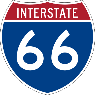
Interstate 66 (I-66) is a 76.32 mile east–west Interstate Highway in the eastern United States. The highway runs from an interchange with I-81 near Middletown, Virginia, on its western end to an interchange with U.S. Route 29 (US 29) in Washington, D.C., at the eastern terminus. Much of the route parallels US 29 or State Route 55 (SR 55) in Virginia. I-66 has no physical or historical connection to US 66, which was located in a different region of the United States.

<span class="mw-page-title-main">Centreville, Virginia</span> Census-designated Place in Virginia, United States

Centreville is a census-designated place (CDP) in Fairfax County, Virginia, United States and a suburb of Washington, D.C. The population was 73,518 as of the 2020 census. Centreville is approximately 20 miles (32 km) west of Washington, D.C.

<span class="mw-page-title-main">Capital Beltway</span> Highway in the Washington metropolitan area

The Capital Beltway is a 64-mile (103 km) auxiliary Interstate Highway in the Washington metropolitan area that surrounds Washington, D.C., the capital of the United States, and its inner suburbs in adjacent Maryland and Virginia. It is the basis of the phrase "inside the Beltway", used when referring to issues dealing with US federal government and politics. The highway is signed as Interstate 495 (I-495) for its entire length, and its southern and eastern half runs concurrently with I-95.

<span class="mw-page-title-main">Virginia State Route 7</span>

Virginia State Route 7 (VA 7) is a major primary state highway and busy commuter route in northern Virginia, United States. It travels southeast from downtown Winchester to SR 400 in downtown Alexandria. Its route largely parallels those of the Washington & Old Dominion Trail and the Potomac River. Between its western terminus and Interstate 395 (I-395), SR 7 is part of the National Highway System. In 1968, the Virginia State Highway Commission designated the road as the "Harry Flood Byrd Highway" between Alexandria and Winchester to commemorate Harry F. Byrd Sr. (1887–1966).

<span class="mw-page-title-main">Virginia State Route 236</span>

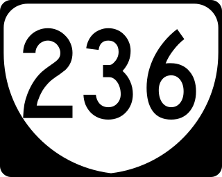
State Route 236 is a primary state highway in the U.S. state of Virginia. The state highway runs 15.63 miles (25.15 km) from U.S. Route 29 and US 50 in Fairfax east to SR 400 in Alexandria. SR 236 is a major suburban arterial highway that connects the independent cities of Fairfax and Alexandria via Annandale in Fairfax County. The state highway is known as Main Street in City of Fairfax, Little River Turnpike in Fairfax County, where the highway meets Interstate 495 (I-495), and Duke Street in Alexandria, where the road has junctions with I-395 and US 1.

<span class="mw-page-title-main">Fairfax County Parkway</span> Primary state highway in Fairfax County, Virginia

The Fairfax County Parkway, numbered State Route 286, is a primary state highway in the U.S. state of Virginia, acting as an arterial route in Fairfax County with a mix of interchanges and signalized and unsignalized intersections. Its alignment runs from southeast to northwest and roughly corresponds to part of the once-proposed Outer Beltway around Washington, D.C. The first segment of the roadway opened in 1987; the road was completed in 2010.

<span class="mw-page-title-main">Virginia State Route 120</span>

State Route 120 is a primary state highway in the U.S. state of Virginia. Known as Glebe Road, the state highway runs 9.10 miles (14.65 km) from U.S. Route 1 (US 1) in Crystal City north to SR 123 at the Chain Bridge. SR 120 is a partial circumferential highway in Arlington County that connects the southeastern and northwestern corners of the county with several urban villages along its crescent-shaped path, including Ballston. The state highway also connects all of the major highways in Virginia that radiate from Washington, including Interstate 395, I-66, US 50, and US 29. SR 120 is a part of the National Highway System for its entire length.

<span class="mw-page-title-main">Virginia State Route 123</span> State highway in Virginia, United States

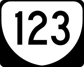
State Route 123 or Virginia State Route 123 is a primary state highway in the U.S. state of Virginia. The state highway runs 29.27 miles (47.11 km) from U.S. Route 1 in Woodbridge north to the Chain Bridge across the Potomac River into Washington from Arlington. It goes by four local names. From its southern terminus to the Occoquan River Bridge, it is known as Gordon Boulevard. From the Occoquan River Bridge to the city of Fairfax it is known as Ox Road. From Fairfax until it enters the Town of Vienna, it is known as Chain Bridge Road. Then, as it passes through the Town of Vienna, it is known as Maple Avenue. After leaving the Town of Vienna, the name reverts to Chain Bridge Road, and continues this way until the intersection with I-495 in Tysons. Between Tysons and the George Washington Memorial Parkway, it is known as Dolley Madison Boulevard. After crossing over the George Washington Memorial Parkway, the name once again reverts to Chain Bridge Road and continues this way until the end of the road, at Chain Bridge. SR 123 is a partial circumferential highway in Northern Virginia that connects Woodbridge in eastern Prince William County with the independent city of Fairfax and the Fairfax County communities of Vienna, Tysons, and McLean, the last being the home of the National Counterterrorism Center and the Central Intelligence Agency. The state highway also connects all of the major highways that radiate from Washington, including Interstate 95 (I-95), I-66, US 29, US 50, SR 267, and the George Washington Memorial Parkway. Furthermore, SR 123 crosses another pair of circumferential highways, I-495 and the Fairfax County Parkway, and SR 7, a major northwest–southeast highway through Northern Virginia. The state highway is a part of the National Highway System for its entire length.

<span class="mw-page-title-main">Virginia State Route 241</span>

State Route 241 is a primary state highway in the U.S. state of Virginia. The state highway runs 1.88 miles (3.03 km) from U.S. Route 1 in Huntington north to SR 236 in Alexandria. SR 241 connects US 1 and SR 236, bypass Old Town Alexandria to the southwest. The state highway connects those highways with Interstate 95 and I-495, Huntington Avenue, and Eisenhower Avenue in a series of interchanges along the boundary of Fairfax County and the independent city of Alexandria. SR 241 also connects the above highways to the Huntington station of the Washington Metro, for which the portion of the highway from US 1 to the station is part of the National Highway System.

<span class="mw-page-title-main">Virginia State Route 28</span> State highway in Virginia, United States

State Route 28 in the U.S. state of Virginia is a primary state highway that traverses the counties of Loudoun, Fairfax, Prince William, and Fauquier in the U.S. state of Virginia. The route serves as a major artery in the Northern Virginia region, with it being an important two-lane highway in rural Fauquier and Prince William Counties, the main thoroughfare through Manassas and Manassas Park, and a high-capacity freeway through Fairfax and Loudoun Counties.

<span class="mw-page-title-main">U.S. Route 17 in Virginia</span> Section of U.S. highway in Virginia

U.S. Route 17 (US 17) is a part of the United States Numbered Highway System that runs from Punta Gorda, Florida, to Winchester, Virginia. In Virginia, the U.S. Highway runs 255.83 miles (411.72 km) from the North Carolina state line in Chesapeake north to its northern terminus at US 11, US 50, and US 522 in Winchester. US 17 is a major highway in the eastern half of Virginia. The U.S. Highway connects the Albemarle Region of North Carolina with the Hampton Roads metropolitan area. Within the urban area, US 17 passes through the South Hampton Roads cities of Chesapeake, Portsmouth, and Suffolk and the Virginia Peninsula city of Newport News. Between Yorktown and Fredericksburg, the U.S. Highway serves as the primary highway of the Middle Peninsula. At Fredericksburg, US 17 leaves the Atlantic Plain; the highway passes through the Piedmont town of Warrenton and crosses the Blue Ridge Mountains on its way to Winchester in the Shenandoah Valley. The route from Tappahannock to Winchester roughly follows the Confederate march during the Civil War to Gettysburg.

<span class="mw-page-title-main">Virginia State Route 237</span>

State Route 237 is a primary state highway in the U.S. state of Virginia. The state highway runs 13.07 miles (21.03 km) from SR 236 in Fairfax east to U.S. Route 50 in Arlington. SR 237 connects Fairfax and Arlington with Falls Church. Between Fairfax and Falls Church, the state highway mostly runs concurrently with US 29. East of Falls Church, SR 237 parallels Interstate 66 (I-66) and connects several of Arlington's urban villages.

<span class="mw-page-title-main">Virginia State Route 228</span>

State Route 228 is a primary state highway in the U.S. state of Virginia. The state highway runs 4.53 miles (7.29 km) from SR 657 at the southern town limit of Herndon north to SR 7 near Dranesville. SR 228 is the main north–south highway through Herndon, connecting the town directly with SR 7 and indirectly with SR 267 in northwestern Fairfax County.

<span class="mw-page-title-main">Virginia State Route 234</span>

Virginia State Route 234 is a primary state highway in the U.S. state of Virginia. It runs from U.S. Route 1 near Dumfries via Independent Hill as Dumfries Road, bypasses Manassas as Prince William Parkway, and has a brief concurrency with Interstate 66 for 2.27 miles (3.65 km) between exits 44 and 47 before continuing northwest via Catharpin to U.S. Route 15 near Woolsey as Sudley Road.

<span class="mw-page-title-main">Virginia State Route 645 (Fairfax County)</span>

State Route 645 in Fairfax County, Virginia is a secondary state highway. There are six portions, three of them being major, named Wall Road, Lees Corner Road, Stringfellow Road, Clifton Road, Main Street and Burke Lake Road. There are also numerous overlaps : some include SR 657 / Centreville Road, U.S. Route 50, SR 652, SR 612, and SR 641. A concurrency used to exist at US 29 near Centreville until the 1990s.

<span class="mw-page-title-main">Virginia State Route 609 (Fairfax County)</span>

State Route 609 in Fairfax County, Virginia is a secondary state highway which traverses western portion of the county. The road is also known as Pleasant Valley Road.

<span class="mw-page-title-main">Virginia State Route 608 (Fairfax County)</span>

State Route 608 in Fairfax County, Virginia is a secondary state highway which traverses the western portion of the county. Before the Fairfax County Parkway from US 29 to Reston was complete, SR 608 was the main north–south road in western Fairfax County.

<span class="mw-page-title-main">Virginia State Route 606 (Fairfax and Loudoun Counties)</span>

State Route 606 in Fairfax and Loudoun Counties, Virginia is a secondary state highway traversing the communities of Reston, Herndon, Sterling, Arcola, and South Riding. The road is important not only because it is an inter-county connector, but it goes around the back of Dulles Airport, is part of the Loudoun County Parkway, and it provides a shortcut between the Reston / Herndon area and U.S. Route 50. Although the Herndon streets are not technically part of SR 606, they are signed as SR 606, and they connect to streets that are part of SR 606, thus providing a continuous route.

Schneider Crossroads is an unincorporated community in Fairfax County, in the U.S. state of Virginia. State Route 620 and State Route 609 cross here and it is located 5.3 miles northwest by road from Centreville. It contains little more than a florists' and a site called Cox Farms. Pleasant Valley Golf Club lies to the northeast, with the two other quadrants also incorporated into yet undeveloped Fairfax County Park Authority parks. As the crossroads is a major traffic bottleneck, with traffic flow formally managed by 4-way stop signs, Loudoun County, just west of the crossroads, offered over a million of the county's funds in 2012 to pay for the intersection upgrade as their residents were inconvenienced the most by the traffic problem, although the intersection is completely in Fairfax County. The Virginia Department of Transportation determined that the optimal solution was a roundabout which was built from 2015 to 2016. Although traffic is much improved, the poor nature of the two-lane Braddock Road to the east of the traffic circle, including a hairpin turn and no shoulder, is now the main impediment of east-bound morning traffic.

<span class="mw-page-title-main">Virginia State Route 662 (Fairfax County)</span>

State Route 662 is a secondary state highway in the U.S. state of Virginia, and traverses western Fairfax County.

References

Template:Attached KML/Virginia State Route 620 (Fairfax and Loudoun Counties)
KML is from Wikidata
  1. 1 2 "2007 Virginia Department of Transportation Jurisdiction Report – Daily Traffic Volume Estimates – Fairfax County" (PDF). VDOT. 2007. pp. 41, 84, 723. Retrieved June 20, 2009.
  2. Greene, Renss (2018-03-29). "Braddock Road Shopping Center Plan Draws Community Protest". Loudoun Now. Retrieved 2019-08-26.
  3. Cline, Nathaniel (July 19, 2019). "Loudoun County supervisors to vote on South Riding commercial development in September". Loudoun Times-Mirror. Retrieved 2019-08-26.
  4. "Supervisor Cook Announces Final Plans for Braddock Road Improvement Project" (PDF). Retrieved 2023-12-23.
  5. "Braddock Road Multimodal Study | Transportation". www.fairfaxcounty.gov. Retrieved 2019-08-26.
  6. "Braddock Road Multimodal Study - Final Report" (PDF). Retrieved 2023-12-23.
  7. Centreville and Virginia Run History p. 5 Retrieved November 11, 2009
  8. Getting Roads Accepted into the Secondary System of State Highways Retrieved June 17, 2009
  9. 1 2 3 4 "The Many Lives of Braddock Road, from The Roads of Northern Virginia". Archived from the original on 2009-01-06. Retrieved 2009-06-18.
  10. Loudoun County Board of Supervisors: "In Re: Street Addressing/Historic Names/Update". Act of July 18, 1989 . Retrieved July 26, 2017.
  11. 123 / Braddock Rd. Interchange Presentation March 4, 2009 Retrieved November 29, 2009
  12. "Route 123 and Braddock Road At-Grade Interim Improvements" (PDF). Retrieved 2023-12-23.
  13. VA DOT Daily Traffic Volume Estimates (Fairfax) 2005 Retrieved June 16, 2009
  14. VA DOT Daily Traffic Volume Estimates (Loudoun) 2006 Retrieved June 16, 2009