Viso Mozzo

Last updated
Viso Mozzo
VisoMozzo01.jpg
Viso Mozzo
Highest point
Elevation 3,019 m (9,905 ft) [1]
Prominence 369 m (1,211 ft)  OOjs UI icon edit-ltr-progressive.svg
Listing Alpine mountains above 3000 m
Coordinates 44°40′40″N7°07′23″E / 44.6779°N 7.1230°E / 44.6779; 7.1230 Coordinates: 44°40′40″N7°07′23″E / 44.6779°N 7.1230°E / 44.6779; 7.1230
Geography
Alps location map.png
Red triangle with thick white border.svg
Viso Mozzo
Location in the Alps
Location Piemonte, Italy
Parent range Cottian Alps
Climbing
Easiest route Hike

The Viso Mozzo is a 3,019 metres high mountain on the Italian side of the Cottian Alps.

Contents

Toponymy

End-of-March view from refuge Quintino Sella. Viso Mozzo dal Quintino Sella.JPG
End-of-March view from refuge Quintino Sella.

In Italian viso means face, but in this context refers to the Monviso, which is very close to the Viso Mozzo, and mozzo means cut off. Thus the whole name should mean Cut-off Monviso; an old local name of the mountain is Viso-Mout. [2]

Geography

Viso Mozzo is located in the upper Valle Po and stands east-north-est of Monviso, from which is divided by the colle dei Viso (Viso Pass). [3] Its western side, facing Monviso, is a long and almost uniform rock-field, while the other faces of the mountain are more irregular.

SOIUSA classification

According to SOIUSA (International Standardized Mountain Subdivision of the Alps) the mountain can be classified in the following way: [4]

Access to the summit

The normal route to the Viso Mozzo runs across the west face of the mountain and does not requires . [3] Starting from Pian del Re (known as the river Po source, 2,020 metres), one can follow the nr.V13 foothpath leading to the alpine hut Quintino Sella . [5] At colle dei Viso, leaving the main foothpath and turning left, following some cairns, in roughly one hour is possible to reach the mountain top, marked by a metallic summit cross and offering an interesting view both on the Monviso massif and on the Po plain. [3]

Mountain huts

Related Research Articles

Monte Mars Mountain in Italy

Monte Mars(in Italian) or Mont Mars(in French), at 2,600 m, is the highest peak of the Biellese Alps, north-western Italy.

Monte Colombano

Monte Colombano is a mountain in the Alpi di Lanzo, a sub-group of the Graian Alps, with an elevation of 1,658 m.

Monte Bo

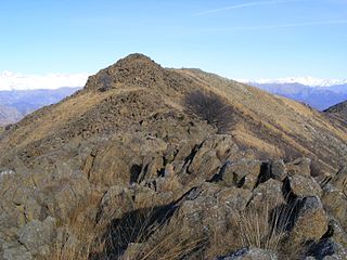
Monte Bo is a mountain in the Alpi Biellesi, a sub-range of Pennine Alps.

Col dÉtache

Col d'Étache in French,, is a pedestrian pass across the Cottian Alps. It connects Susa Valley and Maurienne.

Colle della Croce

The Colle della Croce (Italian) or Col Lacroix is a pedestrian pass of the Cottian Alps.

Monte Cresto

Monte Cresto (2,548 m) is the third highest peak of the Province of Biella after Monte Mars (2,600 m) and Monte Bo (2,556 m).

Punta Sulè Mountain in Italy

Punta Sulè is a 3,384 m a.s.l.mountain of the Graian Alps, located in Italy.

Bric Ghinivert Mountain in Italy

Bric Ghinivert or Eiminàl is a mountain of the Cottian Alps located in Italy.

Monte Albergian Mountain in Italy

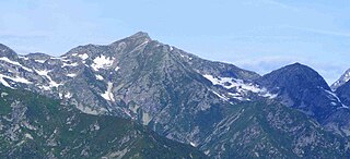
Monte Albergian is a 3,041 m a.s.l. mountain of the Cottian Alps, located in Italy. A battalion of 3rd Alpini Regiment, which during World War I earned a Silver Medal of Military Valor, was named after Monte Albergian.

Punta Tempesta Mountain in Italy

Punta Tempesta is a 2,679 m a.s.l. mountain of the Cottian Alps, located in Italy.

Monte Monega Mountain in Italy

Monte Monega is a 1,882-metre (6,175 ft) mountain of the Ligurian Alps, in Italy.

Corno Bussola Mountain in Italy

Corno Bussola is a 3,023 metres high peak on the Italian side of the Pennine Alps.

Punta Merciantaira

The Punta Merciantaira or Grand Glaiza is a 3,293 metres high mountain of the Cottian Alps.

Mongioia

The Cima Mongioia or simply Mongioia or Bric de Rubren is a 3,340 metres high mountain of the Cottian Alps.

Punta Nera

The Punta Nera is a mountain of Savoie (France) and of the Province of Turin (Italy). It lies in the Cottian Alps range. It has an elevation of 3,047 metres above sea level.

Monte Mucrone Mountain in Italy

Monte Mucrone is an Alpine mountain of Piedmont.

Monte Mongioie Mountain in Italy

The Monte Mongioie is a mountain of the Ligurian Alps located in Piedmont.

Monte I Gemelli Mountain in Italy

The Monte I Gemelli is an Alpine mountain located between Aosta Valley and Piedmont.

Punta Cornour Mountain in Italy

The Punta Cornour is a 2,868 metres high mountain on the Italian side of the Cottian Alps.

Monte Birrone Mountain in Italy

The Monte Birrone is a 2,131-metre (6,991 ft) high mountain in the Cottian Alps, belonging to the Italian province of Cuneo.
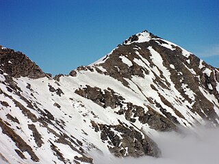
References

  1. Istituto Geografico Centrale, Carta dei sentieri 1:50.000 scale nr. 6, Monviso
  2. Gastaldi, Bartolomeo (1865). "Sulla riescavazione dei bacini lacustri". Memorie della Società Italiana di Scienze naturali (in Italian). G. Bernardoni. p. 17. Retrieved 2018-12-06.
  3. 1 2 3 Giulio Berutto, Monviso e le sue valli - Vol. 2, Istituto Geografico Centrale, Torino, 1991
  4. Marazzi, Sergio (2005). Atlante Orografico delle Alpi. SOIUSA (in Italian). Priuli & Verlucca. p. 85. ISBN   978-88-8068-273-8.
  5. Provincia di Cuneo, Guida dei sentieri alpini della Provincia di Cuneo - vol. 1 - valli Po, Varaita, Maira

Maps