Vorchdorf

Last updated
Vorchdorf
AUT Vorchdorf COA.svg
Austria adm location map.svg
Red pog.svg
Vorchdorf
Location within Austria
Coordinates: 48°00′15″N13°55′27″E / 48.00417°N 13.92417°E / 48.00417; 13.92417
Country Austria
State Upper Austria
District Gmunden
Government
   Mayor Gunther Schimpl [1] (ÖVP)
Area
[2]
  Total47.78 km2 (18.45 sq mi)
Elevation
414 m (1,358 ft)
Population
 (2018-01-01) [3]
  Total7,475
  Density160/km2 (410/sq mi)
Time zone UTC+1 (CET)
  Summer (DST) UTC+2 (CEST)
Postal code
4655
Area code 07614
Vehicle registration GM
Website www.vorchdorf.at

Vorchdorf is a market town in the district of Gmunden in Upper Austria, Austria, as well as the name of the municipal area ("Gemeinde") that the town and others occupy. As of the 2005 census, the town of Vorchdorf had a population of 7,287 inhabitants.

Contents

360deg airborne panorama, shot at hydropower plant Haresau
(view as a 360deg interactive panorama) Vorchdorf - Almkraftwerk Haresau.jpg
360° airborne panorama, shot at hydropower plant Haresau
( view as a 360° interactive panorama )

Geography

Located in the Traunviertel region of the state of Upper Austria, about 15 km north of the town of Gmunden, the town of Vorchdorf has an approximate elevation of 414 m above sea level (highest point: 640 m; deepest point: 370 m). Its area extends 9.3 km from north to south, and 9.8 km from east to west.

The community territory is about 48 km2. 17.2% of the region is wooded and 71.8% of it is used for agriculture. The rivers Laudach and the Alm cross Vorchdorf from the south. The inner Laudach disembogues near the center of Vorchdorf into the outer Laudach.

Localities of Vorchdorf

Hamlets of Vorchdorf municipality include: Adlhaming, Aggsbach, Albenedt, Berg, Bergern, Eggenberg, Eichham, Einsiedling, Falkenohren, Feldham, Fischböckau, Hötzelsdorf, Heitzing, Lederau, Moos, Mühltal, Oberhörbach, Pappelleiten, Peintal, Point, Radhaming, Schart, Seyrkam, Theuerwang, Unterhörbach, Ursprung, Vorchdorf (center), Weidach. The most populated localities are Vorchdorf (center), Fischböckau, Mühltal, Lederau and Feldham.

Population Development (with secondary residence)
YearPopulation
18483127
19003322
19343914
19514849
19705517
19916868
20017585
20087723
20167401

Vorchdorf consists of eleven Katastralgemeinden—that is, cadastral subdivision of municipalities—which are not always congruent with the localities:

Neighbor communities

Neighbor communities to Vorchdorf include: Bad Wimsbach-Neydharting, Eberstalzell, Kirchham, Laakirchen, Pettenbach, Roitham, Scharnstein and Steinerkirchen. Vorchdorf borders to the districts of Wels-Land and Kirchdorf.

Population

Historical population
YearPop.±%
18483,127    
19003,322+6.2%
19343,914+17.8%
19514,849+23.9%
19705,517+13.8%
19916,868+24.5%
20015,685−17.2%

About 500 Transylvanian Saxons relocated to Vorchdorf after the second world war. Thereafter, most of the immigration people descends from Turkey, the former Yugoslavia and from Germany. [4]

History

Because of the geographically convenient location Vorchdorf was settled already in the Neolithic time. [5] Originally lying in the eastern part of the Herzogtum Bayern, the town belonged since the 12th century to the Herzogtum Österreich (Austria). Thereafter since 1490 Vorchdorf was assigned to the Fürstentum (Principality) „Österreich ob der Enns“. During the Napoleonic Wars the town was occupied several times. Since 1918 the Gemeinde belonged to Upper Austria. After the Anschluss Austrias to the Deutsches Reich with 13 March 1938, Vorchdorf belonged to the „Gau Oberdonau“. After 1945 the recovery of Upper Austria took place. The upper Austrian central government decided 1982 to upraise the Gemeinde to a market town.

Emblem

Blazon: In green a silver, square house with three stories. A pedestal, black round arch gate, two black rectangular windows on the ground floor and each four black rectangular windows in the two upper stories, whereas the middle windows are double windows. They are crowned with an arc Frieze. Above it there is a small black round arc middle window and a red hip roof. Sideways bordered with shifted corner cuboids. Colors of the Gemeinde: red-white-green

Politics

The Gemeinderat (parish councils) consists of 31 Mandate, and they are divided as follows:

The Unabhängiger Bauernverband (Independent compound of farmers) do not have any Mandat.

Since 15 April 2008 the mayor is Dipl.-Ing. Gunter Schimpl (ÖVP) after the former mayor Franz Kofler retired from his post.

Economy and Infrastructure

During the early 1960s, Austria built its first autobahn, the Westautobahn A1 motorway. An exit on the roadway was located in Vorchdorf, fostering a great uplift in the economy of the region.

Traffic

The northern area of the city is divided by the Westautobahn and therefore the community is well located for visitation which is a boon to the region's economy. The local trains, Lambach–Vorchdorf-Eggenberg and Gmunden–Vorchdorf, connect the city to Gmunden in the south and Lambach in the north.

Resident Companies

Education

Religion

Culture

Societies

Periodic Events

Sightseeing

Personalities

Sons and daughters:

Persons with reference to the town:

Related Research Articles

<span class="mw-page-title-main">Salzkammergut</span> Resort area in Austria

The Salzkammergut is a resort area in Austria, stretching from the city of Salzburg eastwards along the Alpine Foreland and the Northern Limestone Alps to the peaks of the Dachstein Mountains. The main river of the region is the Traun, a right tributary of the Danube.

<span class="mw-page-title-main">Krumbach, Lower Austria</span> Place in Lower Austria, Austria

Krumbach is a market town in southern Lower Austria, Austria. It is part of the landscape Bucklige Welt.

Rohrau is a village in the state of Lower Austria. The name comes from two German words: Rohr (reed) and Au. South of the village is a riparian forest and a swamp covered with reed.

<span class="mw-page-title-main">Gmunden</span> Place in Upper Austria, Austria

Gmunden is a town in Upper Austria, Austria in the district of Gmunden. It has 13,204 inhabitants.

<span class="mw-page-title-main">Laxenburg</span> Place in Lower Austria, Austria

Laxenburg is a market town in the district of Mödling, in the Austrian state of Lower Austria. Located about 20 km (12 mi) south of the Austrian capital Vienna, it is chiefly known for the Laxenburg castles, which, beside Schönbrunn, served as the most important summer retreat of the Habsburg monarchs.

<span class="mw-page-title-main">Traun</span> Municipality in Upper Austria, Austria

Traun is an Austrian municipality located on the north bank of the river Traun and borders Linz, the capital of Upper Austria, to the east. The name Traun is derived from the Celtic word for river (dru). Traun is the fifth largest town in Upper Austria, located in the district of Linz-Land.

<span class="mw-page-title-main">Sohland an der Spree</span> Municipality in Saxony, Germany

Sohland an der Spree (German) or Załom is a municipality in the district of Bautzen in Saxony, Germany near the border of the Czech Republic in a region called Lusatia. The river Spree flows through the village. Together with some smaller villages it constitutes one of the biggest villages or communities with about 7,700 inhabitants. The most iconic monument of the village is the "Himmelsbrücke" ; it is said that the bridge will break when someone tells a lie while standing on it.

<span class="mw-page-title-main">Kittsee</span> Place in Burgenland, Austria

Kittsee is an Austrian municipality in the District of Neusiedl am See, Burgenland.

<span class="mw-page-title-main">Unterach am Attersee</span> Place in Upper Austria, Austria

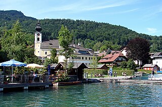
Unterach is a village in the Austria state of Upper Austria on the southern shore of lake Attersee in the centre of the Salzkammergut region.

<span class="mw-page-title-main">Ahrensbök</span> Municipality in Ostholstein district, Schleswig-Holstein, Germany

Ahrensbök is a municipality in the district of Ostholstein, in Schleswig-Holstein, Germany. It is situated approximately 17 km northwest of Lübeck, and 45 km southeast of Kiel.

<span class="mw-page-title-main">Grafing</span> Town in Bavaria, Germany

Grafing bei München is a town in the district of Ebersberg, Upper Bavaria, Germany.

<span class="mw-page-title-main">Petronell-Carnuntum</span> Place in Lower Austria, Austria

Petronell-Carnuntum is a community of Bruck an der Leitha in Austria. It is known for its annual World Theatre Festival.

<span class="mw-page-title-main">Lenggries</span> Municipality in Bavaria, Germany

Lenggries is a municipality and a town in Bavaria, Germany. It is the center of the Isarwinkel, the region along the Isar between Bad Tölz and Wallgau. The town has about 9,500 inhabitants. By area, it is the largest rural municipality ("Gemeinde") in what was formerly West Germany, and the 7th-largest overall.

<span class="mw-page-title-main">Glonn</span> Municipality in Bavaria, Germany

Glonn is a market town in the Ebersberg district in Upper Bavaria, Germany, about 30 km (19 mi) southeast of Munich.

<span class="mw-page-title-main">Schliengen</span> Municipality in Baden-Württemberg, Germany

Schliengen is a municipality in southwestern Germany in the state of Baden-Württemberg, in the Kreis (district) of Lörrach. Schliengen's claim to international fame is the Battle of Schliengen, fought between forces of the French Revolutionary army under Jean-Victor Moreau and the Austrian army under Karl von Österreich-Teschen. As both sides claimed victory, the battle is commemorated on a monument in Vienna and on the Arc de Triomphe in Paris.

<span class="mw-page-title-main">Keutschach am See</span> Municipality in Carinthia, Austria

Keutschach am See is a municipality in the district of Klagenfurt-Land in the Austrian state of Carinthia.

<span class="mw-page-title-main">Obdach</span> Place in Styria, Austria

Obdach is a municipality in the district of Murtal in Styria, Austria.

Oberwölz is a city since 2015 in the Murau District of Styria, Austria. The city was founded as part of the Styria municipal structural reform, at the end of 2014, with the merger of the former independent municipalities Oberwölz Stadt, Oberwölz Umgebung, Schönberg-Lachtal and Winklern bei Oberwölz, whereby the new municipality became ranked as a city ("Stadtgemeinde").

<span class="mw-page-title-main">Eggenberg Palace, Graz</span> Palace in Styria, Austria

Eggenberg Palace in Graz, is the most significant Baroque palace complex in the Austrian province of Styria. With its preserved accouterments, the extensive scenic gardens, as well as some special collections from the Universalmuseum Joanneum housed in the palace and surrounding park, Schloss Eggenberg ranks among the most valuable cultural treasures of Austria. Eggenberg Palace is situated at an elevation of 381 meters on the Western edge of the city. Its architectural design and the still visible imprint of centuries of history continue to bear witness to the vicissitude and patronage of the one-time mightiest dynasty in Styria, the House of Eggenberg.

<span class="mw-page-title-main">Ehrenhausen an der Weinstraße</span> Place in Styria, Austria

Ehrenhausen an der Weinstraße is a municipality with 2,623 residents in the Leibnitz District of Styria, Austria.

References

  1. "Neuer Burgermeister in Vorchdorf". gmunden.oevp.at. Retrieved 2008-09-18.
  2. "Dauersiedlungsraum der Gemeinden Politischen Bezirke und Bundesländer - Gebietsstand 1.1.2018". Statistics Austria. Retrieved 10 March 2019.
  3. "Einwohnerzahl 1.1.2018 nach Gemeinden mit Status, Gebietsstand 1.1.2018". Statistics Austria. Retrieved 9 March 2019.
  4. "Bevölkerungsstand und -struktur für Gemeinden 01.01.2008" (PDF). Statistik Austria. Retrieved 2008-09-18.
  5. "Vorchdorf". tiscover.at. Retrieved 2008-09-24.
  6. "Schloss Hochhaus". Schloss Hochhaus, Hillinger GesmbH. Retrieved 2008-09-21.