Related Research Articles
Skyway Estates Airport is a privately-owned, public use general aviation airport located approximately 4 miles north of Eaton Rapids in Eaton Rapids Township, Eaton County, Michigan, United States.
Campbell Airport is a public-use airport located two miles (3 km) southwest of the central business district of Grayslake, a village in Lake County, Illinois, United States. It is privately owned by Kane Illinois Properties, Inc.
Chorman Airport is a public use airport located two nautical miles (4 km) southwest of the central business district of Farmington, a town in Kent County, Delaware, United States. It is privately owned by Allen Chorman.
Van Wagnen Airport is a privately owned, public use airport located five nautical miles west of the central business district of Napoleon, a community in Napoleon Township, Jackson County, Michigan, United States. It was formerly known as Day Field, owned by Janet Day.

Sault Ste. Marie Municipal Airport, also known as Sanderson Field, is a city-owned, public-use airport located one nautical mile (1.85 km) southwest of the central business district of Sault Ste. Marie, a city in Chippewa County, Michigan, United States.
Paul C. Miller–Sparta Airport is a public airport located 3 mi (5 km) southeast of Sparta, Michigan. Established in 1941, the airport is currently owned and operated by the Village of Sparta and is self-supporting, requiring no public funding. It is included in the Federal Aviation Administration (FAA) National Plan of Integrated Airport Systems for 2017–2021, in which it is categorized as a regional general aviation facility.

Meyers–Diver's Airport is located in Tecumseh, Michigan, United States. It is at an elevation of 815 feet. It is owned by Al Meyers Airport, Inc. and managed by Andy Alto.

Brighton Airport is a public use airport located three nautical miles (6 km) north of the central business district of Brighton, in Livingston County, Michigan, United States.

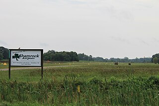
Brooklyn Airport, also known as Shamrock Field, is a privately-owned, public-use airport located in Brooklyn, Michigan, United States. It is at an elevation of 987 feet.
Jerry Tyler Memorial Airport is a privately owned airport in Niles, Michigan, United States. It is included in the Federal Aviation Administration (FAA) National Plan of Integrated Airport Systems for 2017–2021, in which it is categorized as a local general aviation facility. It is used primarily by general aviation (GA) traffic.
Dalton Airport is a privately owned, public use airport located two nautical miles (4 km) east of the central business district of Flushing, in Genesee County, Michigan, United States. It is named after its founder, Edwin P. Dalton, who opened it in 1946 on the former site of the Marsa farm.
Menominee Regional Airport is a public use airport located 1 mile (2 km) northwest of the central business district of Menominee, Michigan, a city in Menominee County, Michigan, United States. It is included in the Federal Aviation Administration (FAA) National Plan of Integrated Airport Systems for 2021–2025, in which it is categorized as a local general aviation facility.
South Haven Area Regional Airport is a public-use airport located 3 miles south of South Haven, Michigan. It is publicly owned by the city through the South Haven Area Regional Airport Authority.
Three Rivers Municipal Dr. Haines Airport is a public-use airport located two miles northeast of Three Rivers, Michigan. The aircraft is publicly owned by the city. The airport covers 305 acres.
Andrews University Airpark is a privately owned, public use airport located 2 miles west of Berrien Springs, Michigan. It is owned and managed by Andrews University, a Christian university that manages an aviation department.
Maple Grove Airport is a privately owned, public-use airport located 3 miles north of Fowlerville, Michigan. The airport is on an elevation of 906 ft.
Ray Community Airport is a privately owned, public use airport located in Ray Township, Macomb County. Michigan. The airport sits on 93 acres of land at an elevation of 632 feet.
Ottawa Executive Airport is a privately owned, public use airport located 3 miles east of Zeeland, Michigan.
Marine City Airport is a privately owned, public use airport located 4 miles west of Marine City in St. Clair County, Michigan.
The Mid-Florida Airport is a privately owned, public use airport located 3 miles east of Eustis, Florida. The airport sits on 30 acres at an elevation of 167 feet.
References
- 1 2 "66G - Wm 'Tiny' Zehnder Field Airport | SkyVector". skyvector.com. Retrieved 2023-04-21.
- 1 2 "AirNav: 66G - Wm 'Tiny' Zehnder Field Airport". www.airnav.com. Retrieved 2023-04-21.
- ↑ "Wm 'Tiny' Zehnder Fld Airport Overview and FBOs (Frankenmuth, MI) [66G]". FlightAware. Retrieved 2023-04-21.
- ↑ "Piper PA-28-180 crash in Michigan (N4595T) | PlaneCrashMap.com". planecrashmap.com. Retrieved 2023-04-21.
- ↑ Perdue, Erica (2012-05-21). "Small plane carrying 4 people crashes in field near Frankenmuth Airport". mlive. Retrieved 2023-04-21.
- ↑ "4 survive plane crash near Frankenmuth airport". Macomb Daily. 2012-05-21. Retrieved 2023-04-21.
- ↑ "Kerr Matthew Starduster Too crash in Michigan (N159MK) | PlaneCrashMap.com". planecrashmap.com. Retrieved 2023-04-21.
- ↑ "Piper Pa 28-180 crash in Michigan (N4756L) | PlaneCrashMap.com". planecrashmap.com. Retrieved 2023-04-21.
- ↑ Lynch, Jim. "Millington man, grandson killed in plane crash". The Detroit News. Retrieved 2023-04-21.
- ↑ "Aeronca 11AC crash in Michigan (N86078) | PlaneCrashMap.com". planecrashmap.com. Retrieved 2023-04-21.
- ↑ "ASN Wikibase Occurrence # 240113". aviation-safety.net. Flight Safety Foundation. Retrieved April 21, 2023.
- ↑ Percha, Michael (2020-08-17). "Plane Crashes Before Takeoff in Frankenmuth". WSGW 790 AM & 100.5 FM. Retrieved 2023-04-21.
- ↑ "Beech G36 Bonanza, N754HC: Accident occurred November 07, 2021 at Wm 'Tiny' Zehnder Field Airport (66G), Frankenmuth, Michigan". Kathryn's Report. Retrieved 2023-04-21.